A Week on the Road with Civil War Trails: Part 3
 Continued from Parts One and Two
Official Records of the Civil War Trails.
The Tennessee Campaign of 2024
A Week On The Road
Day Five
The day dawned bright, and the team was eager, so we skipped breakfast and headed down to Rippa Villa. The historic site, operated by the Battle of Franklin Trust, is best known for that moment in 1864 when Gen. John Bell Hood allowed the Union Army to march right by him. While one team began constructing six new signs, the other ran out for concrete and biscuits. Yes, biscuits. An army moves on its stomach so next time you are in Spring Hill, Tennessee, check out Big Bad Breakfast.
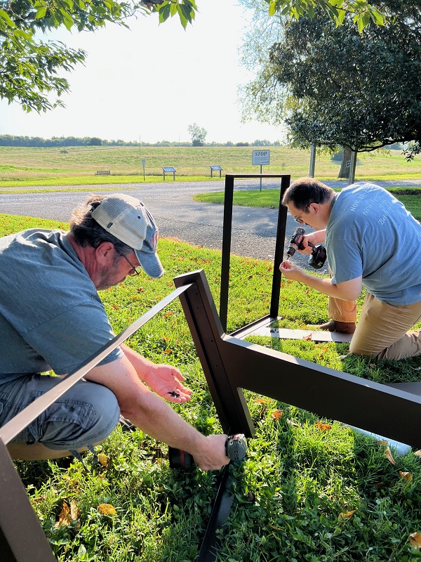
The installation took most of the morning. There hasn’t been much rain in central Tennessee, and it made digging a slow and painful process. Wrapping up, we divided materials, sign panels, parts, paint, and bid farewell to the second Trails team. For the remainder of the trip, we planned to crisscross each other while knocking out more sign repairs, installs, and updates. It was a battle plan that Gen. Joe Wheeler would appreciate.
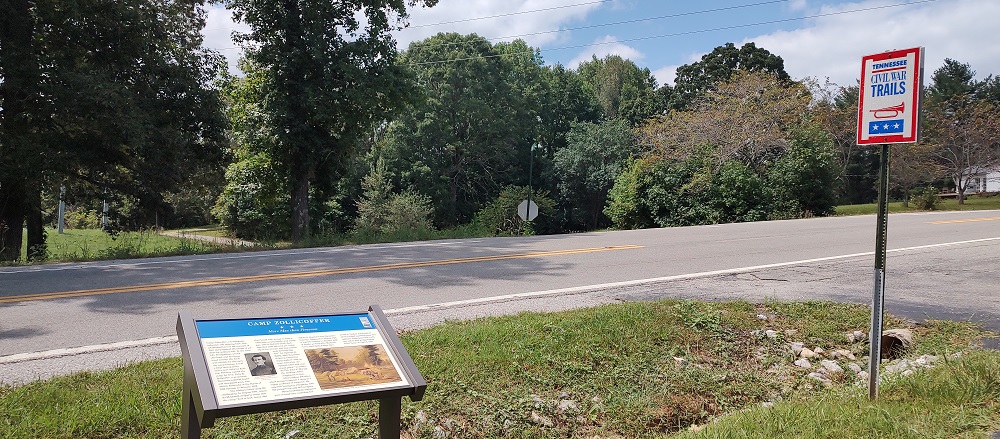
After two hours of driving and just enough time to cool off and rehydrate, our team reinstalled a sign about the Union approach to the battle of Parkers Crossroads. The new sign panel describes a historic roadbed which, in the thick summer Tennessee heat, we found with our posthole diggers. And it was hard. At the same time, across the state our second team was refreshing signs at Clarksville and Fort Redmond in Adams, Tennessee. Also known as Blockhouse No. 1, Fort Redmond was originally constructed by Confederate soldiers to protect a vital railroad crossing. After the fall of forts Henry and Donelson, Union troops repaired bridges and expanded defenses in Adams, Tennessee, including that site. This is just one example of the countless Civil War Trails signs that help connect the dots between the better-known sites and stories.
Gatorade consumed, windows up, and AC on, we eagerly watched the digital compass slowly turn eastward towards home. We started to debate if the GPS was showing our arrival at the hotel in Central time or Eastern time. As always, as one person drove the other rode shotgun plugging away on press releases, responding to visitor emails, and working on this Official Report. We pulled into the hotel at 11 p.m. (Eastern) after some truly forgettable BBQ and crashed hard.
Day’s Summary:
Miles driven through today: 1455
Signs completed: 11
Beers consumed: 0 (Sadly)
Day Six
Let’s go home! Our team left Knoxville bright an early with our eyes set on Bristol. Ensuring morale remained high on a long trip is important, and no Civil War Trails campaign is complete without bringing home some goodies. Since we struck out in scoring a few choice bottles of Tennessee whiskey, we pulled into Bristol to do some foraging. Bristol famously straddles the Tennessee and Virginia state line and is also home to the famous American-made workwear brand LC King, and, boy, do we love their overalls. (A great Christmas gift idea for us.) We also had a tip to check out Blackbird Bakery, which did not disappoint.
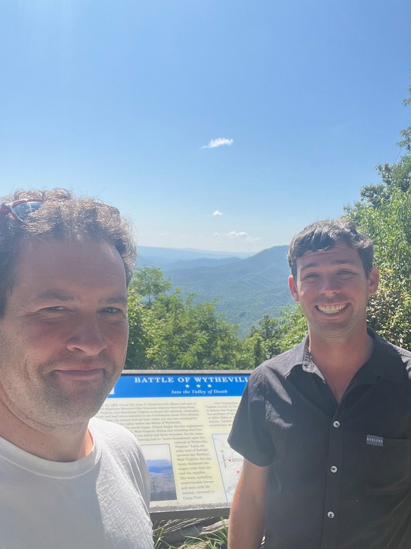
As the second Trails team worked east across Tennessee, we proceeded to Wytheville as the advance guard. We approached from the south, ensuring we did not follow in the footsteps of Union Col. John Toland who was ordered to take Wytheville and destroy the important nearby lead mines in the summer of 1863. The battle which erupted in town on July 18 included some intense street fighting and the death of Toland. There are five Civil War Trails sites between the town and the incredible vista at Big Walker Lookout. We inspected each site and made notes on how to improve the interpretive and directional signs and crossed off the last to-do item on our list.
Merging onto interstate 81, we selected a gas station to top off the tank, procure some fried chicken (gas station eats are often the best), and called the second team to check in. We put on another episode of Lions Led by Donkeys and put the pedal to the floor. During the final leg home, we also chatted with a historic site in the Shenandoah Valley about adding a new site to the program, but by 5 p.m. as we rounded Richmond, things quieted down, and we began to exhale. Although the second team was still a few hundred miles behind us, they had completed their objectives and were hurrying home, too.
Our team walked into our respective homes by 5:45 on Friday, having been on the road since 10 a.m. the Sunday prior. The final count was:
Final Trip Summary:
Total Mileage: 2,073
Total Signs Completed: 62
Total Beers Consumed: 18
Final Observations
Like most of the Official Records, we’ve omitted details here and there for expediency, but hope it gave you an insight into the hard work, time, and effort it takes to maintain our “World’s Largest Open Air Museum.” Having followed along, we hope you will agree we should take some time off and perhaps open another beer or two.
We will take a few days off, and then it’s back in the office to check the to-do list, order materials, and start planning the next campaign. The next trip will kick off in a few weeks when we will split our forces once again and launch into Coastal North Carolina and West(ern) Virginia. It is a tall order but we are up for the challenge.
Our non-profit pulls this off with three full-time staffers, one part-time employee and one contractor who maintains, markets, and administers the program of over 1,500 sites and 525 municipal partners across six states. We cover approximately 200,000 square miles and last year shipped just shy of 200,000 brochures. Our small, but mighty team could use your help.
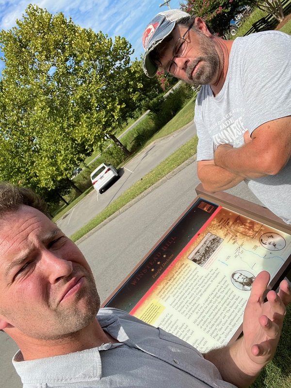
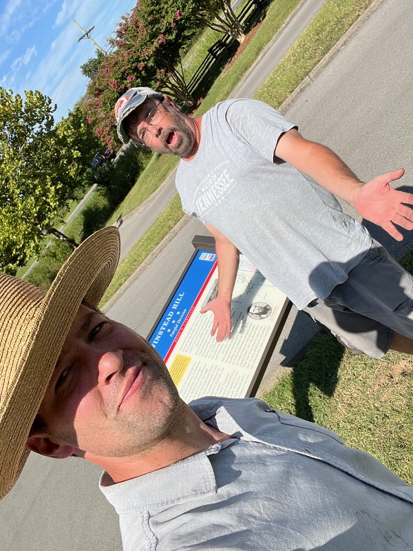
We love it when we receive emails from travelers who have stumbled across a sign which needs a repair, content clarification, if a directional sign is missing, or the map isn’t detailed enough. This insight you provide is invaluable and helps keep the Trail looking good for everyone. Another way to help is simple and kinda fun. When you stop at a Civil War Trails sign that inspires you, snap a selfie with it and post it on social media with #signselfie and #civilwartrails. That selfie shows the site sponsors that people enjoy what we do, and your selfie won’t give away all of the sign’s content either – inspiring others to explore it themselves!
As a non-profit organization we are thankful for our site sponsors, municipal partners, and donors who make this all possible. Although we pinch every penny, things are more expensive now than ever before, so we’ve set up a secure PayPal link where you can automatically give $2, $5, or $10 each month. Even a few dollars automatically donated each month makes a huge difference. If you are inspired to chip in, follow the link here and be sure to click the “monthly” button – we will be eternally grateful.
Lastly, don’t forget to request your free Civil War Trails brochure mailed right to your door at www.civilwartrails.org. Follow #civilwartrails & create some history of your own.
Great job Drew and Jason!
Thank you for this series describing your travels. Your efforts and dedication are praiseworthy as you assist to ensure that descriptions of history are accurately portrayed and erected. Don’t be bashful about asking for money for such a worthy cause. I’ll be sending you a check supporting your fine work. I hope more folks will do as well – keep on going!
Victor, you are too kind! We appreciate the support and next time you are down this way I’ve got to get you to sign my copy of your book.
Hey Drew,
That’s quite a week. You and your teams covered Tennessee from stem to stern. Nice job, and I’m sure that you and the team are glad to be back home. Your comment about costs has not gone unnoticed, and the narrative of your adventure is worthy of an admission. Be sure to check the mailbox next week.
From one Tidewater guy to another. Thank you!
Thank you for a wonderful and entertaining set of stories that also illustrate all the good work you do. It just inspired my own small contribution, and hopefully will spark still more.
Kevin, we are so glad you enjoyed the series. I hope it has inspired you to start planning your own epic trip. Let us know if you need a brochure or two to chart your course. Thanks so very much for the donation. We appreciate that more than you know.
Good work. Thank you guys!!
Tom, thanks for your kind words! We hope the series has inspired you to snap a #signselfie next time you are out exploring and perhaps drop a few bucks into our monthly PayPal. Keep in touch.
Thank you!