Yellowhammers and Environmentalism: The Drive To Raccoon Ford & Getting Ready For Gettysburg (part one)
In 2002 the historical interpretation unit I belonged to, The Southern Guard, was volunteering for a “living-history” program at Gettysburg National Military Park, portraying the 4th Alabama Infantry of Evander McIver Law’s famed brigade that was in John Bell Hood’s Division, of James Longstreet’s Corps, that would assault Little Round Top on July 2nd, 1863.

“The Guard” had a reputation for “hardcore” authenticity, and the National Park Service staff at Gettysburg appreciated our zeal. We would camp in Pitzer’s Woods on Seminary Ridge and conduct public programs throughout the weekend, using accounts from the original troops on the ground they attacked over. Using primary source material was an essential way to bring “sense of place” to the land and further connectivity with the general public. Adding the backdrop of 30 or 40 quality “historical interpretation reenactors” at a National Park Service Military Park, etc., it can naturally add to the “history-vibe”.
We had participated in multitudes of living history programs at Gettysburg before; a high point was once with a 4-gun battery of Napoleons. The Southern Guard had also conducted numerous programs at Manassas, Harpers Ferry, Antietam, Richmond, Five Forks, Shiloh, Chickamauga, Lookout Mountain, etc.; all being worthwhile endeavors. Volunteering at National Battlefield Parks has always been meaningful, and cerebral – and a highlight of my “reenacting career”.
The upcoming Gettysburg event would be no different – account driven, on the battlefield, with authenticity as a paramount component, interacting with the public, etc. But this time I wanted to do something more diverse before the Gettysburg event.
My friend, Joe Loehle, and I decided that on the early Friday morning before the Gettysburg living history program we would follow Law’s Alabamians from Raccoon Ford — just below Culpeper, Virginia — northward on the same roads that brigade traversed in June 1863. In our quest we would go to through the same towns they marched by, to see the period “witness homes” they would have seen. We would go to the various fords and rivers and read accounts at the same spot where the Rebel giants had once roamed – trying to make a historic connectivity through data and space; perhaps “a Civil Wargasm”.
Before any living-history program, a reenactment unit that is “worth their salt” is going to do a considerable amount of micro-study on the specific unit they will portray for the specific battlefield park program – the 17th Virginia at Second Manassas, the 16th Iowa at Shiloh, Pegram’s artillery at Five Forks, and so on.
This research often starts over a year out before the event, using National Archive records, unit accounts, soldier diaries, newspapers, you name it. That micro-study for a living history program (or research on a specific unit for a battle reenactment) is a spring-board into digging further, and deeper, into more esoteric subjects and minutia of the war and beyond.
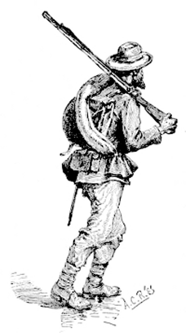 For this trip I used as our main guidebook Morris Penny’s and J. Gary Laine’s “Struggle at the Round Tops” (Burd Street Press, 1999) which focuses on Law’s Alabama brigade in the Gettysburg Campaign.
Because there was much more marching than fighting for soldiers in The Late Unpleasantness I felt it to be appropriate to look at soldier-life from that perspective — less glorious, more common, interaction with civilians, and simply more real.
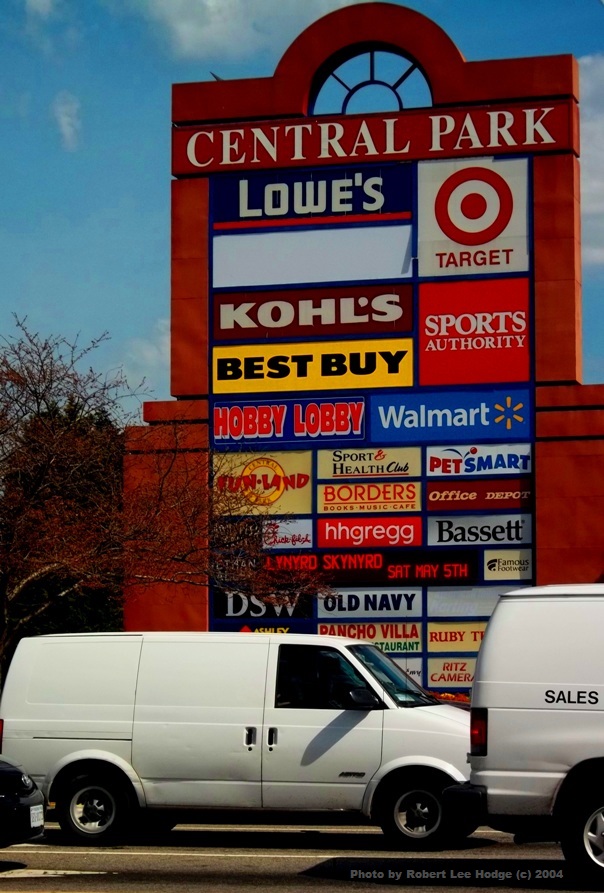
I picked up Joe at 4am near Mount Vernon, Virginia, and drove south on I-95 to Fredericksburg. Seeing the columns of advancing traffic northbound to Washington, D.C. reminded me of the hard realities of preservation, and of local government continuously making poor planning and zoning decisions (in my mind anyhow) as over-population choked areas all over Northern, and now Central, Virginia, overfilling at an alarming rate. The traffic, and what it represented, was simply demoralizing; but you get numb to it at times. But I wonder what this area will look like in 100 years at the exponential pace it is going.
Exiting off at Fredericksburg we fought through some Route 3 traffic going west towards Chancellorsville. We chugged passed the Salem Church battlefield; a 35,000-man fight, yet perhaps just 1% is saved of that battlefield. Despite the haphazard sprawl Salem Church is a great illustration as to poor planning and zoning – perhaps we can learn from this. Perhaps…


I remember a feeling of relief when we approached the battlefield of the first day. It was quickly rural-looking – a mass of fields and woods. Later the Civil War Preservation Trust would conduct a hard-fought campaign to save 300 acres — where a Northern Virginia land-developer wanted to build 2,800 homes and 2.2 million square-feet of commercial space that would have generated 44,000 cars a day – on the Chancellorsville battlefield, where two Medals of Honor were won. Almost all of the Spotsylvania County board of supervisors were in favor of this project. Thankfully, that project was thwarted and the land was saved.
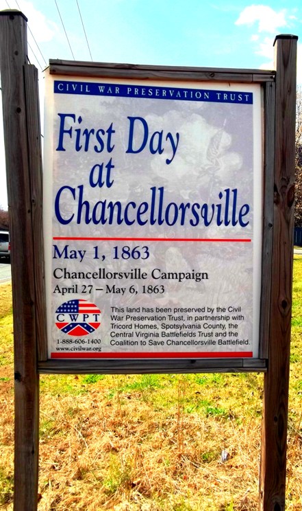
Some of the battlefield land at Chancellorsville, as many know, is partially saved by the Federal government. Seeing that land –the Chancellor site, Fairview, Hazel Grove, and others — felt calming to view.
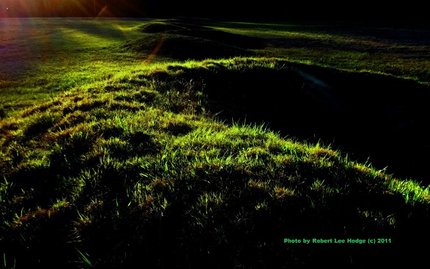
Joe and I also passed a 100-acre field from the first and second days fighting at Chancellorsville that we helped save in 1998 for the preservation group the Central Virginia Battlefields Trust (www.cvbt.org). We had gathered 200 authentic “Rebels” to replicate Stonewall Jackson’s Flank March route, 135 years to the hour, and like Jackson’s march we marched on a Saturday. Most importantly this was a preservation event, and the hardcore authentic reenactors brought $37,000 for the protection of this part of the Chancellorsville fighting – which is also still a heavily fragmented battlefield, despite big chunks saved. Semmes, Kershaw, Nelson Miles and thousands of others had fought on this field that had been up for sale and zoned commercial.
Thankfully, CVBT and the living-history reenactors stemmed the tide of sprawl on that part of the battlefield. The reenactors paid almost 1/10th of CVBT’s debt off with their contribution. It was grassroots empowerment, and it felt excellent. Every time I go by that land I think of all the fine work the reenactors did that weekend in May 1998.
Driving through Chancellorsville also reminded me of the good the Federal government can do, and that local government is often the antithesis of protecting land. Local government has much power, and exercises it through their votes. They eradicate agriculture, the family farm, forests, and the historic and cultural resources in the name of “progress” — the short-term economic opiate of development that expands a tax-base. I have been unfortunately conditioned to view this behavior as predictable. The Sierra Club conducted a great study of how local governments are not often expanding their tax-base through development, but in-fact are chasing their tail – having to also build schools, sewer lines, water lines, add police and firemen, etc.
Much great work has happened at Chancellorsville due to the Central Virginia Battlefields Trust, the Civil War Trust, and others. However, when you look at the tax-maps for Spotsylvania County, juxtaposed to troop movement maps, you realize much more preservation work needs to happen soon. This is the norm at every battlefield park there is, whether it is at remote Shiloh, or Wilson’s Creek, or the 123+ major battles in Virginia.
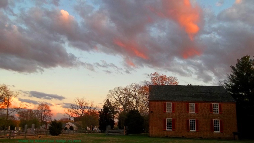
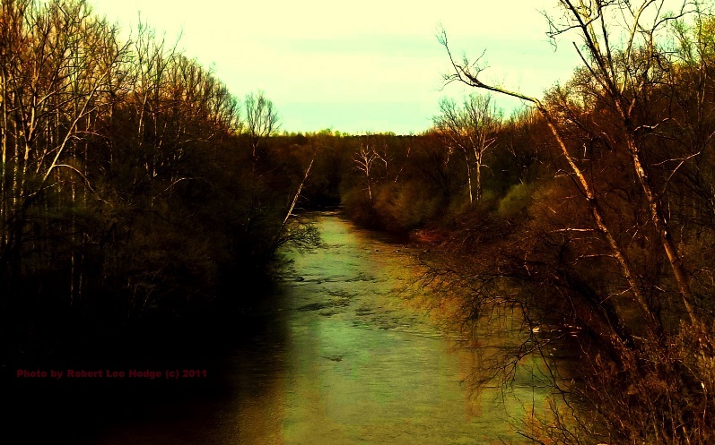
After Joe and I arrived near Culpeper County we turned south on US 522 and arrived shortly at the Raccoon Ford area. As the early rays of the sun were hitting the foggy Rapidan River, you could feel the history around us. The locale was not compromised with a sea of modern sprawl like we had hit earlier; sprawl would “kill” what we were seeing. It is hard to equate why it mattered. It triggered me to wonder, “Why does preservation matter? Why does history matter? Why does memory matter?”
Watch for the continuation of this campaigning story in the coming weeks and months…
Great article about the Raccoon Ford area. Our group (Citizens for Responsible Solar) is now fighting the Culpeper Board of Supervisors re a proposed development of an Industrial Solar site to be located directly in this sacred area. We need to stop this development here and now!
This is an excellent post. Thanks for helping wage this critical fight
Bully for Rob Hodge-a superb and engaging article-the hell you say !