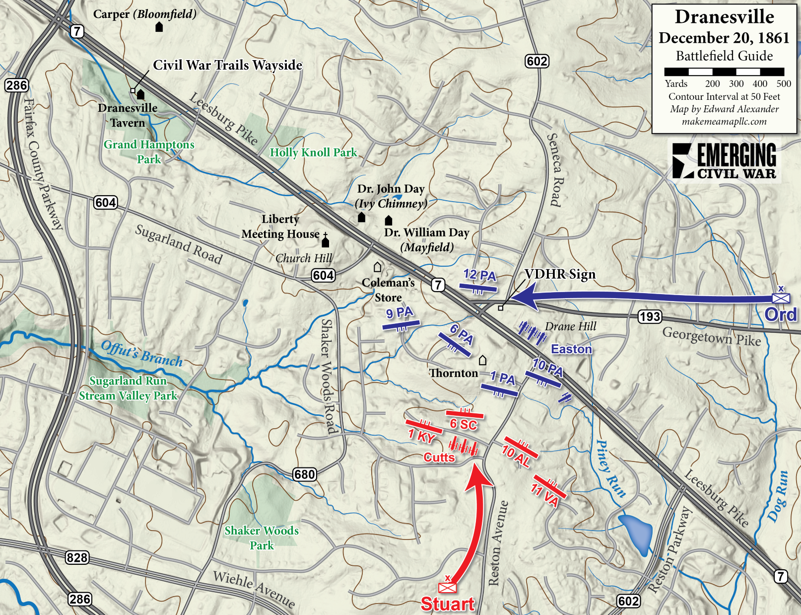
Mapping the Dranesville Battlefield
Ryan Quint’s symposium talk on the battle of Dranesville is now available through C-Span. This topic is one of the reasons I wanted to make modern maps for each presentation. My day job occasionally has me working along the Leesburg Pike around Ashburn or Tysons Corner, and I had continually wondered so where exactly is Dranesville?
Hopefully this map will help those who want to visit it on their own.
Mapping this battlefield proved a challenge, as I had not encountered a single reliable existing map. There are some artistic renditions in the Library of Congress online catalog but those did not match up with modern or historic road maps. Ultimately I just made the basemap and looked to Ryan to help fill in some of the troop positions based off of his research, which he happily obliged. I was also able to find more information on the historic homes in the region through research made available through Fairfax County and the Virginia Department of Historic Resources.
The engagement was a relatively small affair between the Pennsylvania Reserves and Confederate infantry commanded by Jeb Stuart. But as Ryan mentioned, the fighting was fierce and left an impression on those who participated in the fight. Unfortunately, there is not much left to see of the battlefield. Those looking to visit should start by visiting Dranesville Tavern, where there is a Civil War Trails interpretive wayside exhibit. Though the fighting did not stretch as far west as the tavern, it is the best landmark. Visitors can also be on the lookout for historic houses owned by the Day family as they drive on Leesburg Pike toward the battlefield itself.
My wife is a direct descendent of Colonel Crossland who fought on the Confederate side of the battle. Thank you for this map! I look forward to exploring the area. We live in Reston Virginia.