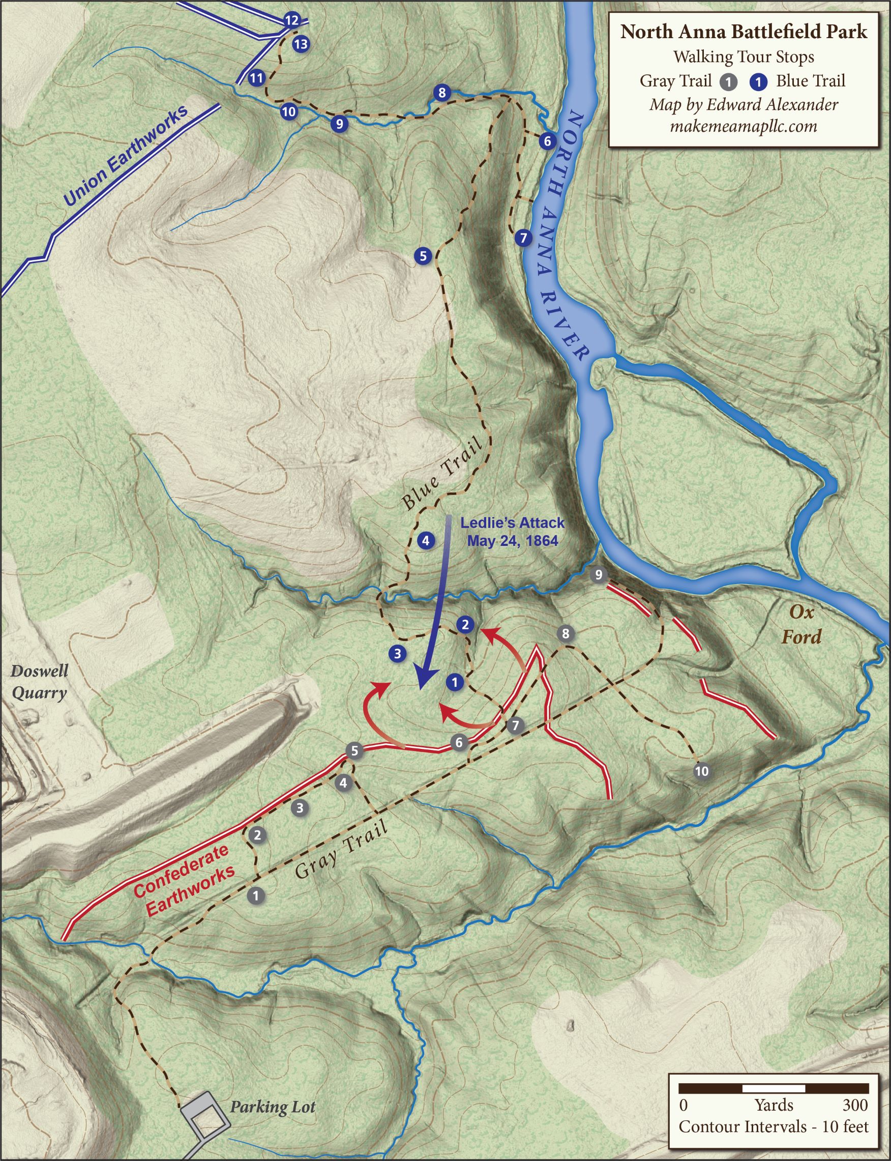
North Anna Trail Map
This past Sunday marked the 156th anniversary of James Ledlie’s doomed assault against the formidable Confederate earthworks below the North Anna, where Emerging Civil War’s Chris Mackowski recently recorded a video tour of the battlefield. Portions of this ground are well preserved by Hanover County, with over five miles of trails and twenty-three wayside exhibits courtesy of the Blue & Gray Education Society. An interpretive brochure is available to download, and please feel free to use this trail map I recently created on your own visit to the North Anna Battlefield Park.
Edward, what software do you use to create your maps? Where are the best sources you’ve found for maps, landcover and elevation data?
Don’t let anyone know your secrets, Eddie!! He uses magic!
Hey, you can’t blame a guy for trying, right? 🙂
Donald, all my design is done in Adobe Illustrator. I find it works better for the final product I am aiming for than GIS software would. Much of the shared relief is pulled from USGS 3D elevation data, and then I tinker with layering, transparency, and color to find the best background for each specific map.
Edward, I’ll look into Adobe Illustrator—thanks.