Ravines and Rifle Pits: The Lost Battlefield of Banks’ Ford
EWC welcomes back guest author Eric Atkisson.
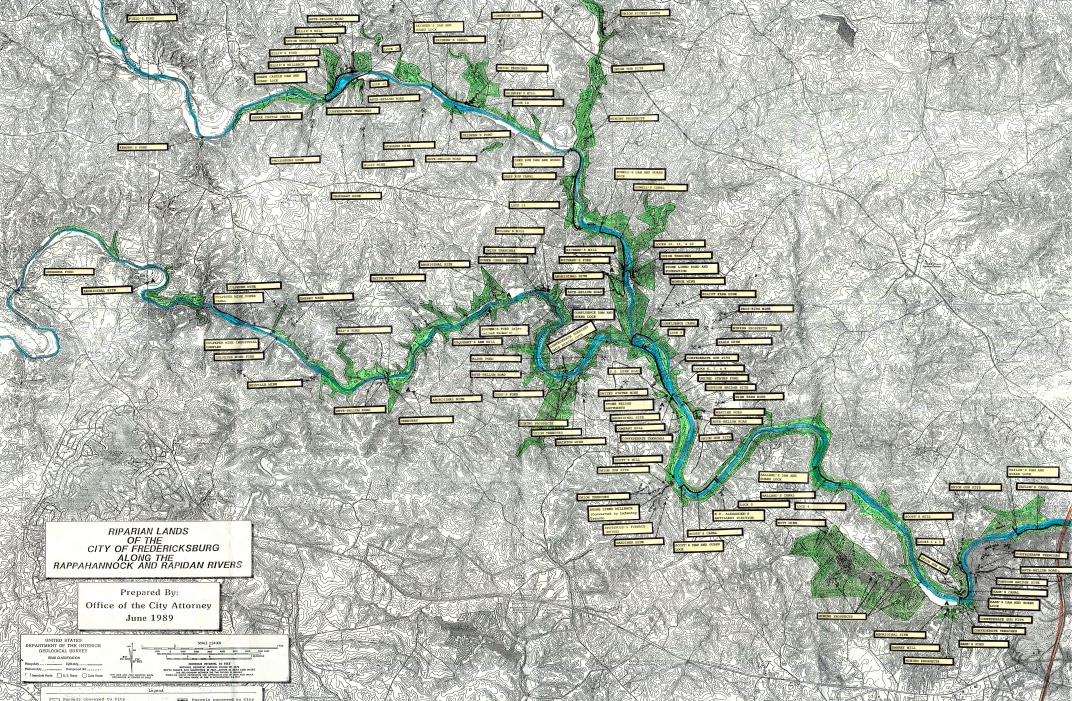
In 2006, the City of Fredericksburg placed more than 4,200 acres of watershed property into a conservation easement with the Virginia Outdoors Foundation, the Virginia Board of Game and Inland Fisheries, and The Nature Conservancy. The intent was to protect the integrity of the city’s water supply and create a “remote natural experience” for “low-impact recreational use” like hunting, fishing, and kayaking.
Stretching 32 miles up the Rappahannock and Rapidan rivers through parts of five counties, the vast riparian easement harbors a wealth of historical features, including antebellum roads, fords, ferry sites, mill foundations, canal ditches, and stone locks and dam abutments, as well as an abundance of Civil War earthworks on both sides of the river. A casual glance at the city’s 1989 “Riparian Lands” map conveys the sheer volume of such features, and it doesn’t even capture all of them:
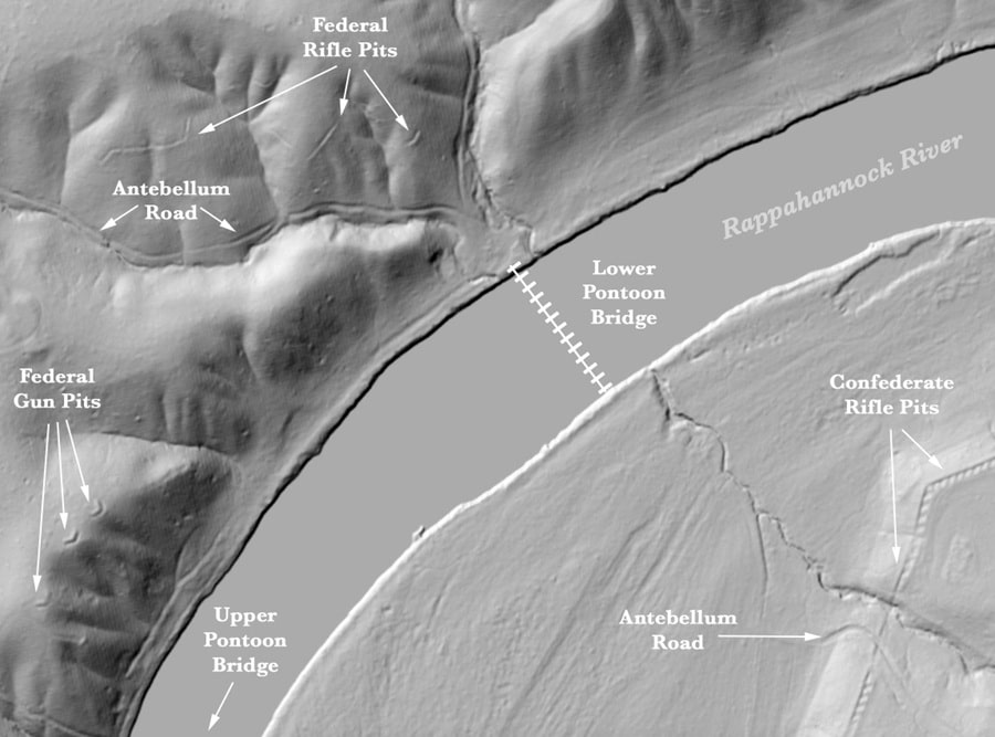
When I first started exploring a portion of the easement upriver from Banks’ Ford last year, I came across a rifle pit I couldn’t find on any maps, from the Civil War or since. About 90 feet long and roughly crescent-shaped, it sits on a narrow spur high above the Rappahannock, commanding the mouth of a long ravine and an old road trace descending through it to the river. It also faces south toward Smith’s Hill, where Confederate batteries were positioned to good effect during the Chancellorsville Campaign.
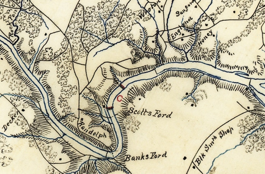
A rifle pit on the far, eastern side of the riverbend, near the site of what was then Scott’s Mill, is shorter but similarly shaped and positioned, guarding the mouth of a larger, forked ravine with multiple road traces descending to the canal locks and the mill’s surviving foundation. This one had been accounted for, along with a rifle pit above the upper ford and four different sets of Federal gun pits. Most of the Confederate earthworks on the other side of the river were also accounted for.[1]
Wondering what else may have been missed within or near the boundaries of the easement, I began studying LiDAR[2] imagery of the area. The intriguing closeup below eventually led me to explore a third ravine, downriver from the other two. There I found three rifle pits totaling around 450 feet and at least two other cuts that may have been unfinished rifle pits, making it by all appearances the most heavily defended Federal portion of the Banks’ Ford area. It’s also the same ravine half of Sedgwick’s VI Corps retreated up after crossing the lower of two pontoon bridges in the early hours of May 5, 1863.
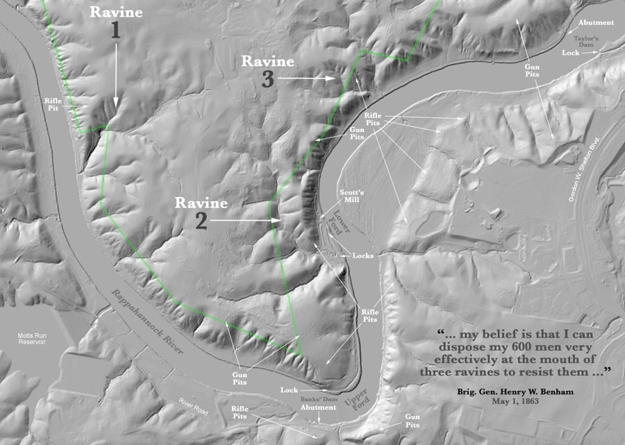
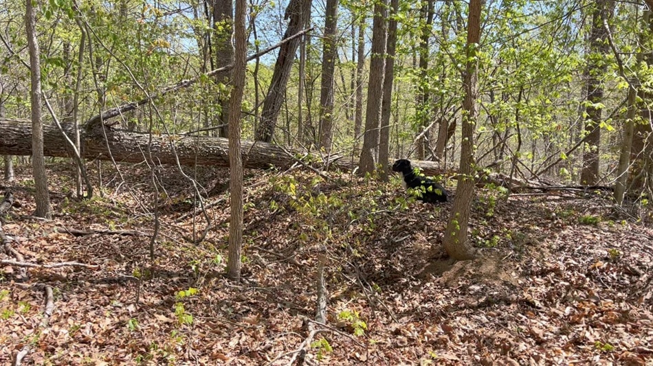
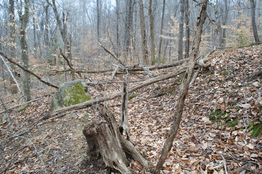
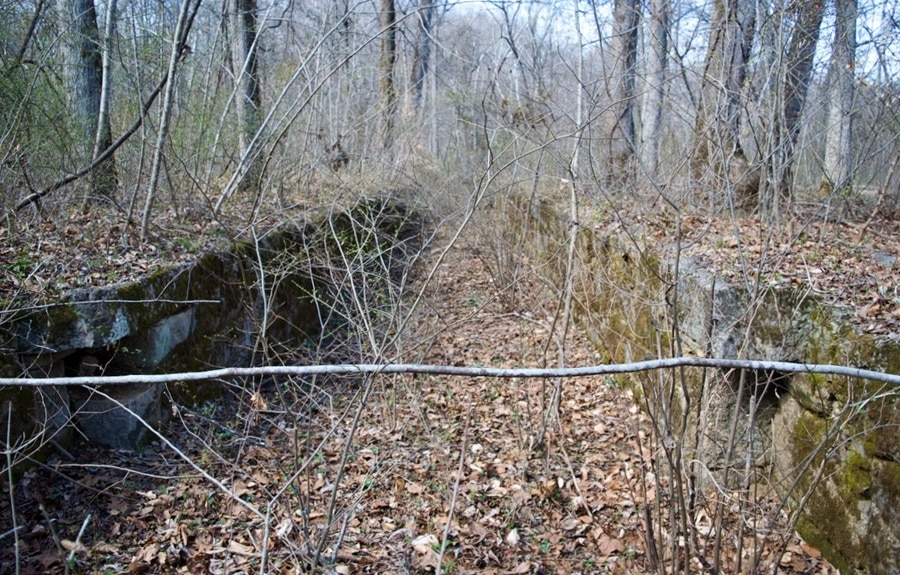
That these rifle pits could have eluded the historical record for so long is due partly to the miles of currently vacant private property blocking them by land and partly to the nature of the easement itself, which has fostered a truly dense riparian wilderness.[4] Today, deadfall covers many of the gun pits and rifle pits along both sides of the river, and living trees grow out of them, some large enough to tear giant chunks out of the earthworks when they eventually fall. Even the antebellum stone locks near Scott’s Mill are so thoroughly covered and surrounded by thick vegetation that they’re almost invisible.
One of the easement’s laudable goals is to “protect the historic and archeological resources located on the Property.”[5] The abject state of nature to which most of those resources have been consigned, however, argues for a more expansive form of protection that includes preservation. New trails and access around places like Banks’ Ford could help with that, allowing local “Friends” groups to monitor and maintain historic works in a careful, respectful manner consistent with easement guidelines, and to identify other resources that may have been missed.
Eric Atkisson is a retired Army National Guard officer and veteran of the Persian Gulf and Iraq wars. He recently started the Friends of Banks’ Ford Battlefield and volunteers for the National Park Service, Friends of Wilderness Battlefield, Cedar Mountain Battlefield Foundation, Culpeper Battlefields State Park, and Central Virginia Battlefields Trust.
Endnotes:
[1] City of Fredericksburg, VA, “Historic Resources Along the Rappahannock and Rapidan Rivers,” 95, accessed May 18, 2026.
[2] Light Detection and Ranging, a technology that uses pulses of laser light to measure distances and map 3D environments with extreme precision. Deployed aerially, it can penetrate thick forest canopy and identify hidden features like structural ruins and earthworks.
[3] The War of the Rebellion: A Compilation of the Official Records of the Union and Confederate Armies (Washington, D.C.: Government Printing Office, 1880–1901), Series 1, Vol. 25, Part 2, 331.
[4] All of the private property on the north side of the river around Banks’ Ford belongs to the Silver Cos. of Boca Raton, FL, and is vacant but slated for future development. The Fredericksburg Area Metropolitan Organization’s River Crossing Parkway Study envisions a major road extension across the property, with a bridge further extending it to Silver properties in the Central Park shopping area. The route currently receiving the closest study would place the bridge over or near the lower ford.
[5] Fredericksburg, Management Plan, 1.
Excellent research and descriptions.
Thank you, Kevin!
This is great. Keep up the excellent Yeoman’s work.
Thank you, and will do!
This is really great detective work. To spot these long deserted battlefield relics. You not only need a very keen eye plus a very active imagination to see though the dense thickets that act as guardians of the past.
Thank you, Ted! What’s especially amazing is that the trenches in that third ravine are almost within a direct line of sight from the I-95 bridge, about a mile away. To be so close to Fredericksburg and all of that surrounding development and yet lost to the historical record because of the severe terrain, the thick forest, and the private property that walls it all off from the north is a rare thing.
many of the confederate rifle trenches are also equipped with firing bays which allowed some protection from enfilading fire from the Federal side of the river….
Wow! This is amazing. My great-great-grandfather, Col. Charles A. Clark, who was serving then with the Sixth Maine, earned his Medal of Honor there. We have long wondered exactly where these actions took place.
You can find his dramatic telling of the events starting on @page 35 here: chrome-extension://efaidnbmnnnibpcajpcglclefindmkaj/https://upload.wikimedia.org/wikipedia/commons/c/ce/Campaigning_with_the_Sixth_Maine_-_a_paper_read_before_the_Iowa_Commandery_Military_Order_of_the_Loyal_Legion_of_the_United_States_%28IA_campainsixthma00clarrich%29.pdf
Thank you for this!!
LIDAR is a powerful tool, thanks for your work to interpret the ground.