A(nother) Word on Behalf of Preservation from the Banks of the North Anna River
The battlefield along the North Anna River remains one of the most beautiful gems in Virginia. Had I not known better, though, a recent stop on the battlefield might have made me think the war had only recently swept through.
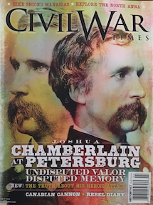
For its April 2017 issue, Civil War Times invited me to help readers explore the North River. This was a huge treat for me, and exciting, because I am such a fan of the North Anna phase of the Overland Campaign. It has such fascinating psychological facets, yet it popularly gets overlooked because of the bloodbaths that came before and after. But it’s because of these fascinating components that Strike Them a Blow: Battle Along the North Anna remains one of my favorite books that I’ve written.
When I travel back and forth to Richmond, I like to make the short detour off I-95 to North Anna whenever I can. Recently, I made the detour because I wanted to re-see the battlefield in the wake of the Civil War Times article.
 I was so pleased with the photographs Shenandoah Sanchez took to accompany the story. He captured North Anna at a time of year—early winter—that doesn’t show off the battlefield’s full natural splendor. However, like all good photographers, he found a way to see his subject and then help me see it, too. Instead of a drab, leafless forest, Sanchez showed the North Anna as a still-wild landscape. Best of all, he captured a sense of something I can only describe as waiting. The battlefield was waiting—for visitors, for the armies, for magazine readers, for spring.
The battlefield I found, however, was not the one I saw in Sanchez’s thoughtful images, nor the drab-dreary winter forest I might’ve otherwise expected.
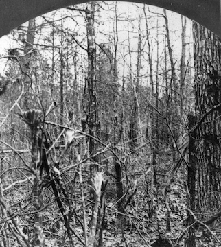
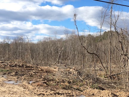
Coming up on the river from Route One, I was stunned to see the beautiful south bank of the river looking very much like one of the apocalyptic post-battle landscapes so familiar to me from other facets of the Overland Campaign, denuded of brush and stripped of trees—except this was 2017 not 1864.
I had noticed last summer along Oxford Road, which runs along part of the north bank, that someone had been doing some clearcutting. (See my blog post from May 27, 2016.)
For what purpose, I had no idea, nor did I know anyone I could ask. The cutting took place to the west of the old Telegraph Road trace, away from Henegan’s Redoubt, so it didn’t look like it would impact the historic landscape, but of course, you never can tell with stuff like that.
To see that the cutting—or different cutting by someone else—had jumped the river alarmed me because now it did look like it might impact the historic landscape.
Here, a strip of trees a few hundred feet wide separated a farmer’s cornfield and the riverbank. The far edge of the field bordered the roadbed of the old Telegraph Road. Abutments of the old Chesterfield Bridge—which Confederates failed to burn, allowing Federals a relatively easy crossing under artillery fire—link the roadbed to the riverbank. On the far north bank, another abutment stands sentry, completing the route if you connect the dots.
There’s no way for me to know what might be going on, but living as I do in the choked area between Fredericksburg and Chancellorsville, my mind first jumps to the worst possible conclusions. The lost Salem Church battlefield is just down Route 3 from me, and just to the north of me along the “First Day at Chancellorsville” battlefield, more houses have been going up adjacent to property the Civil War Trust saved years ago.
So much of the North Anna battlefield remains vulnerable. Hanover County’s battlefield park preserves a good stretch of the Confederate lines and part of the Federal attack field, and the Trust and Richmond National Battlefield have done incalculable service by preserving the battlefield’s Jericho Mill sector. However, those properties total slightly more than 830 acres—out of a total of 16,506.26 acres that fall within the hypothetical battlefield boundary established by the National Register and the National Park Service. That’s only five percent.
Other portions of the field remain in the private possession of conscientious landowners. We’re fortunate that that’s been the case for a century and a half. But we also know that could change in a heartbeat, the sale of a property, the loss of a job, the need for some cash or some room for expansion, the death of a family member.
In the meantime, I’ll continue to enjoy the North Anna area as long as I can. I urge you, too, to go there and, as Civil War Times suggests, “Explore.” Appreciate how beautiful it is. See it with news eyes, as Sanchez invited me to. Be vigilant. And please, whenever you can, support preservation.
* * *
I’ll be talking about Lee’s defense at the North Anna at this year’s Fourth Annual Emerging Civil War Symposium at Stevenson Ridge. I hope you’ll join us!
Click here for more ECW stories from the North Anna River.
One of my favorite battlefields… a highly recommended visit!