A Walk to the Site of Pelham’s Death
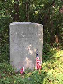 At the Symposium over the weekend, one of the attendees asked me how to get to the John Pelham marker at Kelly’s Ford. “Keep walking out the trail, and when you think you’ve gone too far, keep going,” I told him. “You’ll eventually come to a fork. Take the right, and it’s off in the bushes on the left-hand side down the trail.”
“I kept going all the way to the river,” he said.
“It’s out there,” I assured him.
I later heard that he asked someone else. “Chris apparently doesn’t know where it is,” he told that person.
Except I do. I just didn’t have exact directions to give him, that’s all. (I admit, “It’s out there” doesn’t really pinpoint much.)
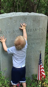
On Tuesday, I had the opportunity to take Sarah Kay Bierle and some other folks out to the site (including my 2-year-old battlefield buddy, Maxwell). While we were out there, Sarah shot a quick video for ECW’s YouTube channel. I, meanwhile, measured the trip so I could provide, here on the blog, more exact directions to the site of the marker for all those who try to make the trek and can’t find their way.
The marker is located in the C. F. Phelps Wildlife Management Area on the south bank of the Rappahanock River. There’s a parking area just off Route 674, 0.9 miles from the intersection to Kelly’s Ford Bridge.
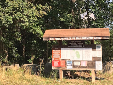
From the yellow gate at the parking area, it’s .38 miles to the marker. My Fitbit told me I took 806 steps to get there.
Past the yellow gate, a gravel road stretches into the woods. The remains of a stone wall are visible in the woods to the right of the path; this is the stone wall Federal troops hunkered down behind during the first phase of the battle.
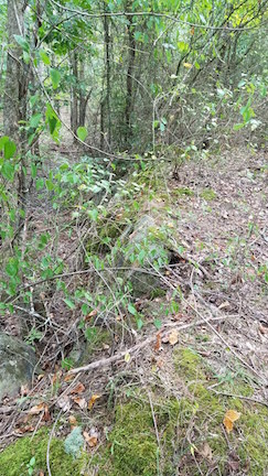 The gravel road eventually narrows to a pathway. Farther along, it will wind beneath a large fallen tree that leans over low enough to force hikers to crouch beneath it. The tree is crawling with poison ivy, so be careful not to brush against it as you duck under.
About 0.05 miles farther, the path forks. The fork isn’t easy to see unless you’re looking for it. Go right.
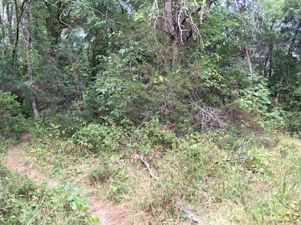
More fallen brush across the path forces a hiker to do a little weaving.
And then suddenly, past the foliage of a fallen tree, there’s the marker, standing like a creature of the forest, still but vigilant, watching, waiting, wondering if you’ll see it.
We did.
And now you can, too.
It is always important and touching that we remember family, regardless of which end of the table at which they sat.
Sounds like a great place for some volunteer path clearing when the weather cools down … and maybe a couple of wayfinding signs.
Thanks! I am from Hoover, Alabama and a civil war fan of Major John Pelham, CSA. I live 2 miles from the City of Pelham which is named after Major Pelham. John was from Jacksonville, AL.
It is a shame that it is so hard to find. Thanks again for the effort.
Impeccable directions, and easy, if you have been there once before 🙂 I bet it’s a lot easier to spot in the winter.
Thank You Chris!! Adding to my CW hiking bucket list!
Hi DC, if you don’t mind me asking what other places are on your Civil War hiking bucket list? Always looking for places to combine the Civil War and hiking!!
Was there today, September 15, 2022, must admit that if it wasn’t for you directions we would never have found Pelham Marker.. No signs of any kind about it, very over grown this time of year, no one has maintained even the main trail going in this year.. but by determination and some luck in finding your directions we finally came across it.. and probably a 100 chiggers. I took coordinates on my cell phone and will post separately
In 1863 a young confederate cavalry officer was struck in the head by a fragment of a Union artillery shell. Knocked from his horse he fell near a gap in a field stone wall where Union cavalrymen hid, fired and retreated from their opponents. That day a farmers field up to the wall yielded to brush along the river concealing the ford there.
A monument stands today at the gap in the wall where the officer, Major John Pelham, fell. A hunters trail through what in now thick brush and trees leads to the monument for steadfast history buffs willing to face the insects, fallen trees and poison ivy that guards the site.
If you find the marker note that it is where Pelham lived his last conscious moment on March 17, 1863. He succumbed to his wound in nearby Culpepper, Virginia in the predawn dark of March 18th in the home of Judge Shackleford. The judge’s daughter Bessie wore mourning for “the Gallant Pelham.