ECW Weekender: Tom’s Brook “Battlefield”

 “There’s nothing to see at Tom’s Brook,” my battlefield buddy told me.
“Well, I know there aren’t monument and markers, but I have book with a driving tour so we can see some of the battleground. Let’s just see what there is to see.”
With the book Bloody Autumn by Dan Davis and Phill Greenwalt, we headed out to explore the three tour stops listed in the ECW series. In case you’re looking at your own copy of the book, we used tour stops five through seven in Driving Tour #2 toward the back of the volume.
A cavalry fight erupted around Tom’s Brook on October 8-9, 1864 in the Shenandoah Valley, with the most famous parts of the battle on the 9th. The Confederate Laurel Brigade under General Tom Rosser attempted to hold off an attack from Union General George Custer while to the east General Lunsford Lomax encountered blue troopers commanded by General Wesley Merritt.

Custer and Rosser had been at West Point prior to the war, and on the morning of October 9, Custer spotted his friend on Spiker’s Hill. Riding out, the officer in blue saluted Rosser, saying, “Let us have a fair fight and no malice.” In the battle, a flank attack and steady assault broke the thin Confederate lines. The results were similar to the east, and the battle was called “the Woodstock Races” by Union cavalry, mocking the direction that their opponents had quickly fled.
Confederate General Early, tasked with trying to defend the Valley one last time, lost confidence in his cavalry after the fight at Tom’s Brook. However, he still had hopes for his infantry—resulting in the Battle of Cedar Creek ten days later.
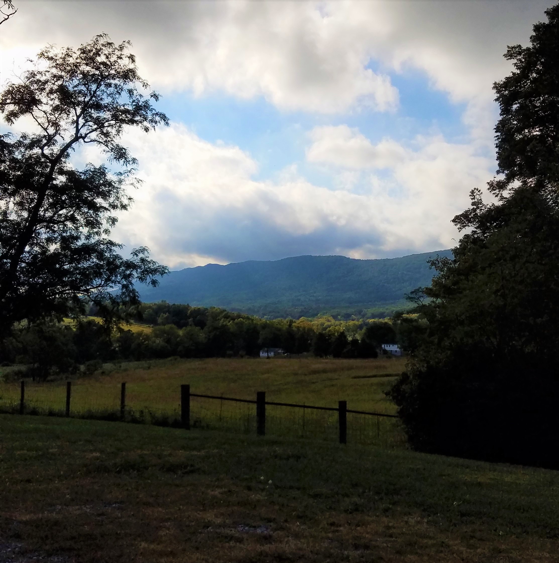
Tom’s Brook is a battlefield, even if it doesn’t appear like the well-marked sites of better-known combats. What I really appreciated about the three driving tour stops recommended at Tom’s Brook is the opportunity to look at land that is still virtually untouched by development and most of it still privately held. The later point makes it difficult to go take a hike or consider hauling a horse out there for a really authentic perspective, but many of the paved roads follow the originals from the 19th Century.
Driving along Back Road follows the route of skirmishing as Union troopers drove back the Confederates to Spiker Hill. From a church parking lot, I looked across to Spiker Hill and knew that somewhere —probably within the current view—Custer had ridden out to greet and salute his West Point friend. Driving over to east side of the battlefield (marked by a Civil War Trails sign) was helpful for understanding the range of the fighting area.
It’s helpful to have a guide book and bring along other books about the cavalry fights in the Valley in 1864 since you’ll have to figure out where to place the units without the aid of granite markers, but Tom’s Brook is worth the jaunt off Route 11 or Interstate 81 in the Shenandoah Valley. It’s a place where time seems to have stood nearly still. Driving the fought-over-roadway and looking at the high ground as autumn light shines in the Valley and the changing leaves on the trees start to fall offers some of the best, off-the-beaten path battlefielding I’ve enjoyed this year.
Oh…and I convinced my battlefielding buddy that there is something to see at Tom’s Brook. We just needed some resources, patience, and a little imagination to see the autumn scene as the place where horsemen charged.
This is excellent and easy to understand. Are you interested particularly in cavalry battles? If so, David Ruth, former superintendent of Richmond Battlefield Park, is going to write about May 4-13, 1864. His particular emphasis will be on Sheridan’s Richmond raid.
Bryce
According to my understanding of the battle, the scene where Custer saluted Rosser happened in the fields just south of the modern St. Matthew Lutheran Church on Sand Ridge Road. I was surprised how the ground sharply drops off toward Toms Brook (the river) in this sector. Rosser would have been in the fields north of Big Oak Lane, on the other side of the creek, nearly all of which is heavily wooded today and not accessible.