Shenandoah County Park Unveils New Civil War Trails Sign for Tom’s Brook

 “Don’t let anyone tell you that interest in the Civil War is waning,” says our friend Drew Gruber, executive director of Civil War Trails. “More new signs!”
Drew passed along word from Shenandoah County about a new sign offering details about the battle of Tom’s Brook during the 1864 Valley Campaign. It’s the first of several new signs planned for the county.
From the Shenandoah County press release:
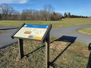
A new Civil War Trails sign was installed at Shenandoah County Park in Maurertown offering a newly updated map, text and media to help fuel the visitor’s imagination. The effort was spearheaded by Civil War Trails, Inc., Shenandoah County’s Department of Tourism and Economic Development, Shenandoah County Parks and Recreation, and the Shenandoah County Library. It is the first of several new signs being planned for the County.
This new sign replaces and older version which has served visitors for over two decades. The content and text was researched and drafted by Zach Hottel, archivist for the Shenandoah County Library.
In fact, the Civil War Trails program is constantly refreshing and update their old signs – even as new sites join. “Our program is unique in that the sign content is constantly updated to keep pace with scholarship, input from the communities, and expectations from our dynamic audience,” said Drew Gruber, Executive Director of Civil War Trails, Inc. “A story like this one has been told and retold for over 150 years so our challenge was to ensure we delivered exciting content to both our dedicated history travelers and those who may happen upon the sign.”
Each Civil War Trails site is networked together with over 1,400 others across six states. Each site is marketed internationally by state tourism offices, destination marketing organizations and municipal partners. Especially over the last two years the Civil War Trails program has been instrumental in driving safe and responsible travel to communities. “History based travel, including those exploring the Civil War Trail signs derive an economic impact at the local level as visitors spend money and support other local businesses within the region,” says Jenna French.
Shenandoah County Parks and Recreation also assisted in the effort, permitting a new, more visible location. The new sign is being installed closer to the athletic courts to help increase accessibility and provide visitors with a better perspective of the historic battlefield. The park is located at 380 Park Ln., Maurertown, VA and is one of a dozen Civil War Trails sites throughout Shenandoah County. Check out the interactive map at civilwartrails.org to begin planning your own trip.
For more information about the program please contact Civil War Trails, Inc. at 757-378-5462. Snap a sign selfie and tag them @civilwartrails and #civilwartrails. For more information about Shenandoah County or for a visitor guide check out visitshenandoahcounty.com
“Our program is unique in that the sign content is constantly updated to keep pace with scholarship, input from the communities, and expectations from our dynamic audience.”
Civil War Trails might want to think twice about hiring anyone named “Winston Smith.”
Has anyone noticed a pattern where CWT changes the wording or placement of their signs, based on the actions of activist groups? It’s one thing if a community wants a sign to be moved or its wording changed; it’s another if the “dynamic audience” is only a few zealots with laptops, lawyers and flags/banners.
I’ll stipulate that Civil War Trails is in a very, very difficult spot. It has to create one sign, and put it at the right spot, to commemorate an event that generates passions among groups of passionate people who often disagree with each other.
It’s also important to support Civil War Trails. Otherwise, people will drive by important places from the Civil War and never know what happened there. When I took my son on the Route of Lee’s Retreat, I relied on CWT signs to tell the story.
Nice! Looking forward to checking it out. I really like Tom’s Brook area and the driving tour notes in Dan Davis and Phill Greenwalt’s “Bloody Autumn” (ECW Series) are my current go-to directions for exploring that battlefield.