ECW Weekender: Exploring The “Waterlogged Marsh” at Fredericksburg

For a couple of years now I’ve wanted to explore the low ground between Prospect Hill and Slaughter Pen Farm. It’s the area where — on December 13, 1862, during the Battle of Fredericksburg — General George Gordon Meade’s Union troops broke through Confederate General “Stonewall” Jackson’s division lines.
In his classic study on the Battle of Fredericksburg, historian Frank O’Reilly described the situation and how the Confederates viewed it:
“Gregg rested his command on the Military Road, behind a waterlogged marsh. The road was a improved logging path that ran along the ridgetop. The Confederate high command had determined that the six-hundred-yard wide wetland between Archer and Lane wa impassable to an organized force. Officers from Lane’s and Archer’s brigades objected, but A.P. Hill assured them that the “interval,” a trivializing term used by Hill to describe the area, could not be breached. He placed Gregg’s South Carolina brigade in reserve behind the gap just to be certain.” (The Fredericksburg Campaign: Winter War on the Rappahannock, page 129.)
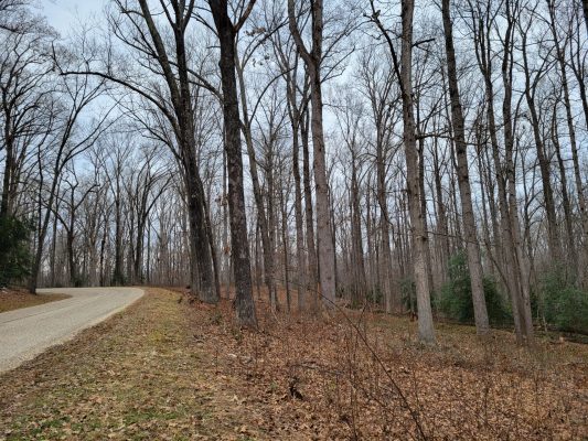
There are no official trails into this area of the battlefield, but it is within the National Park Boundary. After spending some time looking at maps, I decided to walk in on the Bernard Cabin Trail (off South Lee Drive), then continue toward Prospect Hill, following the NPS Boundary line which is in the woods parallel to the railroad track. I knew that if I stayed along the boundary and well away from the tracks I would not have an issue with trespassing or potential dangers from the train.
One Sunday afternoon when the temperatures rose to nearly 40 degrees, I bundled up, left my plans with a responsible person, and headed down the trail. Since this is a bushwhacking adventure and an area not easily accessible I took photos along the way. Want to come along on a hike?
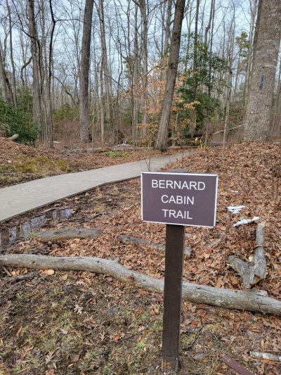
Starting the trail that is maintained by the National Park Service out to the site of the Bernard Cabins. The cabins for the enslaved community were destroyed during the 1862 battle and never rebuilt.
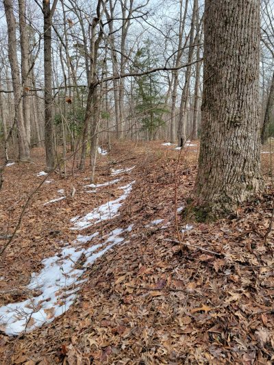
Snow can be helpful when photographing trenches. These were likely built after the Battle of Fredericksburg.
The ground, mud, and shallow puddles are all frozen! It’s actually kind of nice, just step carefully in case it’s a slick patch of ice.
There’s still snow on the ground at the Bernard Cabins clearing. If you’re familiar with the trail, the interpretive panels are just ahead on the rising ground…
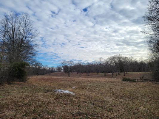
Approaching the NPS Boundary and getting ready to turn right toward Prospect Hill. The railroad tracks are visible in the background and just on the other side of the tracks is Slaughter Pen Farm. We’re in low ground now.
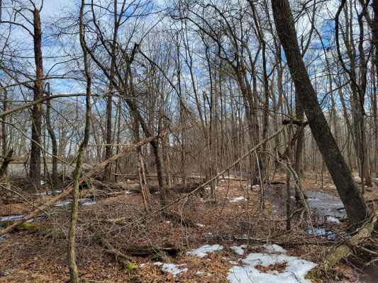
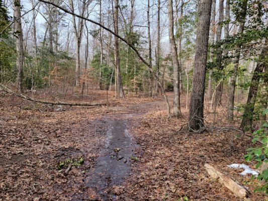
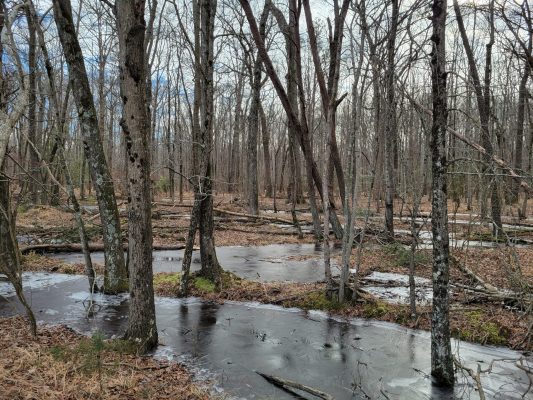
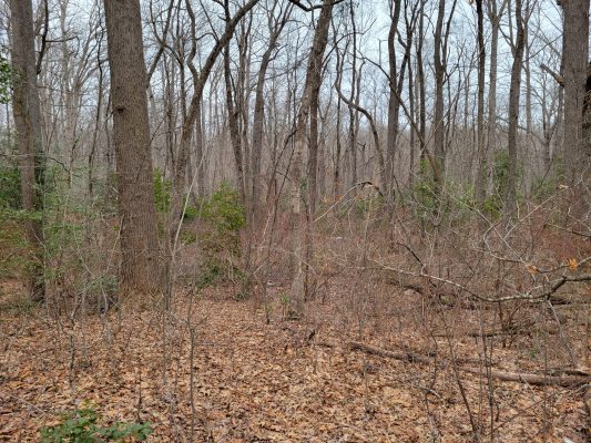
Again the railroad tracks are visible at the left side of this photo. There are a lot of shallow frozen puddles that can be walked over. I’m not sure this area would be passable during the summer and even if it is passable, I imagine this is “snake heaven.” I am glad to attempt this adventure in the winter.
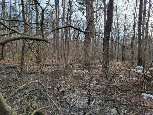
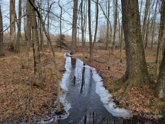
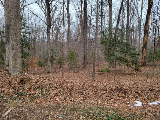
The puddles and water-filled ditches get deeper and the ice is thin. I have to find strips of land to walk on. The brush gets denser and in some areas, it’s a twister game to get through. I think about turning back. I can see this is low, unpleasant ground. But then I think that this might be one of the best times to explore. At least the mud is frozen. I keep going and hope I can keep my boots relatively dry.
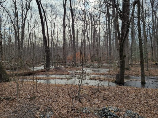
Part of the way there is a deep ditch of water and I’m able to push through the brush on the dry land beside it and along the Boundary Line. I wonder if this is an old trench that could’ve been built after the battle? Or maybe a historic ditch fence for a boundary? But I didn’t bring heavy books into the woods today. I’ll have to look another time.
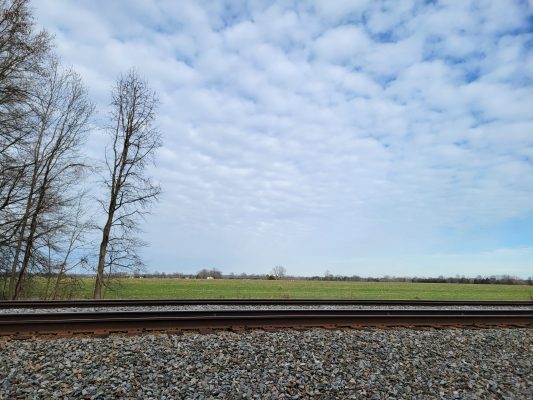
I leave the woods to take a peek over the railroad tracks into Slaughter Pen Farm. The house at the parking area is just barely visible. As I keep walking, I’ll be crossing the ground where Meade’s troops achieved their breakthrough.
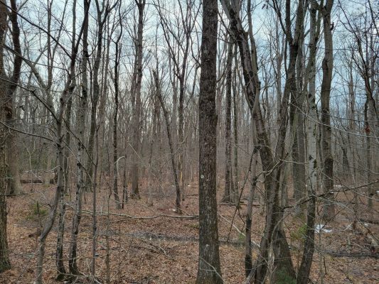
This looks like low ground to me. I pause to watch some woodpeckers hammering on the trees and little nuthatches flitting from branch to branch. (But I wasn’t able to get a good photo of the birds. Sorry!)
But would you leave it protected with just a skirmish line and reserves on the high ground, opening a gap in the rest of the defensive line? That’s what the Confederates did in December 1862.
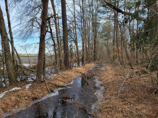
As I get close to Prospect Hill, I notice that the wooded ground begins to sloop up toward the south (the direct I’m walking). Maybe I’m leaving the marsh at last.

And there’s the pyramid, now called Meade’s Pyramid. It’s on the other side of the tracks and not accessible, so I just take a photo and turn toward Prospect Hill.
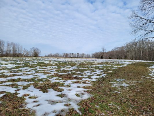
In case you ever wondered if Prospect Hill is really a hill… Yes, it’s a pretty good piece of high ground.
I start following the NPS road (South Lee Drive) back toward the Bernard Cabins trailhead. Check out how quickly the ground is sloping away toward that swampy area as I’m heading away from Prospect Hill.
A little further up the road… Here’s a look into the woods and again that slope down toward the “swamp” and the railroad tracks is clearly visible.
Here’s a look from directly behind the NPS interpretive signs about the Union breakthrough. Just a few feet behind the signs the ground drops quickly into the low area. Feeling chilled, I decided not to go back down.
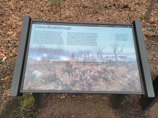
Here’s one of the interpretive panels. There are very accessible at the pull-off along Lee Drive.
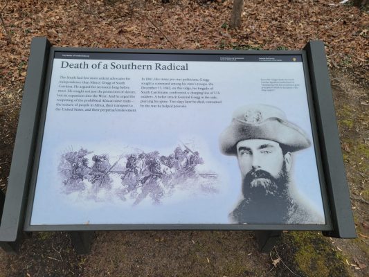
And the other interpretive panel which tells about Confederate General Gregg’s mortal wounding.

Thanks for “hiking” with me at Fredericksburg in this ECW Weekender.
My takeaways from the walk are:
- Yes. The ground is terrible.
- If this area was left unguarded (which it was), it’s the perfect spot for a breakthrough. The marshy swamp is unpleasant but not deep enough to actually prevent determined soldiers from advancing.
- I’m glad I did this bushwhacking adventure on a really cold day. I’m not sure that I would have been able to complete it except for the frozen ground.
- While exploring within the NPS boundary is allowed, I would not recommend this hike. I can see that there is a reason there’s no trail in this area!
Good article
Thanks for reading and “hiking” with me.
Sarah Kay, thanks for such an interesting and informative virtual hike. Love your commentary, it really gave me a sense of being there.
Aww…thank you. I wish I could’ve got a good photo of the woodpeckers to share. They were incredible to see in the wild.
Excellent tour of the low ground, Sarah! Thanks for asking me to come along.
Thanks to our battlefield tour guide,Sarah Kay , I imagined I was there and saw the maneuvers and battle . A job well done !
Thank you! Your use of photos and descriptive text reminds me of the Blue & Gray
Magazine articles. Such offerings are very informative for those that have limited opportunities
to “walk the ground”. Again…..thank you.
Thank you. I’ll try to do some other walks like this at lesser known or harder to reach sites.
SarahKay, your piece, together with the pictures, adds significantly to my understanding of this part of the battle. With the recent ABT fundraising campaign on the Slaughter Pen Farm, including hiking videos, you have helped me understand previously under reported aspects of the battle.
Wonderful! Thanks for sharing. I can’t wait for the victory announcement from the Trust…soooo close!
Let me know the next excursion in that area. I’ll join you.
Fine tour! You make it very easy to visualize this remote portion of the field. Many thanks!
Thank you for this virtual tour. Your picture of Prospect Hill from its base really shows its elevation more than is apparent from the tour road.
Thank you, Sarah, for photographing the low ground as you hiked. I’ve been up to the railroad tracks from the Slaughter Pen side and peered into those woods; they look some different from the “Confederate” side!
Thanks for taking this walk through this famous ground so I don’t have to!