Civil War Weather: How African Winds and Yellowstone Snows Impact Mississippi River Valley Civil War Sites
In January 2023, I gave a presentation about by second book Defending the Arteries of Rebellion: Confederate Naval Operations in the Mississippi River Valley 1861-1865 to the Brunswick Civil War Round Table in North Carolina. At the end of the presentation, I was autographing some books when a group member approached. His question was one I have been asked a few times before at speaking engagements discussing naval engagements across the Mississippi River valley: Besides visiting the Vicksburg National Battlefield Park, what is the best Mississippi River site for experiencing these naval engagements?
I quickly answered Port Hudson, Louisiana. The state park there offers extensively preserved trenches and fortifications with wooden platforms allowing visitors to walk directly over them. Having walked Port Hudson numerous times, I can say that it is most certainly worthy of more visitors.
The questioner wanted more sites, and after a few seconds I had to explain something that most Civil War site visitors do not quite realize. Many Civil War battlefields are preserved in national or state military parks. In them, painstaking efforts are taken to recreate the exact fence lines and woodlots that were present during a battle, but winds from as far as Africa and snow from as far as Yellowstone National Park in Wyoming has severely impacted the Civil War’s Mississippi River valley sites. Many are now either lost or are so altered that it is difficult to actually reach, fully experience, or preserve them.
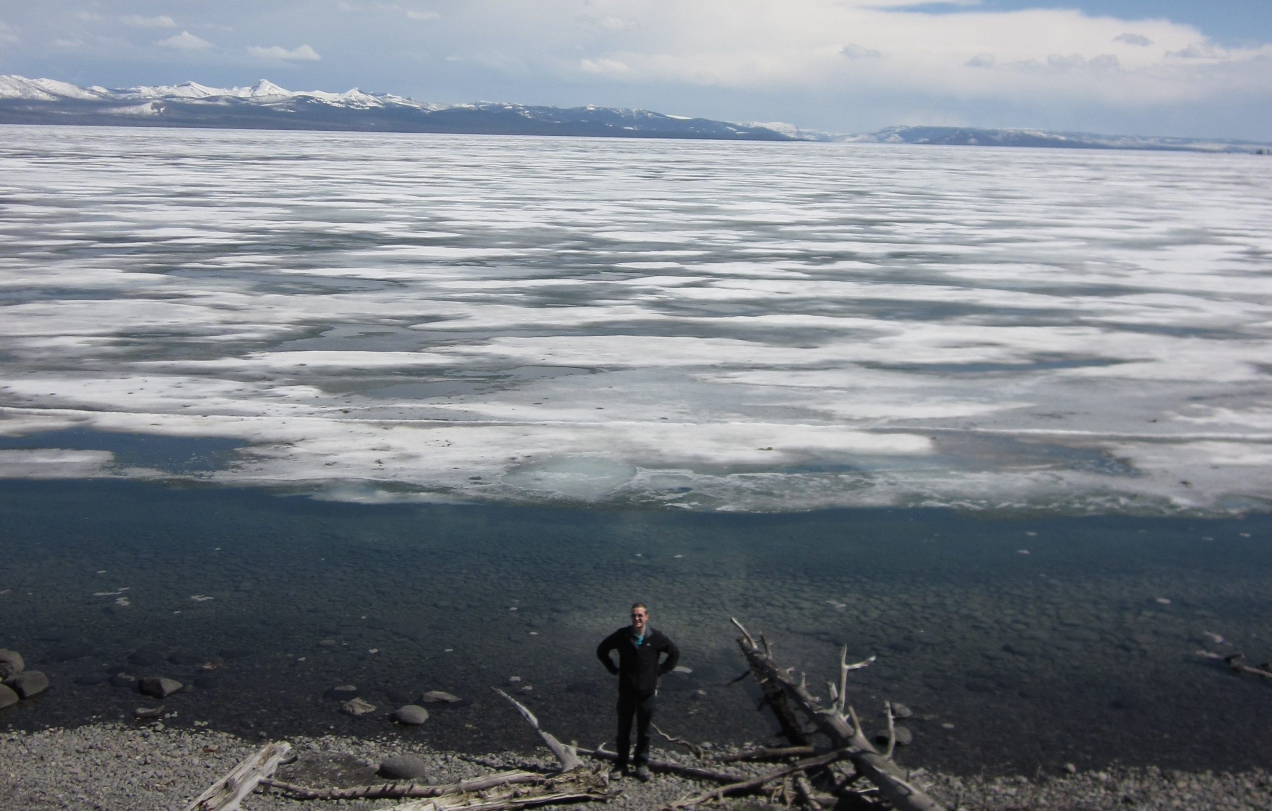
What exactly do I mean by African winds and Yellowstone snow? Exactly that. High- and low-pressure systems drive winds and storms from the African coast across the Atlantic. These can form hurricanes that impact the eastern seaboard, especially the Gulf of Mexico and Mississippi River Delta. In the southern Mississippi River, hurricanes and coastal erosion have impacted Louisiana’s Civil War sites. The Mississippi River valley is also impacted by annual freshets when winter snows melt, bringing rivers across the continent to flood stage, increasing currents, and causing flooding. Snowfall as far as Yellowstone melts into Yellowstone Lake, which flows into Yellowstone River, which then flows into the Missouri River, and then into the Mississippi. Shifting channels, both through manmade adjustments and annual spring thaws, have literally changed where inland rivers are.
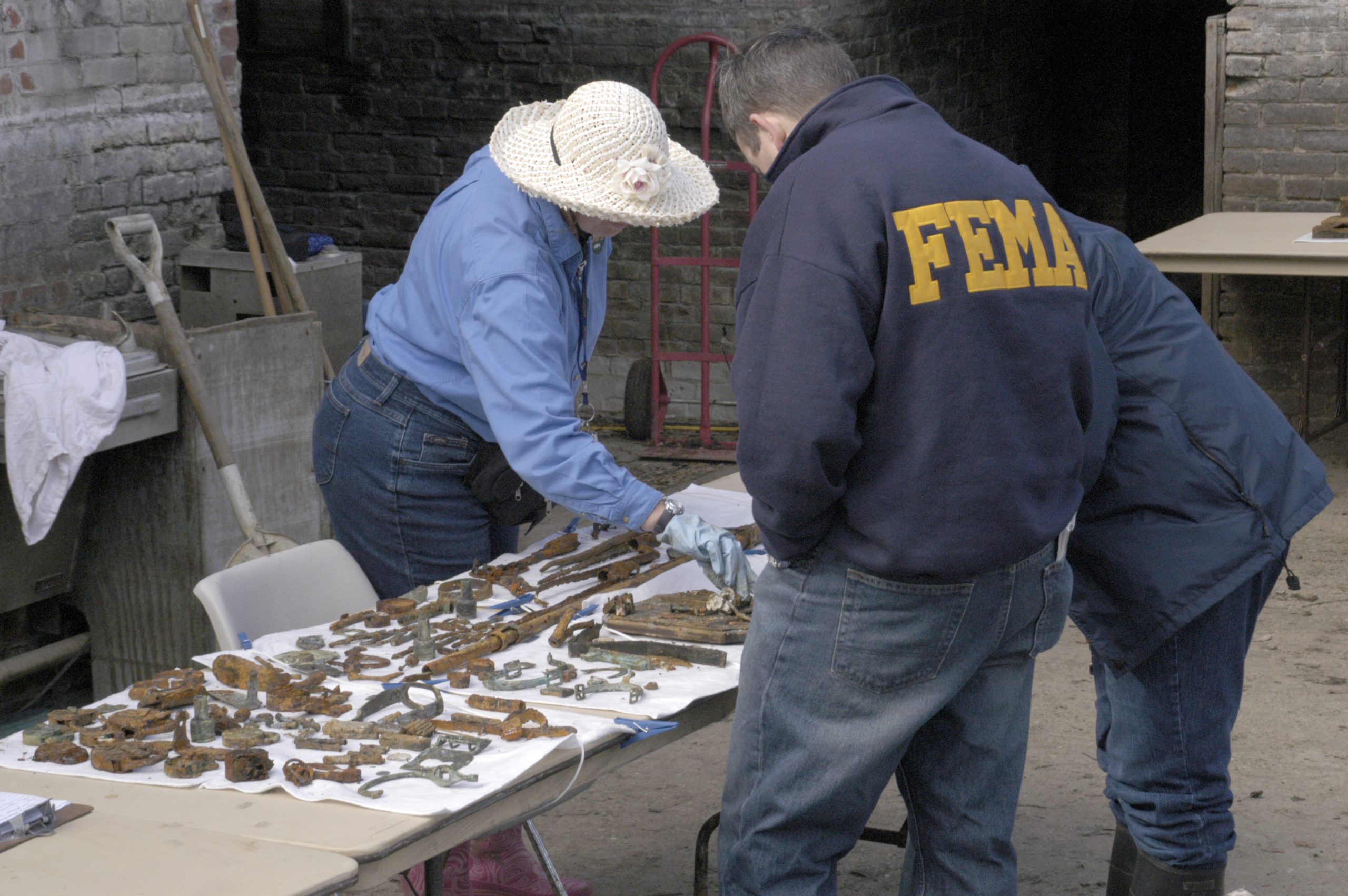
Starting at the river’s mouth, the most well-known Civil War fortifications near New Orleans are Forts Jackson and Saint Philip, which David Farragut’s ships passed to seize the Crescent City in 1862. Today Fort Saint Philip is inaccessible and largely lost to surrounding swamplands. Fort Jackson was an operating park until 2005’s Hurricane Katrina flooded the site and destroyed most of its exhibits. Today the fort’s interior is officially closed, though visitors can access the site’s outer perimeter and Plaquemines Parish operates the Fort Jackson Museum and Welcome Center where preserved artifacts are on display.[1]
Further upriver, melting snowfall from Montana, the Dakotas, Minnesota, and Pennsylvania can cause the Mississippi River and its tributary and distributary waterways to overflow their banks and flood the countryside. Over time, the Mississippi’s course has shifted, both from these floods and from work by the Army Corps of Engineers to create better shipping channels. Civil War sites have been impacted throughout the river valley.
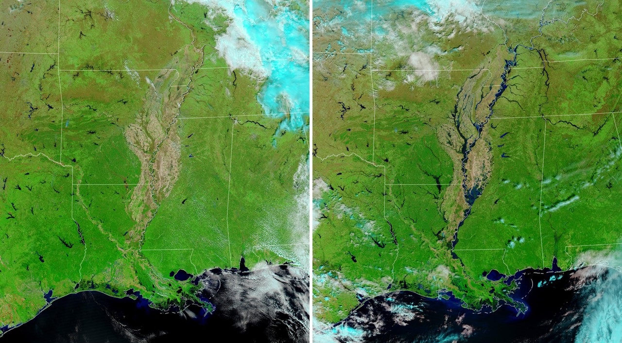
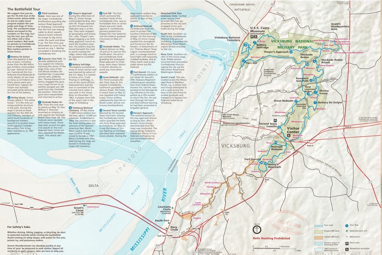
At both Port Hudson, Louisiana, and Vicksburg, Mississippi, the course of the Mississippi River has shifted from the hairpin turns that made them so strategically important in the Civil War. While this may not have a major impact on visiting the fortifications and battle lines at both Port Hudson’s State Historic Site or Vicksburg’s National Battlefield Park, it significantly impacts how easy it is to understand the naval elements of these campaigns. Visitors need better context and understanding to fully comprehend why these two sites were crucial positions to maintain by the Confederacy. The parks do a good job of showing this on modern maps, but not being able to stand atop Vicksburg’s bluffs and see the river as it was when Admiral David D. Porter rushed past the batteries does take away from the experience.
Changing river courses thanks to spring thaws, combined with erosion from a constant current, has essentially destroyed two major river battle sites above Vicksburg. Fort Pillow, Tennessee is remembered for the massacre of African American soldiers after their surrender to Nathan Bedford Forrest’s cavalry in 1864, but in 1862, it was a Confederate bastion supported by the River Defense Fleet. In May 1862’s battle of Plum Point Bend, those Confederate ships rammed and temporarily sank two United States ironclads. Though Fort Pillow State Historic Park works to preserve the history of the land position, shifting river channels have turned the site of the May 1862 naval attack into mostly woodlands and marsh. A small lake known as the chute is all that remains of the river channel where the naval action occurred.[2]
Upriver from Fort Pillow, Island Number Ten was the site of a major Confederate attempt to maintain control of the Mississippi River in March and April 1862, and where General John Pope earned laurels that would later get him transferred to Virginia. Named such because it was the tenth island downriver from the merging of the Ohio and Mississippi Rivers, the island is no longer there. Increased river currents from spring freshets have eroded much of the island away, and a small change in the river’s channel finished the job.

It is not only the Mississippi River where spring thaws and river currents have impacted Civil War sites. In the 1930s, the Tennessee Valley Authority constructed dams to control river flooding and Fort Henry, one of the pair of fortifications built to control the Tennessee and Cumberland Rivers, was permanently submerged in the efforts.[3] Louisiana’s Atchafalaya River has shifted its channel away from Grand Lake, the site of a large naval engagement in April 1863.
The Mississippi River has a plethora of examples of how hurricanes, shifting channels, flooding from melting snow, and erosion have impacted Civil War sites, but it by no means has the monopoly. Hurricanes ravage the entire Gulf of Mexico and Atlantic coast and many Civil War sites have been negatively impacted or essentially abandoned as a result.
To name a few, east of New Orleans, Forts Pike and Macomb, seized and garrisoned by Confederates in 1861 to guard entrances to Lake Pontchartrain, are today part of the Fort Pike State Historic Site. They are closed to the public because of erosion issues.[4] South of New Orleans lies Fort Livingston, which stood guard over the entrance to Barataria Bay on Grande Terre Island. Today it is in disrepair, though boaters can still visit the island, which is a Louisiana Commemorative Area, a Louisiana Department of Wildlife and Fisheries marine laboratory, and a Louisiana Department of Natural Resources wave-protection project.[5]
Ship Island, Mississippi, was the site where David Farragut planned and staged assaults against New Orleans and Mobile. Hurricanes literally split the island in half and herculean efforts at coastal preservation have resulted in a small sandbar reconnecting it into a single island.[6] In North Carolina, Fort Fisher’s historic site can only preserve parts of the fort that have not been reclaimed by the Atlantic. Many other sites are similarly affected.
Weather not only affected Civil War battles but continues to significantly impact how visitors to those battle sites experience the past history. And such weather goes far beyond a rainstorm drenching someone as they visit a park. Among other elements, winds from the African coast and snows from Yellowstone National Park both have their place in shaping how people preserve and experience the Mississippi River valley’s Civil War sites.
For those wanting to dive much deeper into how the Mississippi River’s channels have changed, the best resource out there is the 1944 War Department report written by Harold Fiske titled Geological Investigation of the Alluvial Valley of the Lower Mississippi River.[7]
Endnotes:
[1] Senator Ron Wyden, Report to Accompany S.311, Lower Mississippi River Study Act, (Washington D.C., U.S. Government Printing Office, 2013), https://www.govinfo.gov/content/pkg/CRPT-113srpt26/html/CRPT-113srpt26.htm
[2] Fort Pillow State Historic Park Map, https://tnstateparks.com/assets/pdf/additional-content/park-maps/Fort_Pillow_web.png, accessed January 28, 2023.
[3] B. Franklin Cooling, “Fort Henry”, Tennessee Encyclopedia, (2017), http://tennesseeencyclopedia.net/entries/fort-henry/
[4] https://www.lastateparks.com/historic-sites/fort-pike-state-historic-site, accessed January 26, 2023.
[5] Jackie Ann, “Nature is Slowly Reclaiming this One Attraction in Louisiana and You Need to See It,” Only In Your State, https://www.onlyinyourstate.com/louisiana/fort-livingston-la/, accessed January 26, 2023.
[6] Neil P. Chatelain, “Ship Island: Versatile Key to the Gulf,” Civil War Navy – The Magazine, Vol. 10, No. 3, Winter 2023, 35.
[7] Harold N. Fiske, Geological Investigation of the Alluvial Valley of the Lower Mississippi River, (War Department: U.S. Army Corps of Engineers, December 1, 1944), https://lmvmapping.erdc.usace.army.mil/, accessed January 28, 2023.
This is a wonderful and detailed article about the dynamics of the Mississippi River and its tributaries. Thank you.
I don’t really know anything abut the Red River campaign, but how accessible are sites there?
Hey Scott, the most accessible Red River site is the Forts Randolph and Buhlow State Historic Site (forts built after the Red River Campaign). Other Red River forts are marked for preservation, but not much has been done to begin that process. The largest land battle of the Red River Campaign can be visited at the Mansfield State Historic Site.
Thank-you for this informative article!
Milliken’s Bend is gone too. Davis Bend is no longer connected to the State of Mississippi by land. The location of the capture of the Indianola is not a part of the river now either, I think.
Post war levee building, or even lack there of, probably contributed as well to some of the destruction of sites. All the land traversed by Grant along the Louisiana side of the river no longer floods regularly so you can really get a sense of how messy wet it was.
Can’t.
Really informative, thanks. I knew of some of the changes, but not all.
Taking a Civil War cruise on the Mississippi in 16 days. Going to Port Hudson and Vicksburg. This article was very informative about what has happened on the “Father of Waters” in the long time since the Civil War occurred. That is history. That is nature taking her part in it.
Looking forward to seeing these sites. Thanks for the informative article.