We’ll See You on the Battlefield: Bert’s Tips for Battlefield Visits
I am a details guy, so I like to plan thoroughly when I travel. I also like to get into the details of an event, so this may be more in the weeds than many readers will want to go. But if wading streams, climbing fences, and going over hill and dale is for you, read on.
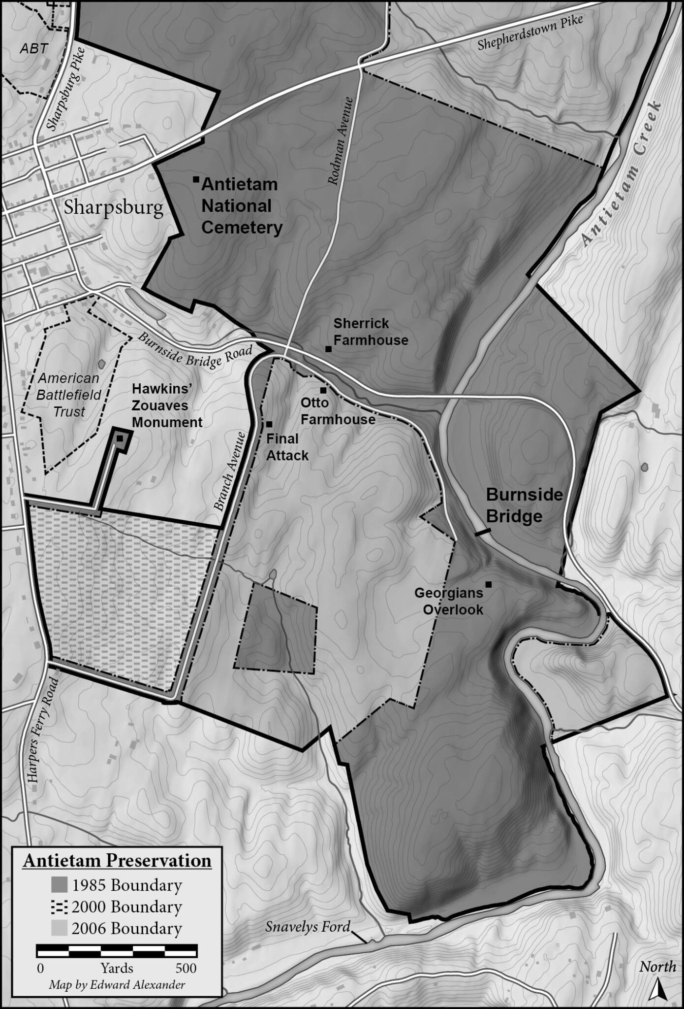
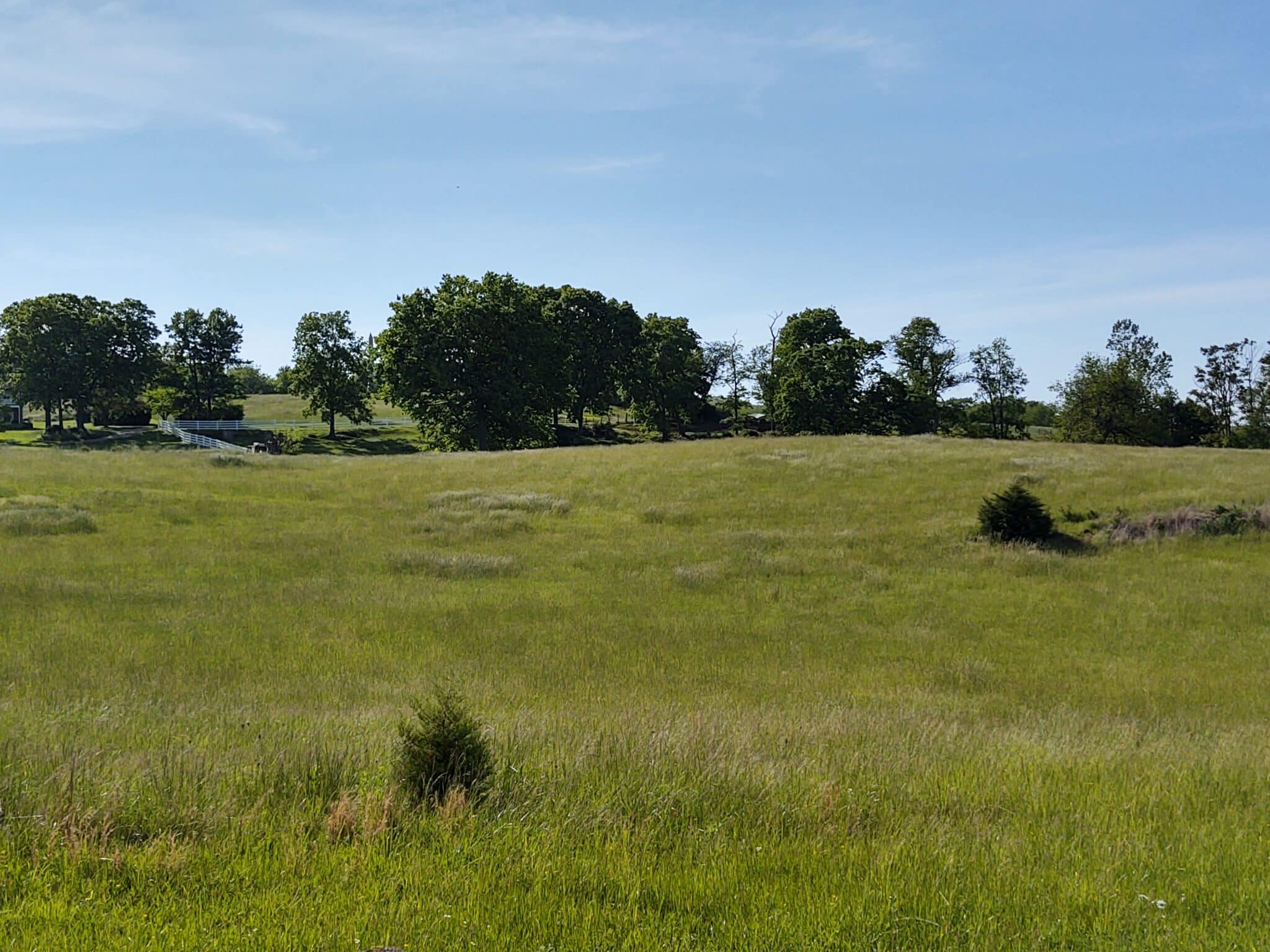
First and most importantly for a battlefield visit are good maps. Troop movement maps are just the beginning. You have to have those, but then I look at the ground I will be touring. I look at satellite photos, topo maps, and 3D images to get a sense of the terrain — hilly or flat, where it will be challenging — so that I can plan accordingly. Topo lines are helpful, but it really is better to look at the ground ahead of time in any way possible.
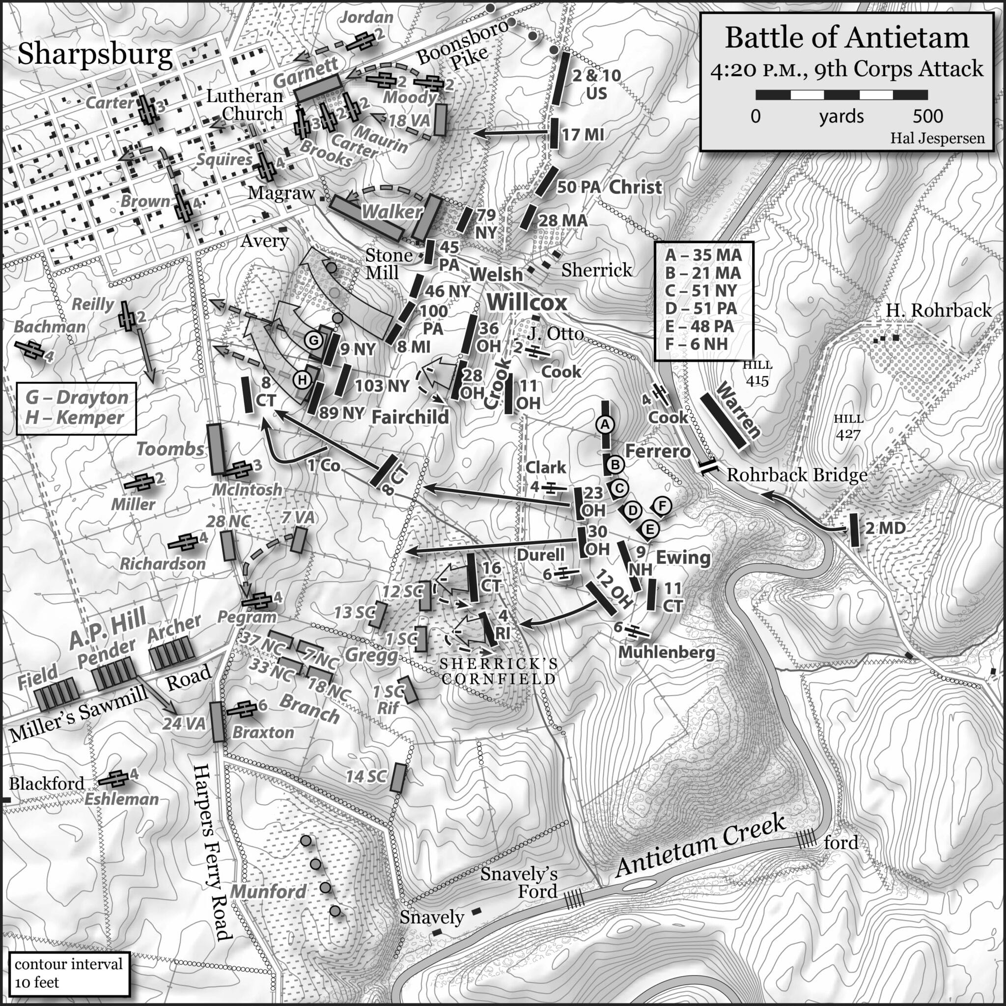
This also ties into my understanding of the event: I want to be able to see what a commander or troops could see, or not. Analyzing views is very important. It also ties into the flow of combat, so I consider the range of weapons in conjunction with this. The ground I will explore, its historic appearance, the views of the opposing sides, and the range of their weapons are all key factors for me.
Going along with this, you have to look at how the landscape has changed, if at all (it usually has). Some of the ABT maps are very helpful for this, but I also look at historic maps and photos. Is it more or less wooded? What about fences? Has the landscape been altered by development? New roads? The list is endless.
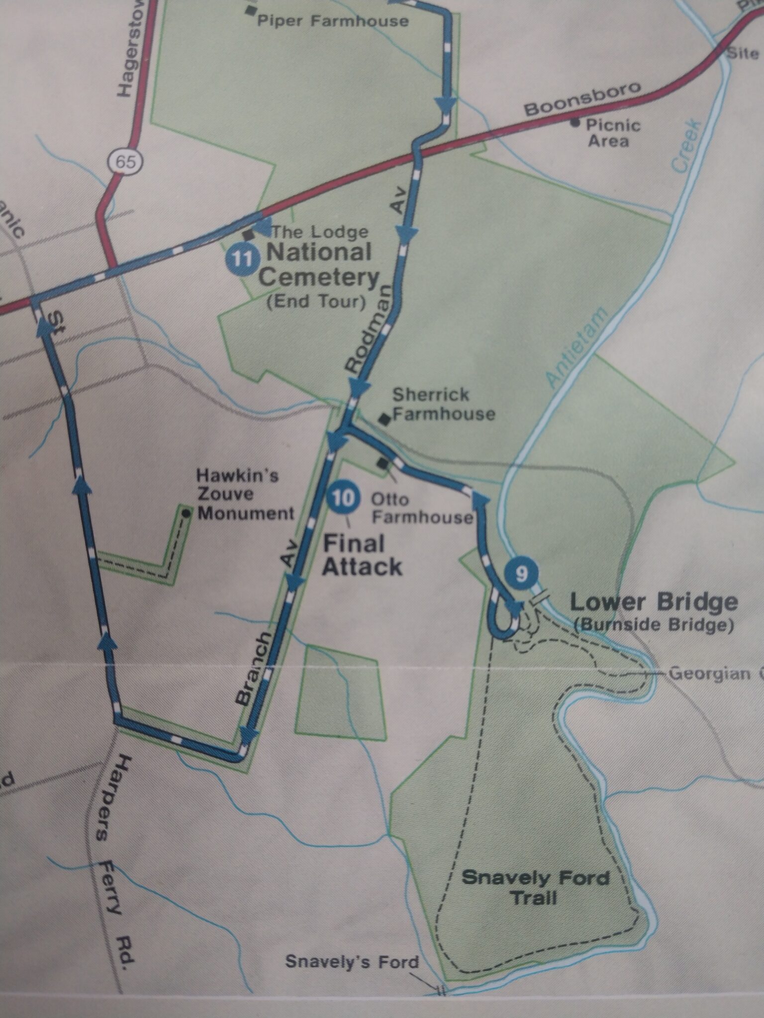
It is also important to consider what is preserved, and when. Some areas have been added to a park over time, what was accessible in the past and how has it changed? What is preserved, or not, influences our access to a battlefield and our understanding of it. There are key parts of many battlefields that none of us have been able to access: it is either private property, developed and altered beyond comprehension, or mother nature has changed it and made it inaccessible.
Every battlefield has key moments and significant sites that affected the overall outcome. I want to find what those were to understand the shifts in momentum and key decisions.
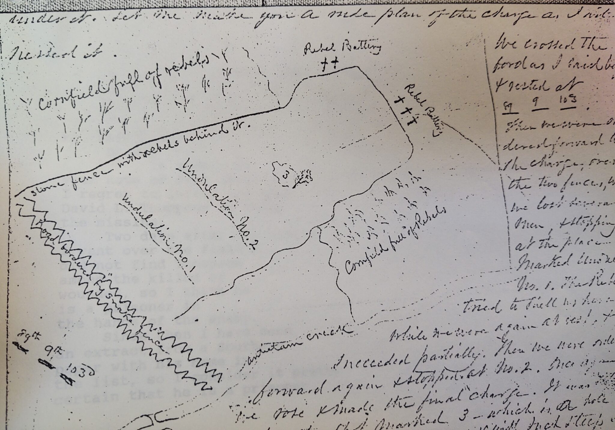
To understand the event ahead of time I consult primary sources like the Official Records, newspapers, letters and diaries, etc. I also access archaeological reports and historical studies, if available. I will consult secondary sources, like books or articles that summarize, but do that last, I want to use the primary sources first before influencing my understanding.
Together these things give me a good feel for the battle, the terrain, viewsheds, decision making, preservation, and the history of its interpretation. Good weather is here, so lets get out and explore! Oh, one last thing, watch for ticks. I HATE ticks!
Excellent overview, much more to it than I have considered researching!
Thank you!
Yep. You’ve nailed it. Ticks can make a good day turn bad.
Bring along a can of insect repellant to equalize the weight of the water bottle.
Great article, Bert -especially on maps. Ultimately, as you point out, only by visiting can you actually “drill down” to how the terrain affected what units did or did not do and why (subject to knowing the intervening changes). Even a good topo map has limits. Ask anybody who has used USGS 7.5 minute quads in the back country – there’s a lot still hidden between those contour lines that only show up when you’re on the ground.
You Tube provides animatede battle maps, specifically of Gettysburg by Jeffrey the Librarian. Using a cellphone, you can actually see the troop movements at a particular location while standing on the spot that is shown on the image with the troop movements there during the battle. I’ve used it at my last visit to the battlefield
Excellent article. I enjoy learning from the best.
When visiting a battlefield
Make
A
Plan