Shaping Chancellorsville: The Second Battle of Chancellorsville

part eleven in a series
Easily the highest-profile land acquisition at Chancellorsville in the last two decades has been the Day One battlefield. On May 1, 1863, east of the Chancellorsville intersection, Confederate forces intercepted the Federal advance, much to the Federals’ surprise. As a result, the Federal army withdrew into a defensive position around the Chancellorsville intersection, setting the stage for the fighting that ensued over the next two days. Some 700 casualties resulted from the fighting on May 1.
For the first 130 or so years, Fredericksburg and Spotsylvania National Military Park (FSNMP) paid little attention to the ground, ostensibly because it lay outside the official park boundary. However, nothing exists to suggest that the property was ever considered for inclusion in the first place. From a historiographical perspective, the park’s use of the battlefield to tell the battle’s chronological narrative had begun at the Lee-Jackson Bivouac Site. The park brochure from the mid-30s described the Day One fighting as “a brief skirmish,”[1] and subsequent brochures omitted specific mention of fighting entirely.[2]
The lack of attention to the action on May 1 began to change in 1995 when John Mullins bought the property with the intent of building a nursery.
“The Mullins Nursery proposal sits at the very heart of the initial encounter between Lee and Hooker,” wrote FSNMP’s cultural resource specialist in a memo to the park’s assistant superintendent. “There was skirmishing on the tract on April 30, 1863, between the 8th Pennsylvania Cavalry and the 12th Virginia…. On May 1, 1863, the two armies converged simultaneously on this site.” The memo then went on to explain in detail the action that took place on the property.
This tract is very important to the N.P.S., as the historians use it for education. Many of the historians conduct extended tours of the Chancellorsville battlefield for highly specialize Civil War interest groups or staff rides for the modern military. The historians use the terrain to study the first day’s encounter at Chancellorsville…. The “cluttering” of the terrain will destroy all understanding of the battle waged over the Mott’s Run valley.[3]
The memo avoided the use of specific historical memories and stuck to “just the facts.” The memo represented an important attempt by NPS officials to articulate among themselves the importance of the Day One battlefield, which then allowed them to articulate that importance when they expressed concerns about the nursery proposal.
Mullins continued in fits and starts to develop the land. “This will essentially destroy the first day’s battlefield of Chancellorsville—a scene of more combat and more casualties than several entire immense NPS historic sites (like Pea Ridge’s 4,000 acres),” grumbled Krick in memo attached to an internal NPS review of another of Mullins’ proposals.[4] Krick conceded there was little the park could probably do, but personally, he began to marshal forces that led to the creation of Central Virginia Battlefields Trust (CVBT).

Mullins, meanwhile, used language that downplayed the threat of his proposed developments. At one point, he characterized his property as being “in the vicinity of the scene of combat between Union and Confederate forces at the start of the Battle of Chancellorsville” (emphasis added).[5]
In response, the newly formed CVBT characterized the Mullin Farm as “the scene of most of the first major combat of the week-long Chancellorsville campaign.” After providing site-specific narrative, their letter to the County Board of Supervisors went on to say:
The primary significance of this site, however, lies not in the tactical maneuvers that took place there on May 1 but in the larger strategic importance of that fighting. By meeting Hooker’s army and attacking at the Mullins property, Lee seized the initiative and prompted Hooker to make one of the Civil War’s most controversial decisions, namely, to abandon the open ground and withdraw back into the woods around the Chancellorsville crossroads.[6]
Spotsylvania County finally approved Mullins’ applications for a zoning change in 1999, allowing for more extensive commercial and residential development on the site.
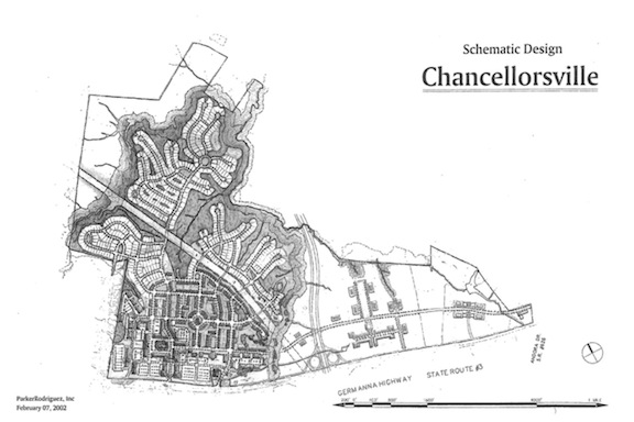
Compounding the issue in 2001, the Virginia Commonwealth Board unveiled a plan for an “Outer Connector beltway” that would stretch from Interstate 95 to Route 3, affecting a juncture through the Day One property. Mullins saw that as an opportunity to develop the site to take advantage of the additional infrastructure and traffic flow, and by 2002, Mullins allied himself with the Dogwood Development Group to create a 2,350-house subdivision, with 2.4 million square feet of additional commercial space, on the site. Preservationists, alarmed, banded together by the end of July to create the Coalition to Save Chancellorsville Battlefield.[7]
The fight to save the Day One battlefield at Chancellorsville was about to escalate to a whole new level.
————
[1] NPS brochure, circa 1935.
[2] As recently as 2009, the park map has opted for language like the following, which has existed since at least the 1991 map: “Lee discovered the threat to his position and rushed westward, prompting Hooker to abandon the initiative and establish a defensive line, which was vulnerable on the right flank.”
[3] CRM Specialist. Memo to Assistant Superintendent. 13 September 1995.
[4] Krick, Robert K. “Re: Ashley/Mullins.” 21 August 1997. FSNMP administrative files. CRM office.
[5] Sullivan, Donahoe & Ingalls, PC. “Design Narrative for Ashley Farms Commercial Center Planned Development Commercial Rezoning Application.” 8 September 1999. pg. 3.
[6] Mitchell, John D. Letter to Ronnie B. Acors, chairman. 9 December 1999.
[7] Nelson, Erik and Campi, Jim. “Timeline at Chancellorsville.” November 2004. CVBT collection.