Review: The Maps of the Wilderness
 The Wilderness Battlefield exhibit shelter sits in the middle of Saunders Field like a tiny oasis as the roar of Route 20 zooms by. The Wilderness is no longer wild these days, with vast gated communities hidden behind the trees. What forest still remains is older and less dense than the woods of 1864. These factors have only added to the difficulty of helping visitors understand a battle already difficult to follow. Union and Confederate armies fought on two fronts in conflicts that unspooled on different timetables over two days.
One participant described the battlefield an “impenetrable gloom . . . which could be likened only to the shadow of death.” The modern buff or the battlefield tourist might find it just as impenetrable to make sense of everything today.
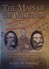
Leave it, then, to Bradley Gottfried to lay open “the dark, close wood” in a way that makes sense of time, space, and wilderness. His latest entry in the Savas Beatie Military Atlas Series, Maps of the Wilderness, carries on his fine tradition of bringing clarity to complexity.
The format of the book is familiar to fans of the series, which now consists of six titles. The covers of the others appear on the back of the dust jacket, but because they’re a little hard to read, a list of them and their authors would be useful inside. (Gottfried has actually written five of them, but the sixth is by ECW’s Dave Powell and cartographer David Friedrichs.)
Open the book to any spread in its main section: on the right-hand page is a map depicting a particular phase of the battle; on the left-hand page is text that explains the action depicted on the map. That section is preceded by a detailed table of contents and some introductory notes by the author and is followed by an order of battle and extensive footnotes.
“The only good way to really understand a military campaign (besides walking the ground) is through good maps,” Gottfried says in his introduction, articulating an important military history truism. And Gottfried does, indeed, have good maps. The full-color printing on glossy paper makes those maps look sharp, but it’s the attention to detail on the maps themselves that make Gottfried’s maps so useful. He breaks the action down to the regimental level and—to me, the neatest surprise in the book—his cartography makes the thickness of the Wilderness itself palpable on the page without obscuring the troop movements.
For those of us who’ve spent a lot of time on the Fredericksburg-area maps, Frank O’Reilly’s detailed troop-movement maps, published by Eastern National, have become the gold standard. However, they’re maps meant to be spread out on a table, which makes them ungainly for walking around in the field. Gottfried’s maps have the huge advantage of being small enough to be hand-held, yet large enough to really see detail. And with 121 maps, Gottfried can get into a lot of detail.
Gottfried describes the text, too, as “reasonably detailed.” The book reads smoothly and easily. “The Maps of the Wilderness is not the last word or definitive treatment of this campaign or any part thereof—nor did I intend it to be,” he offers as a caveat. “Given space and time considerations, that is simply not possible.” He admits that he sticks to a fairly traditional interpretation of the battle, although he has some interesting theories about the placement of Heth’s Confederate battle line on May 5.
The book’s subtitle provides its scope: “An Atlas of the Wilderness Campaign, Including all Cavalry Operations, May 2-6, 1864.” The stalemate of May 7, often overlooked by students of the battle because neither commander launched offensives, was no less awful for the men taking potshots at each other all day along the front line as forest fires still burned around them. As far as troop movement on maps, though, there’s not much to depict.
More unfortunate, though, was the omission of cavalry operations around Todd’s Tavern that day, which set the stage for clashes along the Brock Road during the May-8 overnight march to Spotsylvania. That’s where one phase of the campaign bleeds into the next, and I assume it will be covered in Gottfried’s Spotsylvania volume. It might have made a fitting contribution to this volume only to put the failings of the Federal cavalry during this phase into sharper context.
But in a book this rich and detailed, there’s little to complain about. Gottfried’s map studies get better and better, and here he’s at the top of his game. He has mastered his format and knows how to best take advantage of it. Aside from Gordon Rhea’s The Battle of the Wilderness, this is the best in-depth single-volume examination of the battle.
I don’t think you can mention one-volume wilderness studies without mentioning steers who some still consider as trumping Rhea.
I have never heard of O’reillys map collection is there somewhere oneline I could purchase it?
I don’t know if Eastern National has Frank’s map set available on line. I would recommend calling the bookstore at Fredericksburg National Battlefield and inquiring with them directly. They have sets of maps for all four battles, and the maps are fantastic!
This is the first I’ve heard of O’Reilly’s troop movement maps, too. Can you give a full reference? Thanks.
I have a set of the maps, but honestly, I wouldn’t know the full reference for them. The only place I’ve seen them for sale was at the two book stores at Fredericksburg & Spotsylvania National Military Park. Frank did a set of maps for each of the four main battles in the park, and they are WELL worth the money. I would recommend calling the bookstores, run by Eastern National, and inquiring with them directly.
Just to reiterate what Chris has already said, the bookstores at Fredericksburg and Chancellorsville Visitor Centers, part of the NPS and run by Eastern National, are the only places you can get the troop movement maps. Maps exist for Fredericksburg, Chancellorsville, Wilderness, and Spotsylvania– each map covers, generally, about 2 hours of fighting.
Similar maps exist for the Battle of Beaver Dam Creek– the first in a proposed Seven Days Battles series, but funding ran out before the series could be completed.
The best books for the nuts and bolts of the battlefield. He makes it perfect for understanding unit movements and the whole campaigns as it relates to that particular battle. He even give nuggets of gold in each book, like adding the Battle of Balls Bluff in the First Manassas Battlefield book and Battle of South Mountain in the Antietam Battlefield book. You can find his books at the Visitor Center bookstores and Amazon.
In studying the Wilderness using good maps is essential. I just finished reading an original work newly published and endorsed by Gordon Rhea. It is a brand new analysis of the casualties of Lee’s forces during the campaign. As Gordon Rhea said in the forward of the book the implications that follow from this analysis are profound. Until now it has been difficult to ascertain with certainty which units were engaged in various actions and which ones bore the brunt of the combat. The authors analysis of strengths and casualties at the small-unit level are especially revealing. As the author convincingly shows, the campaign thoroughly gutted many of Lee’s veteran units. This whole study is wonderfully new and different and is food for a great deal of new thought on the Wilderness. The book is Lee’s Army During the Overland Campaign-A Numerical Study by Alfred C. Young (LSU Press). I think this would be a great companion publication along side The Maps of the Wilderness.
May i add to get the understanding and feel of the battle of the ones who were there nothing can surpass the words of the men who were there.you can get that feeling in Richard Wheeler’s Voices Of The Civil War.