A Sketch of Stevenson Ridge, 1864
 A couple weeks ago, as I was looking at Harper’s Weekly’s coverage of the Overland Campaign, I came across a fun unexpected surprise: a wartime illustration from Spotsylvania that shows Stevenson Ridge.
The image, sketched by Alfred Waud, is labeled “Army of the Potomac—Crossing the River Ny, Virginia” and appeared in the June 11, 1864, edition with two other illustrations from Spotsylvania Court House.
I had seen the image before, but it hadn’t clicked until my recent viewing that the property off in the background was the property now owned by my wife’s family. In May of 1864, of course, it was part of the Beverly plantation; Stevenson Ridge is the modern name my wife’s family gave the property when they bought it in 2001.
Here’s the image a bit larger:
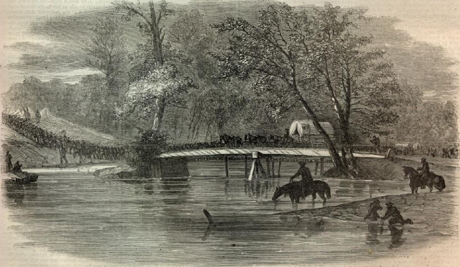
The Army of the Potomac had three opportunities to cross the Ny (or “Ni,” as it’s called today): The first was just to the northeast of Stevenson Ridge; the second was along Massaponnax Church Road; and the third was along Telegraph Road.
Of those three possibilities, the evidence points strongest toward the location nearest Stevenson Ridge.
Harper’s Weekly itself offers the strongest evidence. On page 382 of the paper, it elaborates briefly on each of the three sketches from Spotsylvania. “One represents the RIVER NY,” the paper says, “which is one of four known respectively as the Mat, Ta, Po, and Ny, which, when they join, form the [Mattapony]. The Ny lies northeast of Spotsylvania Court House, and will be historical for its connection with the battles fought around it.” [emphasis added]
The only one of the army’s three Ny crossings that took place northeast of the Court House was the crossing that took place closest to Stevenson Ridge. The others are to the east and southeast.
The Federal IX Corps captured the Ny crossing on May 9 and, for the duration of the battle, it remained in Federal control. Ulysses S. Grant used the road—“Fredericksburg Road” then, “Court House Road” today—to shuttle in a constant stream of fresh supplies and reinforcements. The movement depicted in the image suggests a scene late in the two-week struggle because of the sheer volume of men as well as the wagons; such movement would not have been possible early in the campaign because the area was still very much a “hot zone.”
Note, too, that the river seems high (a detail first pointed out to me by Spotsylvania historian John Cummings). Torrential rainfall that began on May 11 filled the local waterways to capacity. Today, the Ni in that area is no more than ten feet across on average—far narrower than depicted in the image.
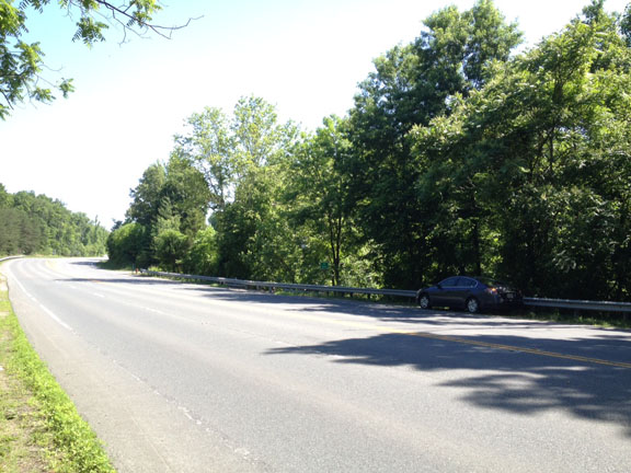
The riverbank today looks little like it did in 1864. The modern road—Route 208—consists of four lanes separated by a median. At the Ni River, it runs parallel about a dozen yards to the north of the original road, and the roadbed has been built up some fifteen feet or so to make the crossing easier to bridge.
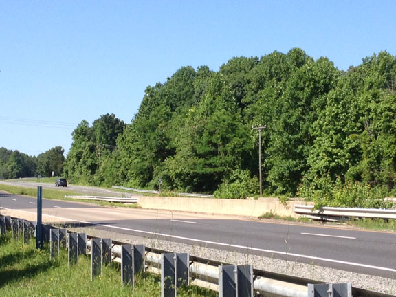
If you look at the sketch, once the road crosses the river, it begins to ascend the far slope almost immediately. The photo shows the ascending slope on the far side, which would have been much more dramatic at the time.
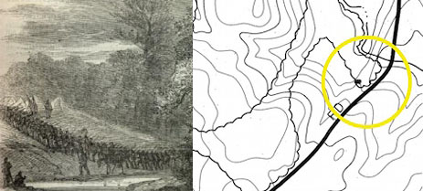
The treeline on the far bank in the sketch matches up to historical maps, too:
Examination of the riverbanks at the other two Ni River crossings rules them out in favor of the first crossing.
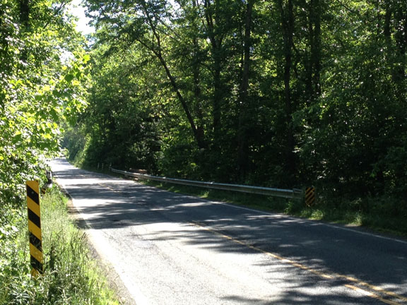
At the second site, along the Massaponnax Church Road, it’s hard to get an angle similar to that in the illustration because the foliage is so thick, obscuring the view.
Most notable here is that the east side of the river—which the soldiers would have been marching toward—has a quarter-mile flat before it finally begins its gradual rise, so the topography doesn’t match the image.
At the third site, along the Telegraph Road—modern Route 1—the topography better matches that in the original image, although the slope here looks longer and gentler. Here, it’s tough to get too far off the road without violating private property.
When the army crossed there, it was backtracking. Ambrose Burnside’s IX Corps had left Spotsylvania along the Ridge Road, which intersected the Telegraph Road just north of the Po River. There, Richard Ewell’s Confederate rearguard stymied Burnside’s advance, forcing Old Burn to turn around and backtrack northward. In doing so, he crossed the Ny before turning eastward on Guiney Station Road. That backtrack, which took place in the dark, was a jumbled bottleneck of a mess—hardly the kind of image the reading public back home would have wanted could Waud see well enough in the dark to sketch it in the first place.
There’s also the image’s caption, which labels the marchers as “The Army of the Potomac.” Burnside’s IX Corps had not yet been officially incorporated into the Army of the Potomac by that point (May 21), so the caption either misidentifies the marchers or isn’t showing the march along Telegraph Road.
That leaves the Ny crossing nearest Stevenson Ridge.
John Cummings pointed me to the original roadbed, tucked away behind a county pumping station. Although quite distinct, the roadbed is chocked with thorns and weeds. Along the riverbank, though, a pile of stones—the remains of an old bridge abutment—belies the location of the way across the river.

From here, the road would have ascended toward Whig Hill and the Beverly plantation. In the illustration, the far treeline to the left of the frame would have stood on a portion of that plantation on the north side of the road. Those distant trees would have stood on Stevenson Ridge.
Could only the soldiers captured in that image looked up to see a sign of home just as familiar to them as that property is to me.
Very cool.
Thanks. I was pretty excited when I realized what I was looking at.
Good post and pics, Chris. Nice to have that personal connection as well.