Reams Station Trail Map
Tomorrow marks the 154th anniversary of the Battle of Reams Station. The Union Fifth Corps cut the Petersburg & Weldon Railroad on August 18, 1864, and Confederate counteroffensives failed to drive them off the position. While Gouverneur Warren’s men built fortifications along the tracks, Winfield Scott Hancock’s Second Corps marched south to further wreck the rails. The Confederate Third Corps and cavalry struck at Hancock’s exposed men on August 25th. This time they succeeded in pushing the Federals back.
ECW’s Ryan Quint offered a fuller look at the battle during its sesquicentennial and a walk along the American Battlefield Trust preserved battlefield makes it easy to understand why the Second Corps position fell apart. Civil War Trails additionally placed an interpretive wayside at Oak Grove Church relating to the Wilson-Kautz Raid. I hope this map helps future visitors to the site.
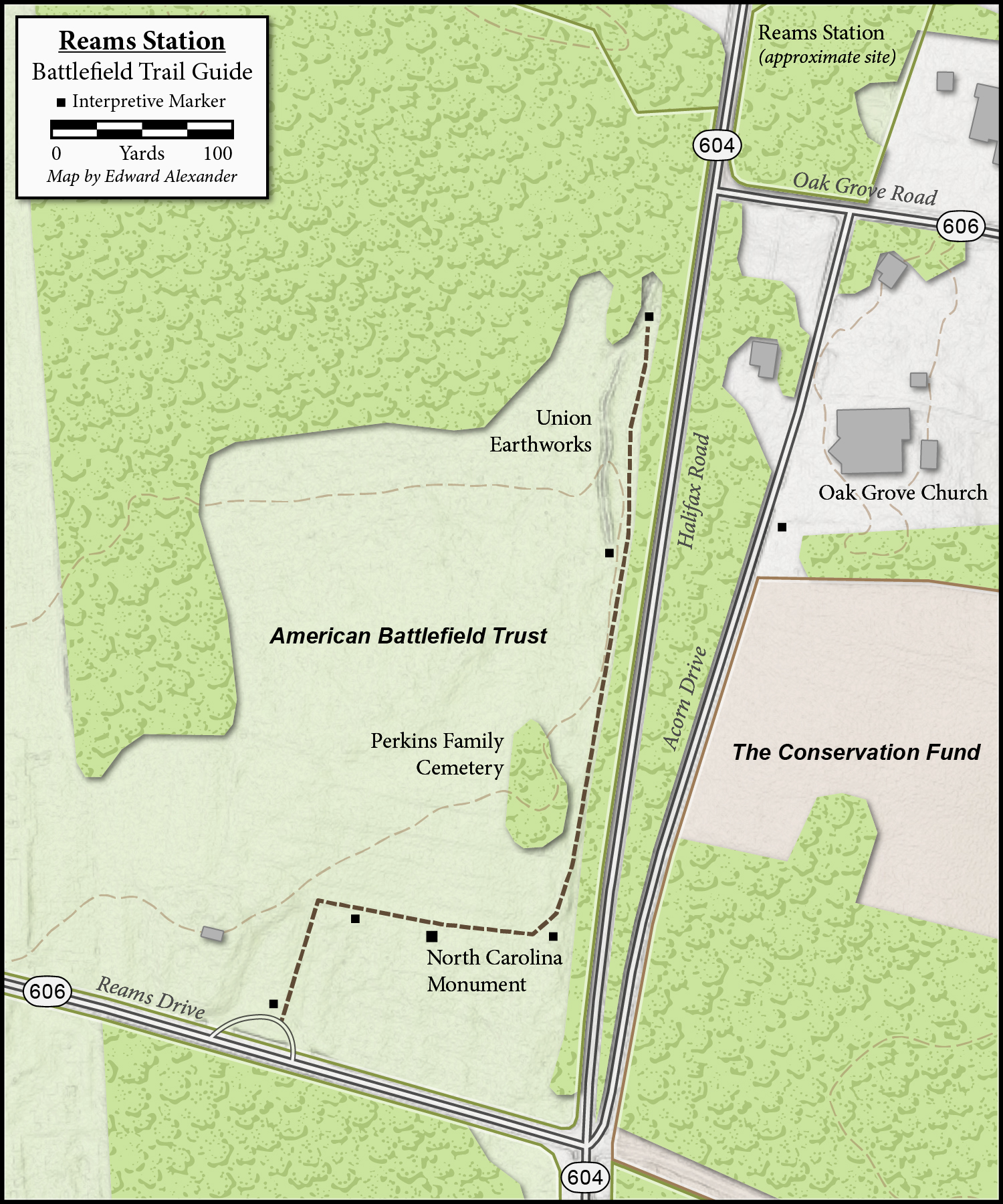 A couple things to note. GPS travelers should not plug Reams Station into their devices, that will likely take them to a gas station with that name a few miles to the north. The site does not have a formal address, though the American Battlefield Trust parking lot is just to the west of the intersection of Reams Drive and Halifax Road. Oak Grove United Methodist Church (12715 Acorn Drive, Petersburg, VA 23805) can also be used for orientation. The modern Halifax Road rests on the bed of the historic Petersburg & Weldon Railroad and the modern railroad is about a mile to the east.
This trail map was updated in May 2025.