Fredericksburg: The Way They Saw It?
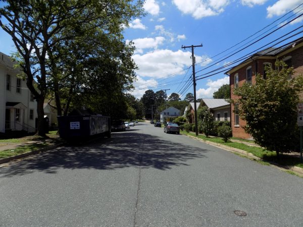
If you visit Fredericksburg battlefield today, you’ll find some areas wonderfully preserved and the landscape relatively unscathed. But other parts of the battleground are now heavily paved, abounding with homes and shopping centers. Walking from the old historic district of the town toward Maryes Heights and the Sunken Road is now accomplished on sidewalks which run in front of neat houses beside paved roads. The lay of the land can still be seen if the battlefielder pays close attention, making the walk certainly worth the time. It can take a little imagination to try understand the open ground and what it would have looked like on that chilly day (December 13, 1862) when Union troops attacked Prospect Hill and Maryes Heights.
Fortunately, archives have preserved detailed maps and Civil War era photographs. These sources – combined with details from primary sources – help us gain a better idea of what happened when the current housing community land was the cross fire zone of the Confederate artillery posted on Maryes Heights.
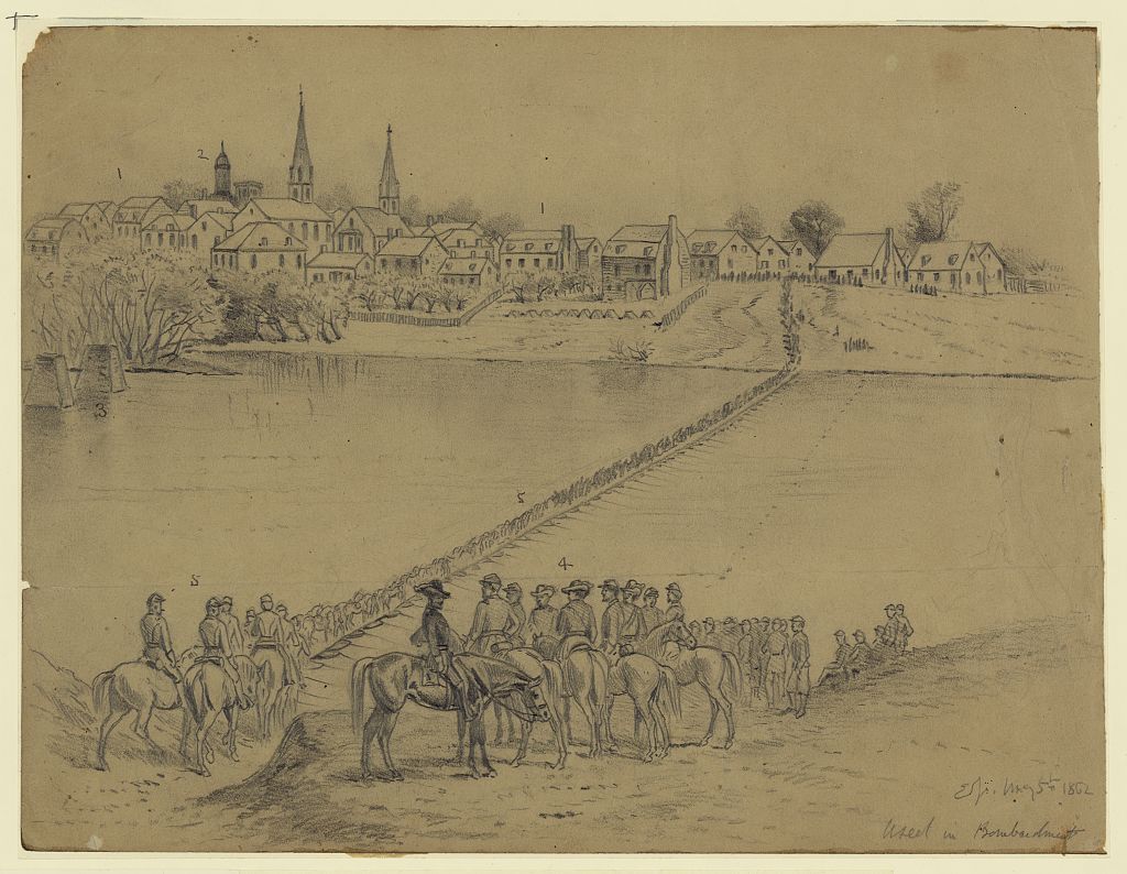
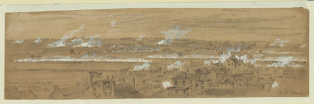
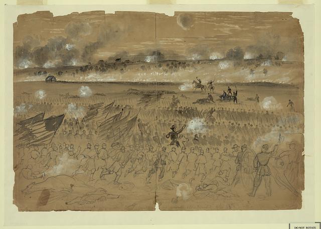
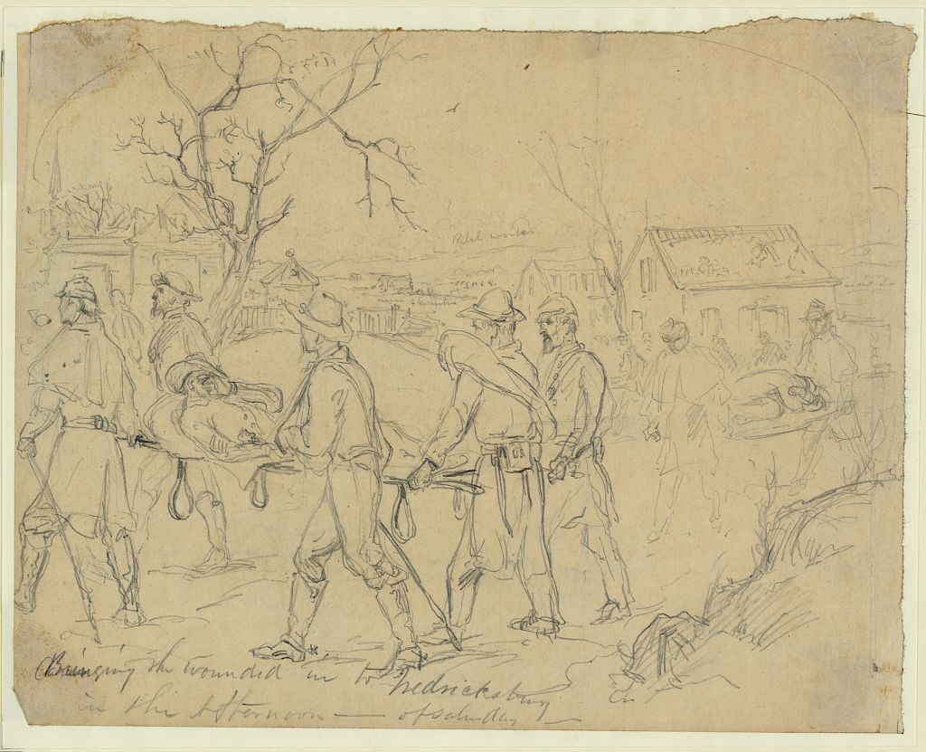
Sometimes it can be helpful and insightful to examine the old sketches and photographs. With that thought in mind, I turned on some reflective music and started examining sketches by war correspondents and illustrators that are preserved and digitized by Library of Congress.Here are some of the sketches of First Battle of Fredericksburg from the paper pads and pencils of Edwin Forbes, Alfred Waud, and others.

I live in that neighborhood on the Fredericksburg battlefield, known as “Bloody Plain”, just below Marye’s Heights. The city was planning to make that area a neighborhood before the war, but it came to a stop. Fredericksburg was so devastated after the war…that they were more concerned about rebuilding the town than preserving a battlefield; which didn’t become a national battlefield until the late 1920’s. In my opinion, Fredericksburg is the most difficult major battlefield to navigate alone, which makes it even more important to have a local guide to show you the way. The NPS only owns a strip of property on Marye’s & Stafford Heights with a city & neighborhood in-between, offering very few interpretive signs (if you know where to look). Fredericksburg is also much more of a complex battle than what is generally understood today. As a local citizen, I’ve taken it upon myself to offer Fredericksburg battlefield driving tours via the downtown Fredericksburg visitor center. http://www.fxbgtours.com/
Those are fantastic sketches, some of which I’d never seen before. Thanks for sharing them.
I was able to visit 20 years ago, and I assume its even more built up now. But I could still stand at the top of the Heights and imagine how impossible it was for the Union soldiers to have ever charged up that Hill and survived. What courageous soldiers and what stupid Generals!
Thank you for sharing this. I’m always amazed by the sketches that were produced and the detail that were involved with them. Definitely helps with painting a picture on what the reality of War was like in the 1860’s.
Glad you found the sketches helpful, Tim. Looking through those digitized files of the sketches is one of my favorite relaxing projects! So much to notice and learn…