Book Review: The Maps of the Cavalry in the Gettysburg Campaign

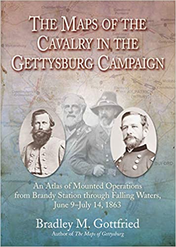 The Maps of the Cavalry in the Gettysburg Campaign: An Atlas of Mounted Operations from Brandy Station through Falling Waters, June 9-July 14, 1863
By Bradley M. Gottfried
Savas Beatie, 2020, $34.95 hardcover.
Reviewed by Zachery A. Fry
Seasoned followers of Emerging Civil War will recognize Brad Gottfried as author of a veritable library of reference publications, seven of them alone in Savas Beatie’s indispensable “Military Atlas Series.” This latest installment, which follows Union and Confederate cavalry north into Pennsylvania, offers much of the same detail and accessibility readers have come to expect from Gottfried and his publisher.
The Maps of the Cavalry in the Gettysburg Campaign expands Gottfried’s previous atlas of the campaign as a whole (volume one in the publisher’s series). This new book consists of eighty-two full-color maps broken down into sixteen “sets” untangling the fluid mounted operations of Lee’s movement north. As with other works in this series, Maps of the Cavalry includes a blow-by-blow account of each individual action the atlas depicts. Gottfried’s flair for writing battle narrative and offering analysis transcend simple commentary. Horses thunder across Gottfried’s pages, trampling meadows and carrying their riders into bloody and desperate combat. Maps aside, Gottfried has given readers one of the most authoritative studies of Gettysburg Campaign cavalry action in print, taking full advantage of the latest scholarship from other authorities such as Wittenberg and Petruzzi.
Gottfried’s work conquers a number of inherent challenges presented by the topic. The summer of 1863 was one of robust change in the organization of the Army of the Potomac and its cavalry arm, and the rapid, dynamic pace of operations leading to Gettysburg exhausted mounted columns in both blue and butternut. To his credit, Gottfried weaves those developments into an easily-digestible narrative. The atlas follows some of the most famous mounted episodes of the Civil War—Brandy Station (which he describes in gripping detail), Stuart’s tortuous ride north to reconnect with Lee, the cavalry actions surrounding Gettysburg on each day of the battle, and the exhausting pursuit toward the Potomac. Generally speaking, the author strikes a sound balance between operational-level coverage (the movement of cavalry divisions across the campaign maps of Virginia, Maryland, and Pennsylvania) and the more minute tactical action at places like Aldie, Middleburg, Upperville, Westminster, Hanover, Hunterstown, and Fairfield.
The atlas presents a few minor shortcomings. Some readers will no doubt have wanted more attention for John Buford’s storied July 1 defense at Gettysburg. The book offers a scant five maps for Buford’s role west of town, only two of which actually depict the famous morning action. This may have been the result of an editorial decision not to overlap too significantly with Gottfried’s previous Gettysburg atlas. And while some of the volume’s maps lack the precision of Philip Laino’s more detailed Gettysburg Campaign Atlas, Gottfried’s comprehensive coverage and Savas Beatie’s handsome production—all of it in full color—more than make up for relative flaws.
The extensive detail in Savas Beatie’s atlas series represents one of the most valuable additions to recent Civil War military history, serving both lay readers and hardened battlefield stompers alike. Gottfried’s own contributions—representing the lion’s share of the series—intricately reconstruct some of the most famous moments of the war’s Eastern Theater. The author deserves credit for his willingness to tackle a breadth of battles and campaigns, and for his dedication in conducting robust primary and secondary research to sort through the chaos of tactical-level carnage. The introduction to this latest volume promises additional map studies for Spotsylvania, Cold Harbor, and the Petersburg Campaign. While those installments alone would suffice to round out a superb series, future map coverage from Gottfried for the campaigns of Second Manassas and Chancellorsville would also represent an important service to the Civil War community.
It’s an outstanding book indeed! I’m a big fan of the Gottfried “maps of” series. Bradley is a really nice approachable author as well. I’m really looking forward to his next “maps of” book. However, I do not see how he can fit the entire “Overland Campaign” and beyond into one book and give it justice…while other battlefields get their own stand alone book. It sounds like a map book too far….
Thanks for your nice comment, John (and to Zachery Fry for a great review!). If you consider the Wilderness Campaign part of the Overland Campaign, then there will be two books. The second book in the series will cover Spotsylvania through Cold Harbor and will be bigger than most of the map books. Still, I had to cut out some of the maps/text because of cost issues.