ECW Weekender: Hiking at Bentonville Battlefield

In mid-February some work travels took me to the Carolinas, and I decided to take a stretch break at Bentonville Battlefield in North Carolina. After exploring the welcoming visitor center and getting a map, I headed out on the trails. Come take a hike through some of the photos!
The battle of Bentonville occurred on March 19-21, 1865, resulting in the largest Civil War battle fought in North Carolina and a Union victory. It’s a battle often-shadowed or overlooked in the ending chapters of the war, but more than 4,000 soldiers fell in the fight as Confederate General Joseph E. Johnston made an attempt to stop or slow Union General Sherman’s advance through the Carolinas.
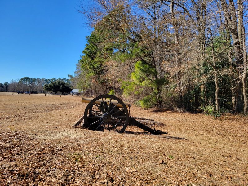
The modern trail system in the vicinity of the visitor center winds along earthworks of the Michigan engineers and then out into the fields of the historic Morris Farm and the location of the Confederate “High Tide” at Bentonville where artillery fire rivaled that at Chancellorsville or Gettysburg according to a participant in all three battles.
You’ll find the trailhead just behind the cannon and reconstructed trenches, across the road from the visitor center…
One of the things that I really like about this trail system is the different options. There is a loop trail, but then there’s also an “add-on” option that is an out-and-back trail. I had enough time to do the whole trail and then pick up the shorter return loop on my way back.
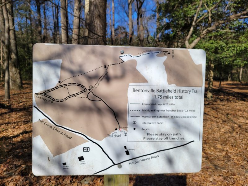
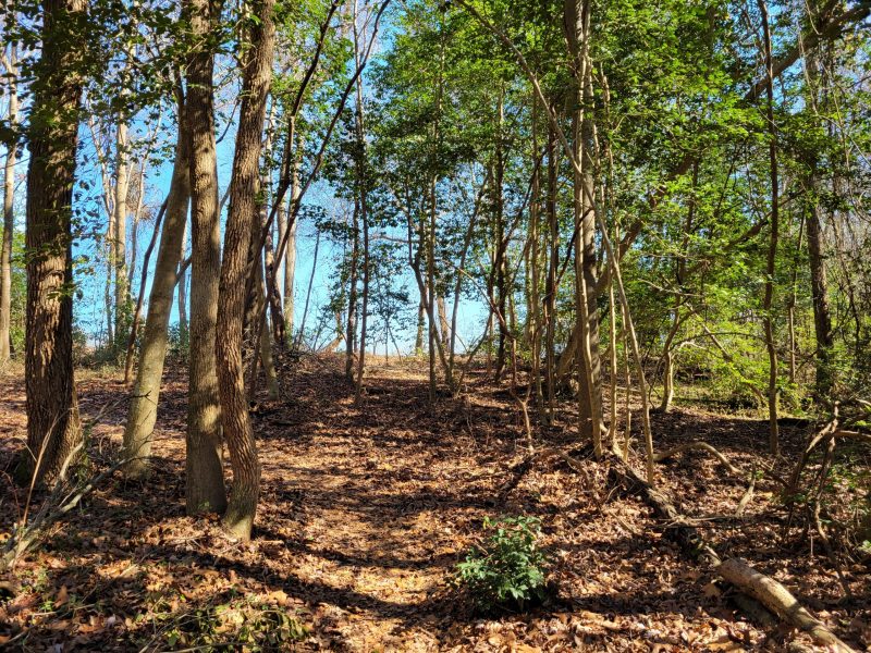
Another thing I really liked about the trails is the guarantee of seeing trenches! If you’ve “hiked” with me before through blog post, you know that I prefer winter hiking for looking at earthworks. However, the routes of these trails at Bentonville ensure that you’ll see some noticeable trenches in all seasons, even when the foliage springs back. The trails run right alongside the trenches, particularly in the shorter loop trail system which is nice for observation.

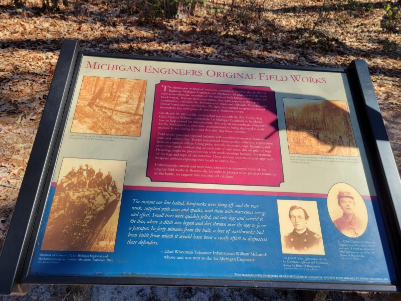
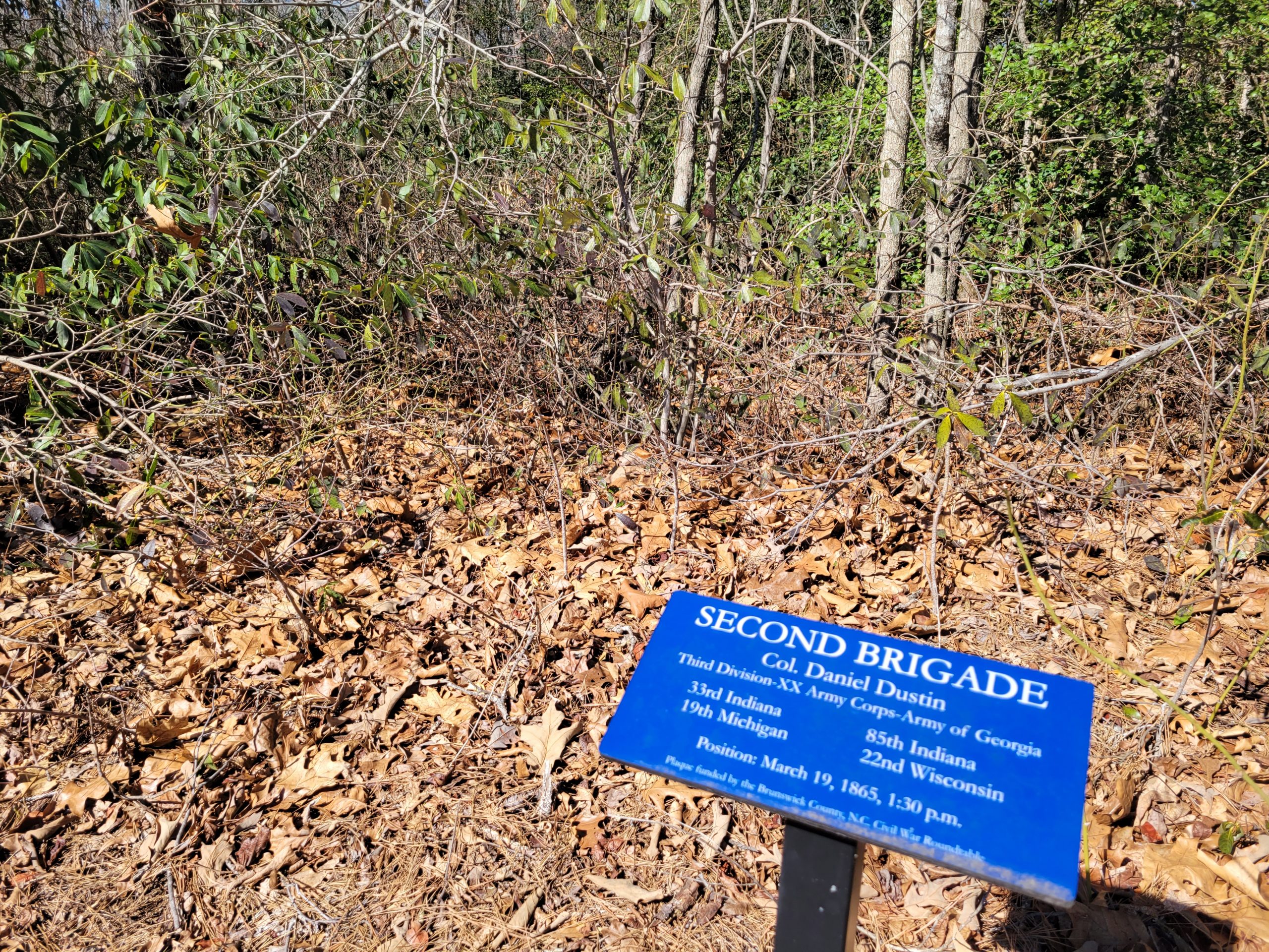
Interpretive panels along the trail feature a variety of historical topics. Some panels are specific to the battle of Bentonville, others focus on regiments, soldier life, and North Carolina flora and fauna.
Here’s a good look at how close the trail and trenches are. Wonderful!
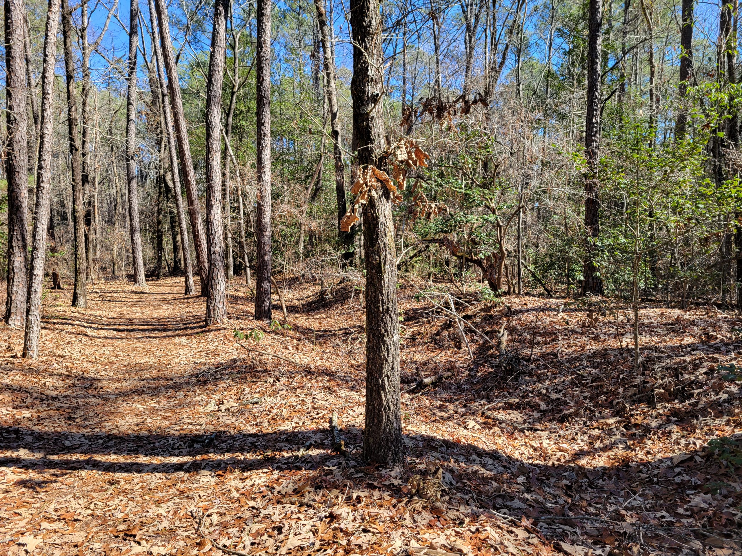
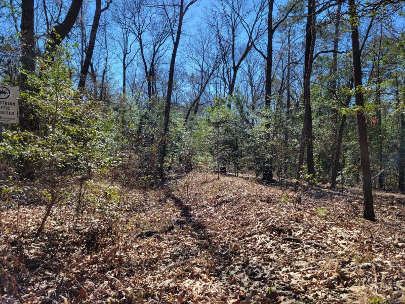
The trails are obvious and well-blazed — always a reason for bonus points in my hiking preferences. And there are reminder signs along the way to stay off the earthworks. They aren’t playgrounds or natural dog parks!
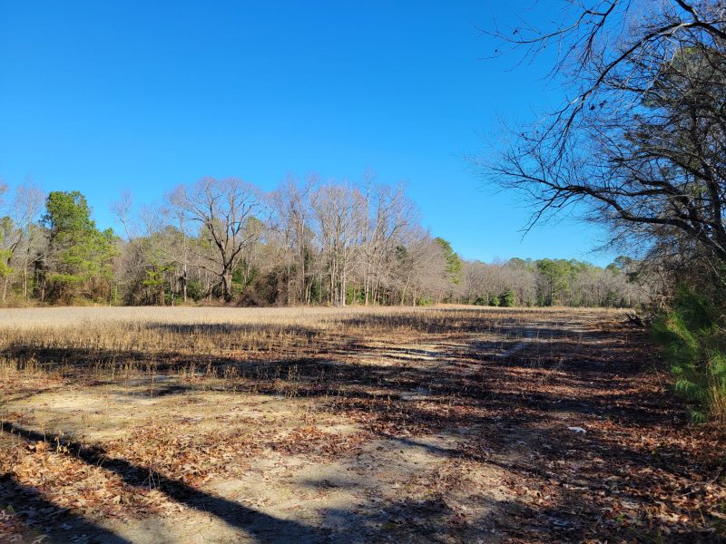
The longer trail option leads out through Morris Farm and through a series of open fields, with the trail skirting the edges. At some points, earthworks are easily visible in the bordering woods and helpful signs match the trenches and topography to battle maps.
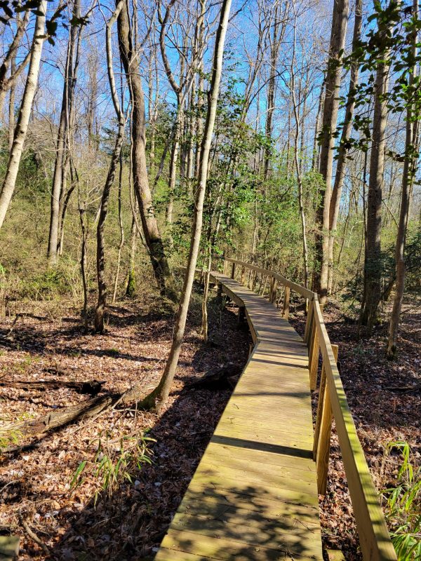
Re-entering the woods after the first fields, the sounds of water sounded and the trail slopes gently down to a wetlands/creek area which is nicely bridged.
Leaving the bridge and climbing up a steeper slope, I think I spy more earthworks at the top of the rise…
Yes, there are more earthworks. The 13th New Jersey and 82 Illinois held this position on March 19, 1865, filling a gap in the Union lines.
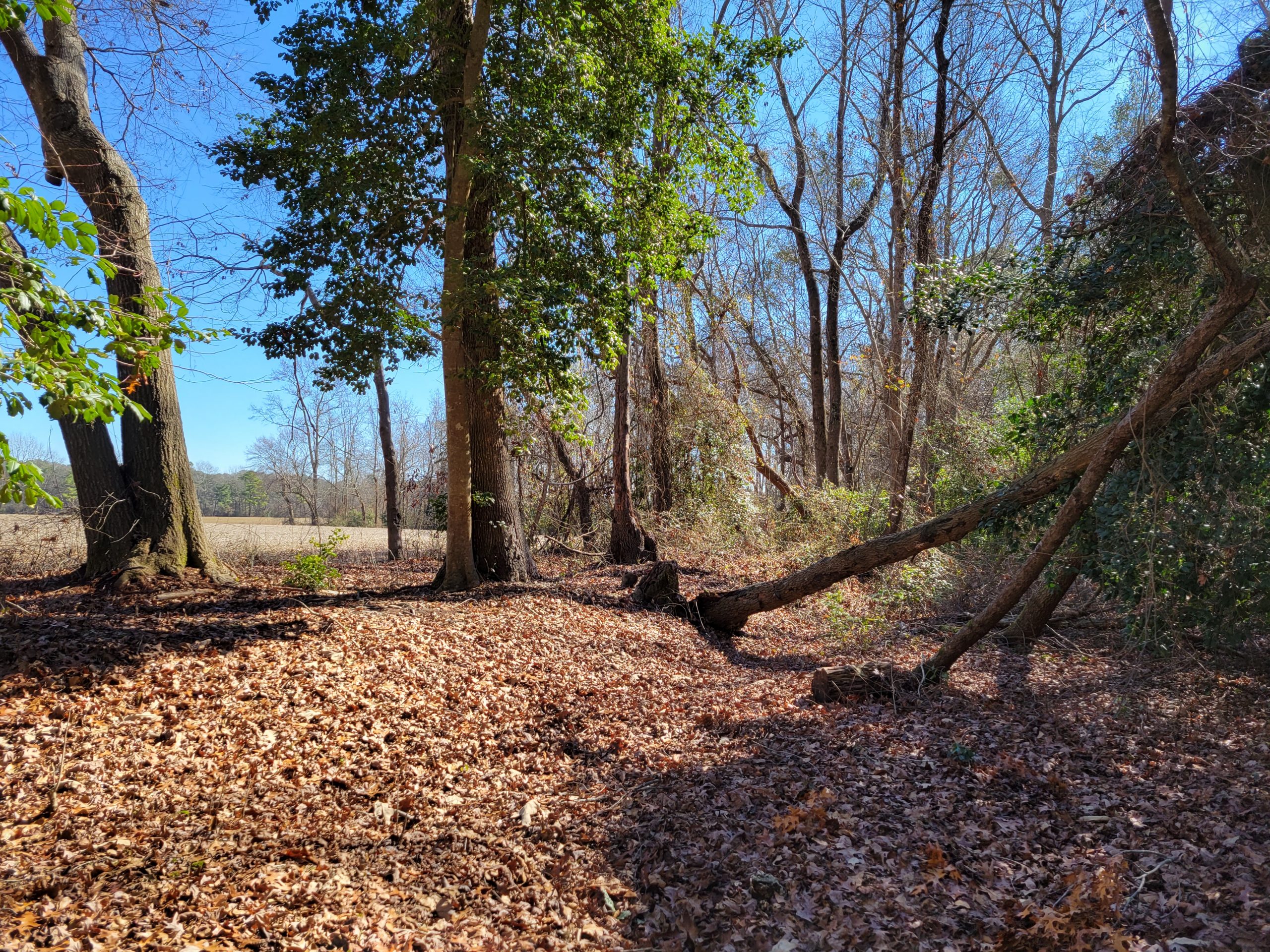
A few more open fields, bordered with trenches in the woods. The trail now takes us into some of the heaviest fighting areas. Regiments that fought across these fields later said the combat was worse than the Wheatfield and Peach Orchard at Gettysburg. But there are no monuments here, just the preserved land holding the stories and keeping its own secrets.
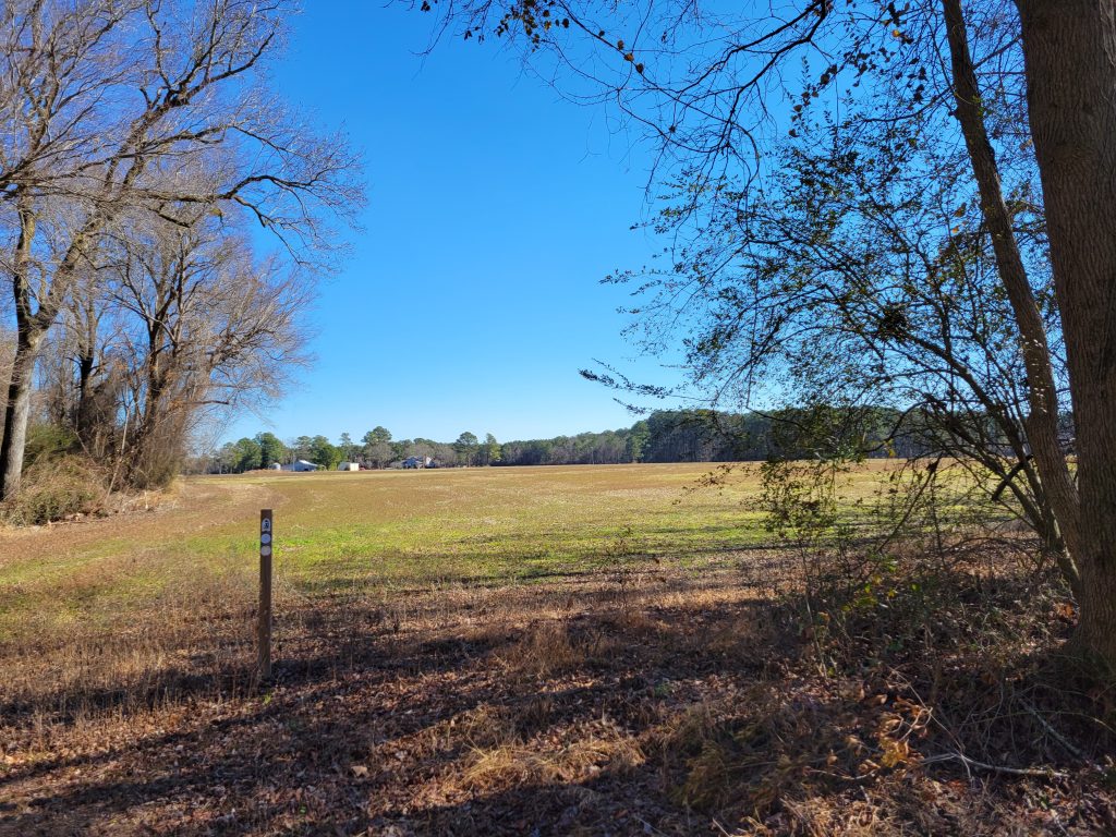
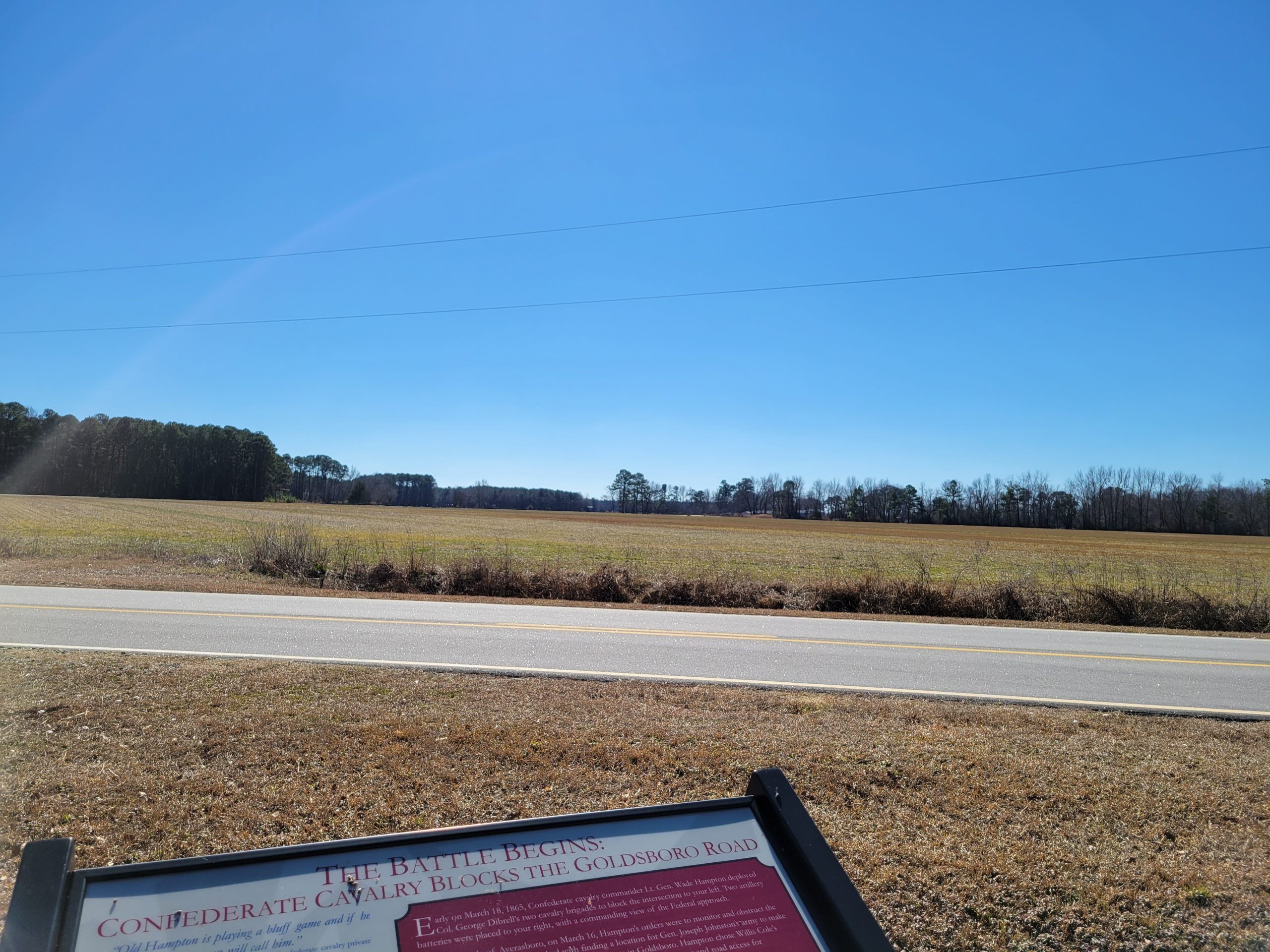
The trail leads to a road and a set of interpretive panels are visible across the pavement. The road is a historic route used during the battle, and looking back over the large field is a view across on the of the epicenters of the battle.
There’s a lot to see and explore at Bentonville Battlefield, including a few monuments, a Confederate burial ground, extensive driving tour, and, of course the museum and visitor center. On this recent trip, I chose to do the museum and hiking trails, and I’ll look forward to going back another time to finish the driving tour and continue gaining a greater appreciation for the preservation work and interpretive opportunities at this battle site.
And don’t forget to take a copy of Dan Davis and Phill Greenwalt’s book from the ECW Series: Calamity in Carolina for a tour book and lightweight historical reference. It does fit very nicely in a hiking bag!
I remember when I toured the Bentonville battlefield on a Trust tour. I was amazed at how pristine the battlefield was. We went from Bentonville to the nearby surrender site, a beautifully preserved historic property. It was there I really understood the Trust policy that it funded acquisition of only property on which (in those days) Civil War action took place. There was a section of industrially zoned land across the highway from the site. Concern was that development of that property would degrade the historic building across the way. Fortunately, there were enough donors like the Capital District Civil War Round Table that did not have a matching restriction on their donations to provide the funds to purchase the impacting property to preserve the historic site. A nice memory.
Dan and Phill’s book on this battle (and Averasboro) are great and were super helpful during my visit. There’s a nice BBQ place nearby as well! One of my ancestors fought in a Wisconsin regiment under Mower, so it was cool to walk in his footsteps.
Ed Bearss was a great friend to Bentonville for more than 30 years. Six NC roundtables dedicated acreage in his memory on 30 Oct. A bronze plaque is in the Visitor Center. Ed always maintained that the only original revetment logs from the Civil War are at B’ville—ask in the VC to find their exact location, just off the trail.
https://emergingcivilwar.com/2022/02/05/saving-history-saturday-ed-bearss-memorial-unveiled/
Chris Mackowski published the above description and photos of the dedication to Ed.