ECW Weekender: Two sites to check out at Antietam

I recently had the opportunity to visit the Antietam National Battlefield for the first time. Befitting one of the most important battles of the war, there’s more here than you could possibly visit closely in just one day. So beyond doing the driving tour, I focused on two parts of the battle that I find particularly compelling.
The first was Burnside’s Bridge, on the far left of what was the Union line during the battle. It’s one thing to read about how difficult it was for the Union troops to attack across the bridge, but I think seeing it in person really drives home the extent of the challenge.
By the time Burnside launched his assault, the Confederates had stripped most of this part of their line for reinforcements. Despite the few remaining troops being badly outnumbered, the strength of their position helped them to stubbornly hold off the Union Ninth Corps through repeated attacks.

On the west side of the creek – the side initially held by Confederate troops – the heights where you park and overlook the bridge are much more imposing than I expected. Before you go down to the bridge, follow the signs to your right (if you’re facing the creek) toward where Toombs’ Georgians were able to spend hours picking off Burnside’s troops from relatively safety.

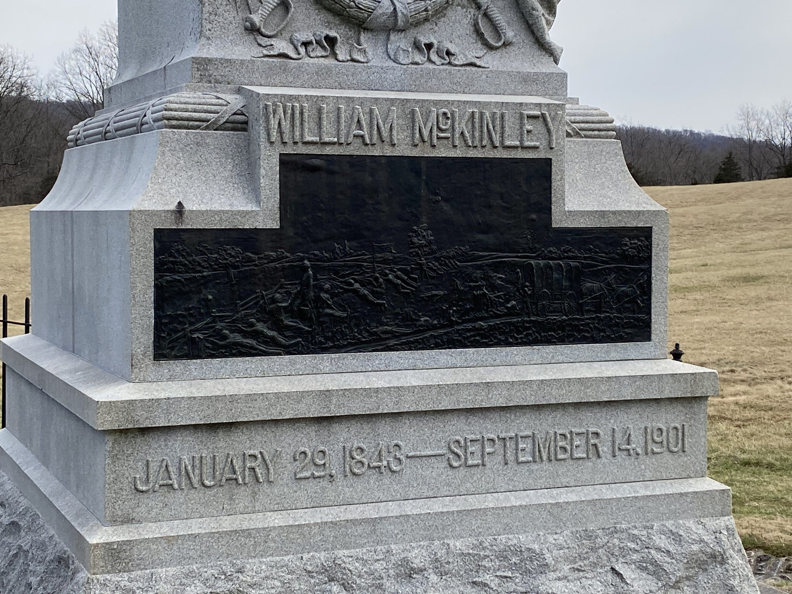
Near this parking area, you can also see a monument to where future president William McKinley ran through enemy fire to bring coffee to his comrades. I’m enough of a coffee addict to acknowledge that McKinley would’ve won my vote with that story alone. Hiking further downstream will bring you to the ford where other elements of the Ninth Corps were able to flank the Confederate line virtually unopposed, bypassing the bridge altogether.
Take the time to cross the bridge and visit the eastern side of the creek. This lets you see the direction from which Union forces attacked. The Confederate-held heights feel even more imposing from this direction, especially when you realize that the attacking units needed to cross over these fields just to reach the long, narrow bridge.
From the Union side of the bridge, it’s easy to miss a monument to the 11th Connecticut. If you’re facing the creek, the monument is a couple of hundred yards behind you and to the left. If you walk downstream, you can follow signs to where it’s tucked up into the woods.
Eventually, after repeated and costly attacks, the Ninth Corps did make it across. Along with troops that forded about a mile or so downstream, they gave McClellan a foothold on the other side of Antietam Creek. They posed a huge risk to Lee’s right flank and his line of retreat back across the Potomac. But the strength of the position meant that the small number of Confederate defenders had bought enough time for A.P. Hill’s division to come up from Harper’s Ferry and drive Burnside back.
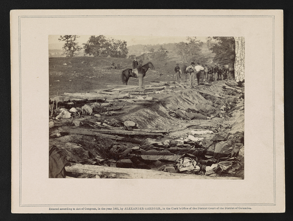
The second site I focused on was behind Bloody Lane, where a sunken farm road created an impromptu trench in the center of the Confederate line. Bloody Lane Trail is a good hike that starts at, and loops back to, the Visitor Center. You’ll have great views of the north end of the battlefield, before going down a ridge and then walking in the footsteps of the Second Corps as they attacked.
If you deviate briefly from the trail, you can easily visit the 60-foot observation tower. Built by the War Department to help train officers after the war, it gives you an unparalleled view of the battlefield and is well worth the climb up the stairs. If you look to the west from the top of the tower, you’ll see two artillery pieces behind the Confederate position at the Sunken Road, at the back of a farm field. Depending on the time of year, these may also be visible from the road.

While these guns seem a little out of the way, they mark the location where Longstreet and his staff briefly manned Miller’s battery of the Washington Artillery. As the Confederate center started to give way, he saw that the battery had stopped firing. In one version of the story, the general and his staff served the guns together until new artillerists came up. In another version – which I find a little more likely – Longstreet held his staffs’ horses while they fired.
Either way, I think it says a lot about Confederate desperation at this moment that the second in command of the entire Army of Northern Virginia was personally focused on keeping a single battery firing.
At this close range to the advancing Union infantry, they were firing canister rounds. Canister is a kind of artillery ammunition that fires hundreds of individual lead balls, effectively turning a cannon into a giant shotgun. They spray out in a fairly predictable cone, especially when guns are firing from the same position for hours at a time. A park ranger explained to me that when the National Park Service did archaeological work here, they were able to map out where the canister had hit the ground, and it pointed them back to a very precise location of where to put these cannons.
You can read more about this moment in the battle here, or watch this video on Emerging Civil War’s Facebook page.
Note that the Antietam Visitor Center is currently under renovation. The temporary one will still give you a good feel for the battle, and the new building should open later this year.
Tell us in the comments: What are your favorite parts of the Antietam battlefield to visit.
I agree with you on the impact seeing the bluffs above Burnside’s Bridge has on one’s understanding of the action there. They are very commanding and make it much easier to understand why the IX Corps struggled so badly to get across against a few hundred defenders. I hope you had time to follow the II Corps path to the Bloody Lane. That too is enlightening in that you see how blind they were to the force awaiting them. I love that park. It, like Shiloh, is really well-preserved and has been largely shielded from development pressure due to location.
Thanks Glen! Agreed, the II Corps path was also worth the time, and felt a lot different walking it than the view I was getting from the Confederate side.
Visited last fall and was taken by the witness tree at Burnside Bridge. The volunteer ranger also pointed out that, other than some repairs, the bridge is the same one that stood in 1862. Reminders of our living history