Gettysburg Off the Beaten Path: Trough Rock
Of the thousands of rocks in Gettysburg National Military Park, a handful are “lucky” enough to be named. One such rock—the Trough Rock—is surrounded in mystery as to its origins.

Located in the Plum Run Valley (or Valley of Death) between Little Round Top and Devil’s Den, Trough Rock is situated just across the footbridge from the Devil’s Den parking lot. However, this sector of the battlefield looked much different 130 years ago. By then, the bloody fields and hills had transformed into a popular turn-of-the-century park. In 1884, construction of the Round Top Branch of the Gettysburg and Harrisburg Railroad allowed visitors to travel from Baltimore, Washington, or Philadelphia directly to Little Round Top and Devil’s Den.[1]
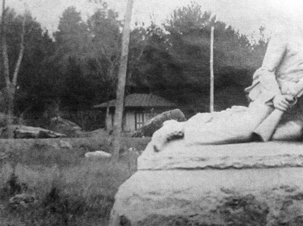
The railroad purchased several acres of land at the terminus of the track to accommodate and entertain visitors and constructed “a spacious pavilion, a kitchen with range, two wells of water with pumps and all necessary buildings.” Other structures went up in the following decade, including a refreshment stand, dance pavilion, and a merry-go-round. In May 1894, the Gettysburg Electric Railway completed its line around Devil’s Den and the Valley of Death, connecting the town with Round Top Park. At some point during this era, photographer Levi Mumper built a small studio in the area called the Slaughter Pen—then known as Tipton Park.[2]

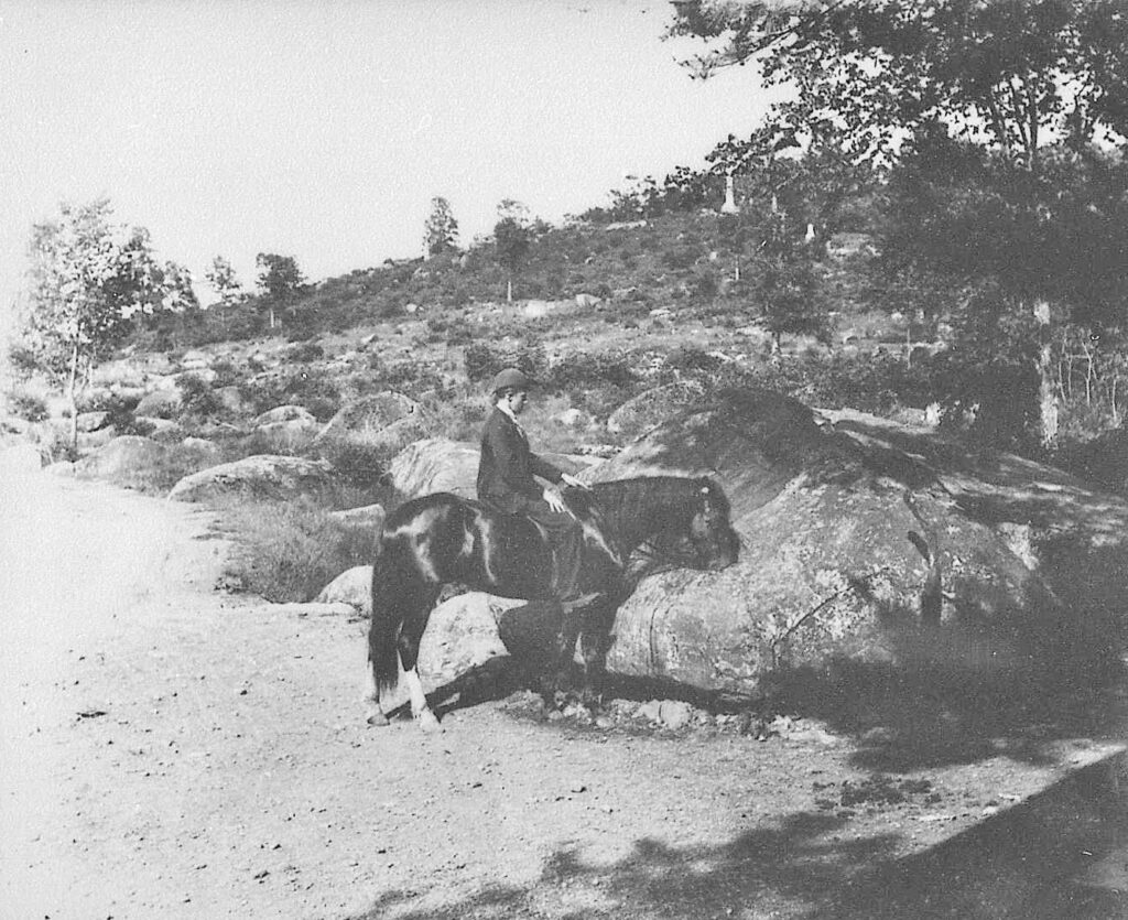
Battlefield tourists and scholars have offered several explanations regarding the origins of Trough Rock, located in the heart of Tipton Park. An 1898 tour book speculated that “one of the curiosities of the field is the Flowing Rock…a natural watering-trough in a crevice of a great boulder.” Other historians have suggested that the trough within Trough Rock was cut before the battle of Gettysburg in 1863. However, it is more likely that the trough was cut after the battle, before or during the era of Tipton Park. Historians have long speculated that Trough Rock served as a watering hole for the horses of early battlefield tourists. (Horses remained a popular form of transportation even during operation of the Gettysburg Electric Railway.) This theory is supported by a William Tipton photograph of a rider allowing his mount to drink from the trough in the 1890s.
But why would park planners cut a trough into a rock that stands about 30 yards away from Plum Run? Surely, mounted visitors to the park could just water their horses in the stream rather than at Trough Rock. This simple assumption, along with a clue in the 1890 photograph, yields the conclusion that Trough Rock was not really a trough. The shadow and porch of Levi Mumper’s photographic studio (later purchased by William Tipton) is visible in the bottom right-hand corner of the 1890 Tipton photo of Trough Rock. Mumper (and subsequently Tipton) needed a reliable water source to produce photographs through wet-plate photography.[3]

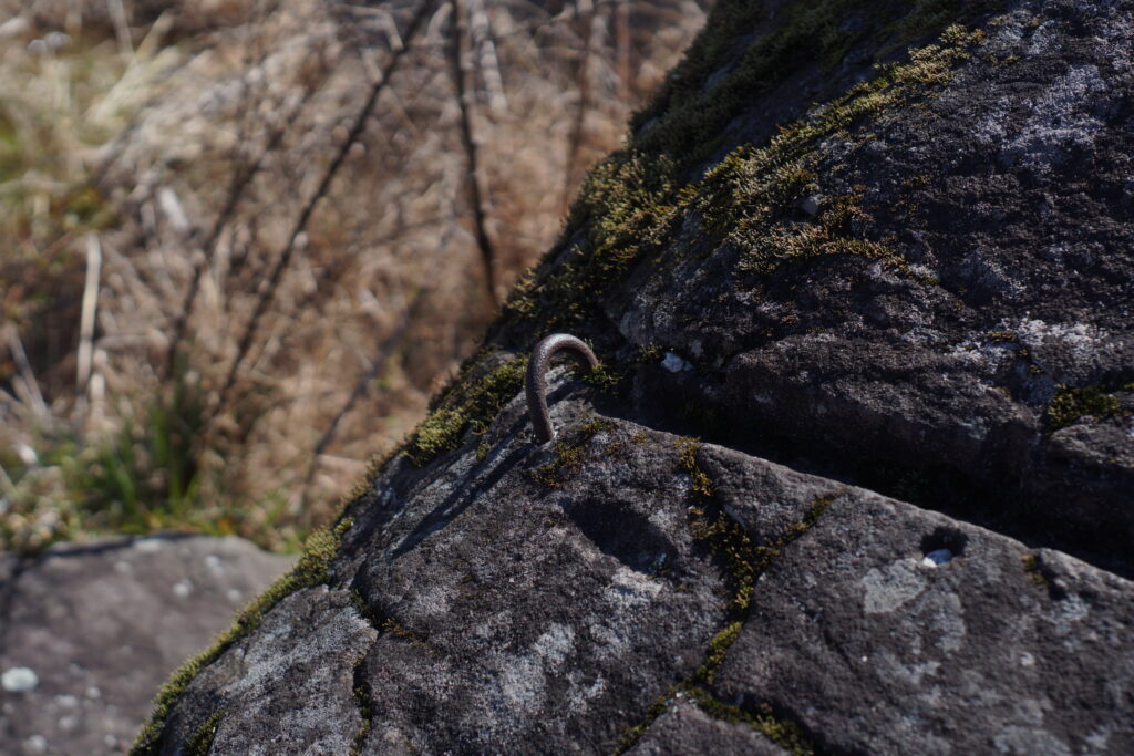
Other alterations to the boulder support this theory. The remnants of a drainage pipe are still visible today to the left of the trough. While the pipe itself is missing, the rings that held the pipe still remain. While these rings have long been speculated to be horse hitches, that is likely not the case. Rather, the pipe probably pumped water from a local spring into the top of the rock, which flowed down the front side into the trough, lending the names “Fountain Rock” or “Flowing Rock” to the boulder. This supplied Mumper and Tipton with the clean water they needed for their tin-type gallery. Then, a second pipe to the left of the rock drained the water from the trough once it was contaminated or no longer useful to the photography process.
In 1902, Tipton Park was condemned by the U.S. government, and the photographic studio was moved a few hundred feet to the slope of Little Round Top. There, it became a souvenir stand operated by David “Blind Davey” Weikert.[4] Today, Trough Rock remains one of the only surviving remnants of a bygone battlefield era. Only sharp-eyed visitors who venture across the footbridge over Plum Run might notice the odd sight of a manmade trough within a boulder.

To Reach Trough Rock
From the town square.
– Drive south on Baltimore Street.
– Make a slight right onto Steinwehr Avenue (US-15).
– Follow Steinwehr Avenue (US-15) for about 2 miles.
– Turn left onto Wheatfield Road.
– Follow Wheatfield Road for about half a mile, then turn right onto Crawford Avenue.
– Continue onto Sickles Avenue and park in the Devil’s Den Parking lot to your left.
– Exit your vehicle and proceed across the footbridge. Follow the widest trail as it curves to the left. DO NOT turn right onto the two trails that break off from the main trail.
– Walk about 150 feet and Trough Rock will be on your right, just off the trail.
————
[1] Garry E. Adelman and Timothy H. Smith, Devil’s Den: A History and Guide, (Gettysburg, PA: Thomas Publications, 1997), 78-79.
[2] Adelman and Smith, Devil’s Den, 78, 94-95.
[3] Adelman and Smith, Devil’s Den, 95.
[4] Adelman and Smith, Devil’s Den, 90.
Neat. Thank you. Another interesting spot to visit on my next trip.
Absolutely! Glad I could help.
Outstanding piece/work! Looking forward to more.
Thanks!