February 2025’s Cover Image: Panorama of the Seat of War
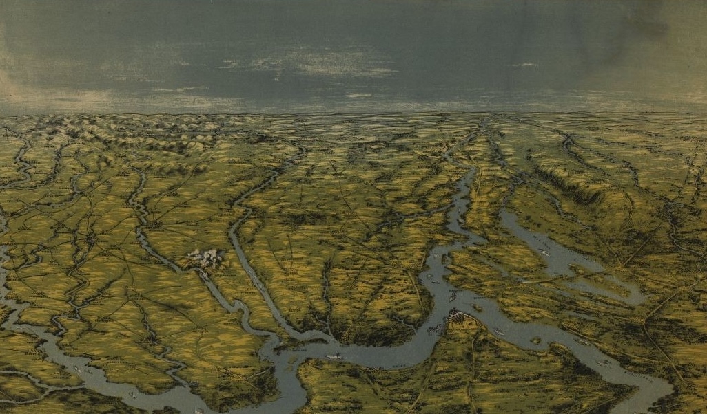
If you know your geography, then you probably recognize the image we have up for this month’s header. The Library of Congress titles this “Birds eye view of Kentucky and Tennessee showing Cairo [IL] and part of the southern states.” You can also see the Tennessee and Cumberland Rivers flowing into the Ohio River, which in turn flows into the Mississippi River.
The top of the full image (cropped out on our page) says “Panorama of the seat of war.” It was “drawn from nature and Lith. by John Bachmann,” who published the print in NY.
The LOC’s fuller description of the map says:
Panoramic view looking south from Cairo, Illinois, showing parts of Illinois, Missouri, Kentucky, Tennessee, and Arkansas. Smoke over Fort Donelson, Tennessee, and the presence of gunboats on the Cumberland River depict the fort’s fall to Union forces in February 1862.
You can see the smoke from that action at Fort Donelson right next to the “E” in “Emerging.”
You can find a higher-res version of the image, as well as its full catalogue information, at the LOC.
George Boutwell describes the “army refuse and dead animals” littering the ground following flooding in low-lying Cairo while on a War Commission mission in July 1862 with Richard Henry Dana and how he preserved his health by drinking water made only from “Iowa ice,” in my just published Boutwell: Radical Republican and Champion of Democracy from WW Norton. Cairo could well have been the worst Union posting of the Civil War.
Mention of “Iowa ice” reminded me of a story I heard while growing up in Rock Island County, Illinois. Since at least the 1850s ice had been harvested by the ton from the frozen Mississippi River during Winter, hauled as large blocks to a warehouse in the port city of Davenport Iowa, and covered with heavy tarps and a thick layer of sawdust; hundreds of tons of this carefully preserved delicacy provided local needs for the entire summer. According to statute, only “channel ice” was to be cut because of the belief that ‘flowing water was the most pure.’ And in vicinity of Davenport the most pure of the channel ice was harvested from the Rock Island Rapids, upstream from Davenport.
However, with increased demand for everything during the Civil War, including ice, one unscrupulous dealer ‘interpreted’ channel ice as “ice from any channel” including the narrow strait between Credit Island and the Iowa riverbank, just downstream from Davenport. Customers swore “it was the sweetest ice they ever tasted.”
wonderful story about “Iowa ice”
Mike is a font of information. A water fountain of information. With ice…
I can see Elvis’ house from here!
Thankyou, thankyouverymuch!