Encountering John C. Frémont Repeatedly in My Research and Travels, Part III: Seeing His Signs Throughout the West
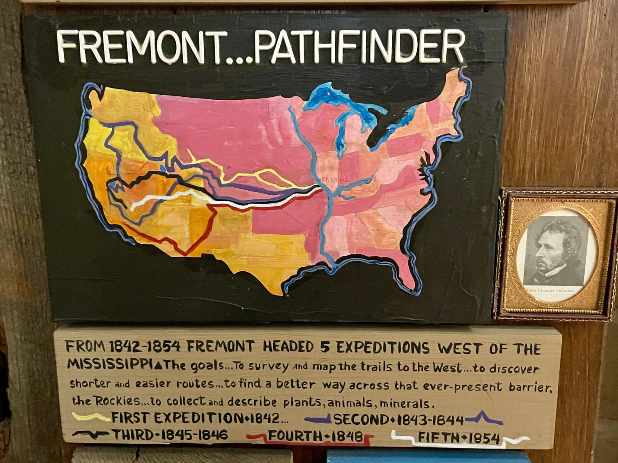
Between 1842-1854, John C. Frémont – with the help of his guide, mountain man Kit Carson – led five major expeditions across the American West, mapping and surveying the Great Plains, the Rocky Mountains, the Great Basin, and California. His maps of the Oregon Trail were critical to the nation’s westward expansion, as were the popular chronicles of his travels that appeared in newspaper accounts and books he wrote with his wife Jessie Benton Frémont’s assistance.
In the 1850s, Frémont was viewed as the epitome of the American adventurer. Both the Democratic Party and the newly-formed Republican Party wanted him as their presidential candidate in 1856. Because of his anti-slavery views, he accepted the Republican Party’s nomination (see Part II), and he chose not to run again in 1860. His actions as commander of the Department of the West in Missouri in 1861 earned him high praise from some and strong criticism from others (Part II). Ultimately, few today would call him a great hero of the Civil War.
Rather, throughout much of the West, it is for his “Pathfinder” history that Frémont is most remembered. In my travels the past couple years in California, Oregon, Washington, and Utah, I have encountered his name repeatedly. Here I will share some of the ways he continues to be memorialized, with photos, museum displays, historic markers, and artwork that tells his story.

Frémont’s first assignment with the Corps was to assist French scientist Joseph Nicolas Nicollet in surveying the region between the upper Mississippi and Missouri Rivers. Nicollet became an important mentor to Frémont, teaching him proper surveying and mapping techniques, as well as effective methods for the collection of botanical, geological, and topographical data; barometric altitude measurement; and expedition management. Their efforts ultimately resulted in the groundbreaking 1843 Map of the Hydrographical Basin of the Upper Mississippi, which corrected previous errors and included the first use of indigenous place names on a U.S. government map. While he was in Washington, D.C. to report on this expedition, he first met his future wife, Jessie Benton (see Part I).


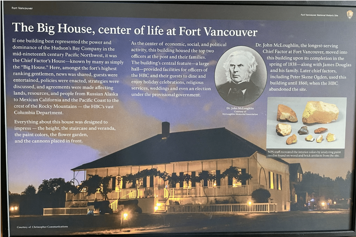
Hudson Bay Company Gov. George Simpson wanted McLoughlin to turn away American settlers, whom he saw as encroaching on this shared British and American territory. Instead, McLoughlin offered them credit in the fort’s shops – later leading to his being called the “Father of Oregon.” [9]

Those American emigrants McLoughlin helped would not have been arriving in such large numbers if not for Frémont’s maps and written descriptions. After he returned from this expedition, he and Jessie “turned his report … into an international best seller blending scientific details with salty frontier anecdotes. The characters – Kit Carson, Indians, mountain men, fur traders – came alive, crowding with human drama the landscape that Frémont had mapped and charted, turning the unshaven, rough-hewn explorers into heroes on a visionary quest. For the first time in American history, an explorer’s report offered a gripping narrative and the literary polish of the world’s classic adventure stories, with the leader’s exploits elevated to a par with such world-class figures as Captain Cook and Coronado.” [10]
Officially titled Report of the Exploring Expedition to the Rocky Mountains in the Year 1842, and to California in the Years 1843–’44, Frémont’s report fueled the expansionism desired by then-President James K. Polk and influenced the Mormons’ decision to settle in Utah. It “guided thousands of overland immigrants to the Oregon and California regions from the years 1845 to 1849. In 1849 Joseph Ware wrote the Emigrants’ Guide to California, which was largely drawn from Frémont’s Report, and was to guide the forty-niners through the California gold rush years. Frémont’s Report was more than a travelers’ guide—it was a U.S. government publication that achieved the expansionist objectives of a nation, and provided scientific and economic information concerning the potential of the trans-Mississippi West for pioneer settlement.” [11]
That expansionism matched up with Polk’s vision. He had campaigned in 1844 on the slogan “Fifty-Four Forty or Fight,” expressing his desire for the U.S. to acquire the entire Oregon Territory from Britain up to the northern boundary. Once elected, Polk “set forth five goals, all of which he carried out successfully during his single term in office. He reduced the tariff, established an independent treasury, settled the Oregon boundary, annexed Texas, and acquired the California Territory, the latter resulting in an unpopular war with Mexico. During Polk’s administration the United States acquired more than 50,000 square miles of western land.” [12]

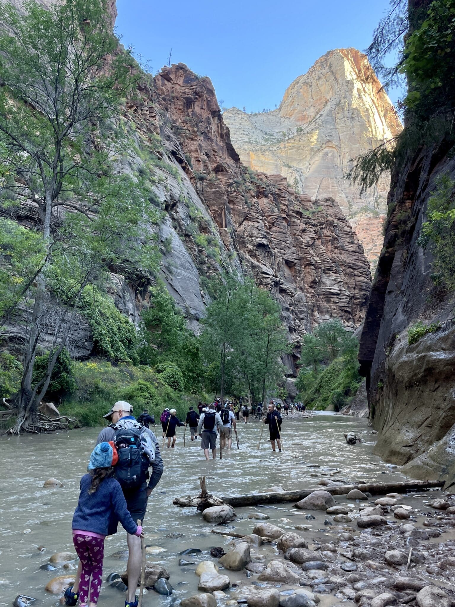
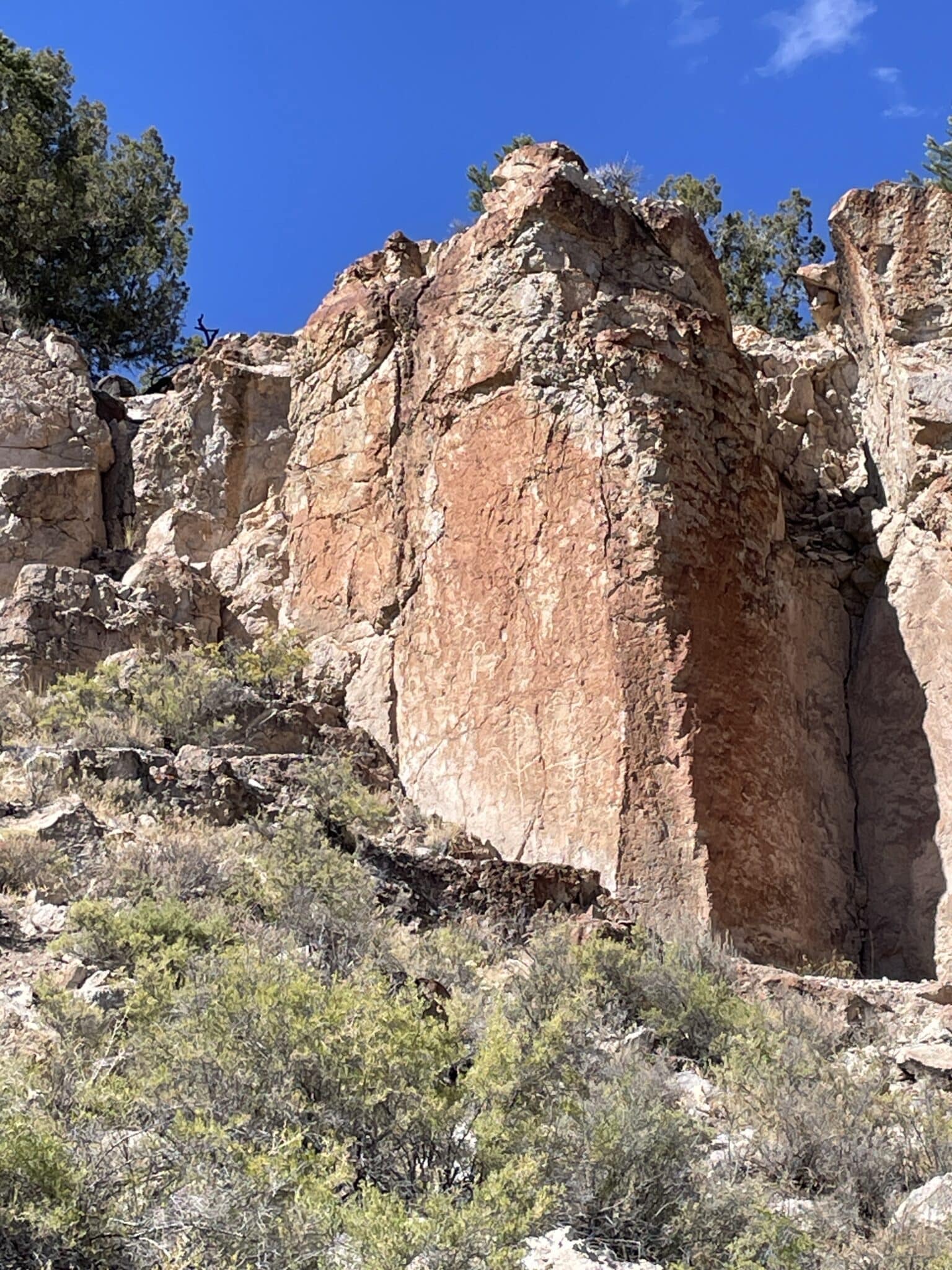
One place Frémont missed on his 1843-44 expedition was Zion National Park in southwestern Utah. He came close in1844, when he crossed the Virgin River where it trickles out onto the Mojave Desert. According to this display sign above, Frémont said it was “the most dreary river” he had ever seen, having no idea of the “sanctuary” upstream. While we chose not to hike the popular “Narrows” in Zion, where people walk through the Virgin River between towering sandstone cliffs, we did enjoy our hike on the Riverside Walk – and it was certainly not “dreary.” The scenery in Zion is gorgeous, and we watched as people set off through The Narrows.
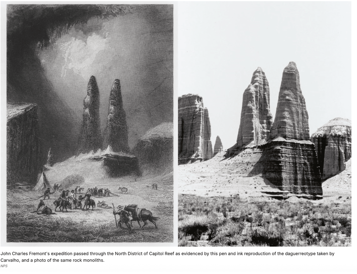
Frémont also missed out on seeing the areas in southern Utah that now make up Bryce Canyon, Canyonlands, and Arches National Parks – definitely his loss. He and his expeditionary group did, however, pass through what is now Capitol Reef National Park during the winter of 1853 while attempting to find a northern railroad route to the Pacific Ocean, as evidenced by the images below.
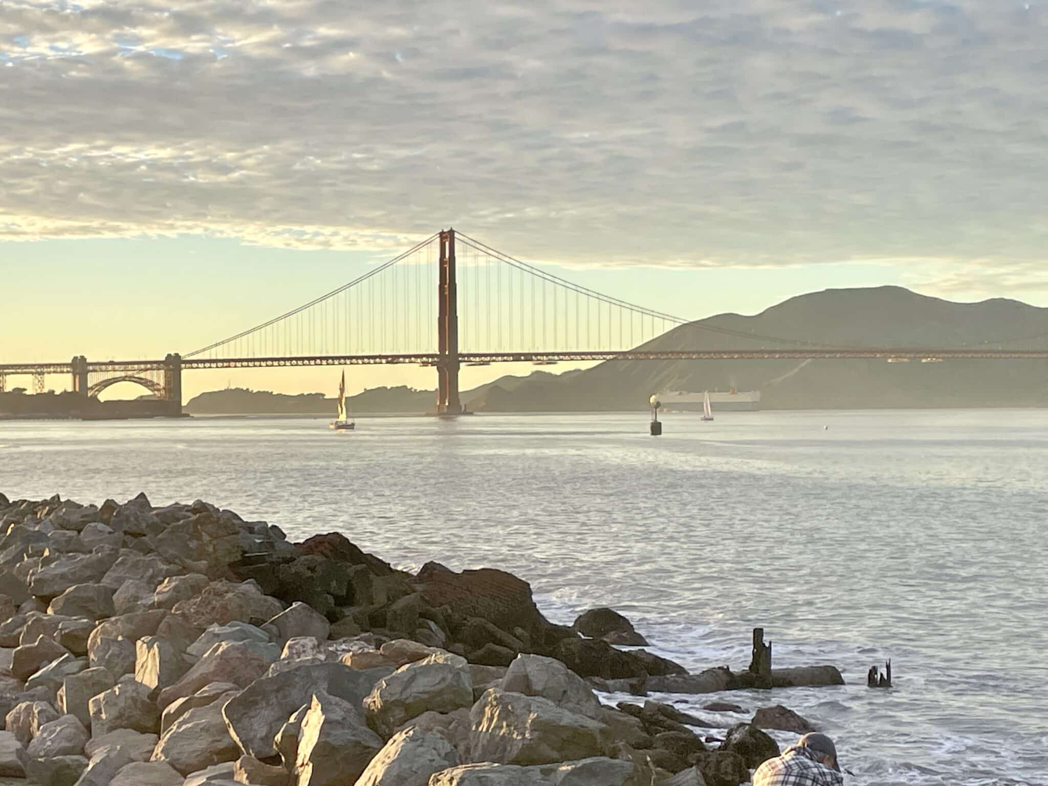
Living just 56 miles south of San Francisco, I found it especially interesting to learn that it was Frémont who came up with the name “Golden Gate.” When he first gazed on the narrow strait that separates San Francisco Bay from the Pacific Ocean in July 1846, two years before the discovery of gold in California, he said it was “a golden gate to trade with the Orient.” The name first appeared in print in both Pruess’s 1848 map and Frémont’s 1848 Geographical Memoir Upon Upper California, where he wrote, “To this Gate I gave the name of “Chrysopylae” or “Golden Gate” for the same reasons that the harbor of Byzantium was called Chrysoceras, or Golden Horn.” [15]
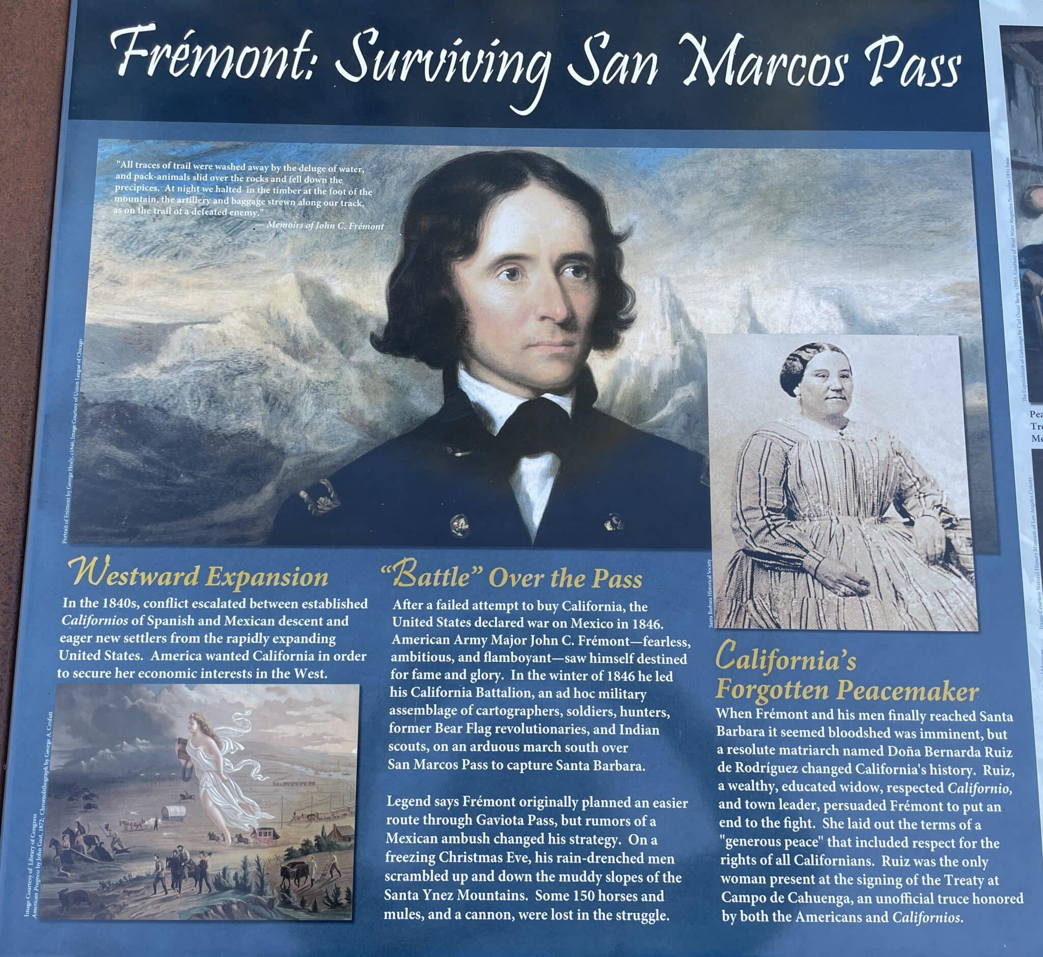
Frémont’s role in the conquest of California and his subsequent court-martial are too complicated to explain here – for a short but informative explanation, read THIS. I did run into this display recently, though, while driving along San Marcos Pass to Santa Barbara, and learned something I had never known about his role in the battle for California: “In the winter of 1846 [Frémont] led his California Battalion, an ad hoc military assemblage of cartographers, soldiers, hunters, former Bear Flag revolutionaries, and Indian scouts, on an arduous march south over San Marcos Pass to capture Santa Barbara…. When Frémont and his men finally reached Santa Barbara it seemed bloodshed was imminent, but a resolute matriarch named Doña Bernardo Ruiz de Rodriguez changed California history … [by persuading] Frémont to put an end to the fight.”
Apparently, we need more women involved in peace negotiations!
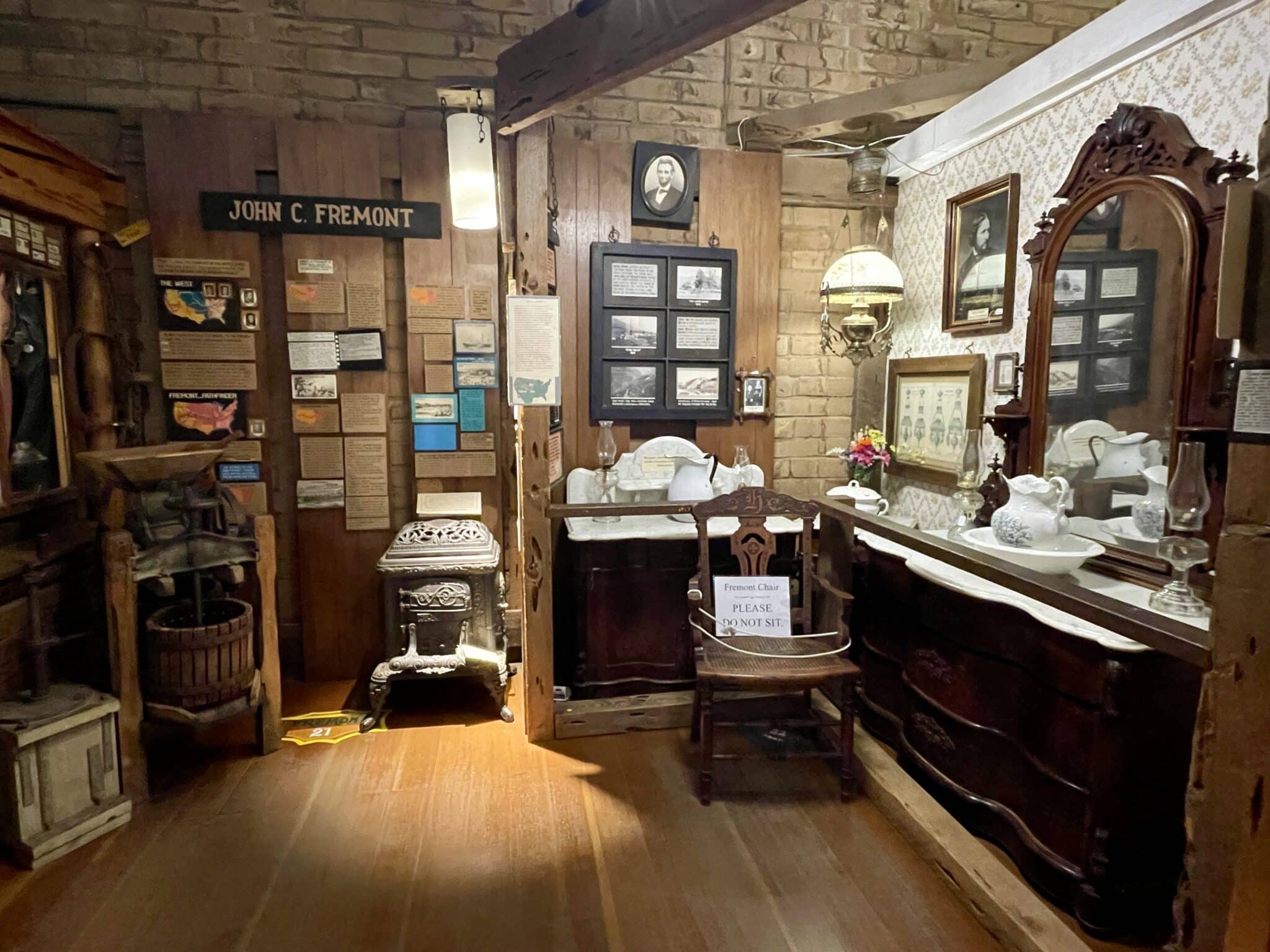
Now I want to focus on Frémont’s California land purchase. In 1847, while “engaged in winning California from the Mexicans, Frémont gave $3,000 to Thomas O. Larkin, American consul at Monterey, with which to purchase a tract of land overlooking San Francisco Bay…. Just before leaving California for the humiliating court-martial, Frémont learned that Larkin, using his own judgment, had purchased with the $3,000 a tract of 44,000 acres in what is now Mariposa County,” which lies just outside Yosemite, about 150 miles east of San Francisco. [16]
Back East, Frémont was “found guilty of disobedience and conduct prejudicial to military discipline,” but Polk “remitted the penalty, [desiring] Frémont to continue in his service.” Frémont, however, resigned from the army; then, in October 1848, set out to return to California with two objectives in mind: “first, to find passes for a railroad from the Atlantic to the Pacific; and second, to get back his $3,000, with which he intended to settle down in California and study law.” [17]
Thus began Frémont’s disastrous fourth expedition (1848–1849), a private attempt to survey and map a central Rocky Mountain railroad route that resulted in the deaths of 10 of his 33 men due to extreme cold and starvation and another two killed by Ute warriors. Frémont ignored the advice of experienced mountain men (Carson was not with him on this expedition) and led his party into the snow-covered San Juan Mountains in November 1848. There they became trapped, suffered from extreme cold, lost their 120 pack mules, resorted to eating leather, and even allegedly turned to cannibalism. The survivors were eventually rescued in mid-January 1849 after Frémont and four other men walked 130 miles to Taos, New Mexico, to seek help.
Good news awaited Frémont, though, as he continued on to California. Near the Gila River, he encountered a caravan of more than a thousand Mexicans heading west who let him know gold had been discovered in Upper California. Frémont’s thoughts immediately turned to the land he now owned but had never seen – Rancho Las Mariposas – and wondered if he might find gold there. He hired 28 of the Mexicans to work for him at his estate so he could find out.
Las Mariposas has previously been granted to Juan B. Alvarado by then-California Governor Micheltoreno in 1844. Alvarado conveyed it to Frémont, but it was a “floating grant, with its exact boundaries undetermined at the time of making, and Frémont thought that he would be entitled to his choice.” [18] Boundary disputes would cost him many legal battles and significant amounts of money down the line.
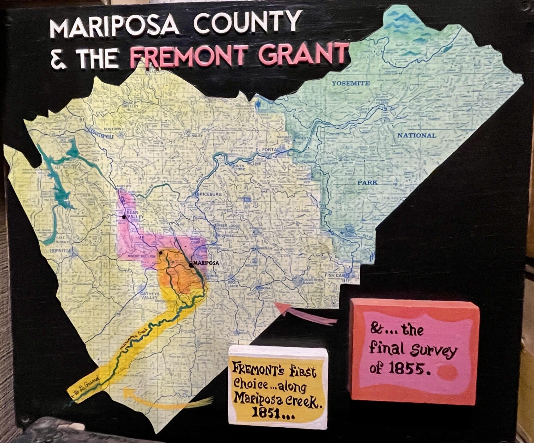
Fremont’s property ultimately proved immensely lucrative. The Mariposa Vein was discovered on his property in late summer 1849, and the soon-operating Mariposa Mine “eventually came to be one of the largest-producing mines in Mariposa County, employing hundreds of people and generating approximately $2,398,405 throughout its operations between 1849 and 1859,” according to another museum display. [21]
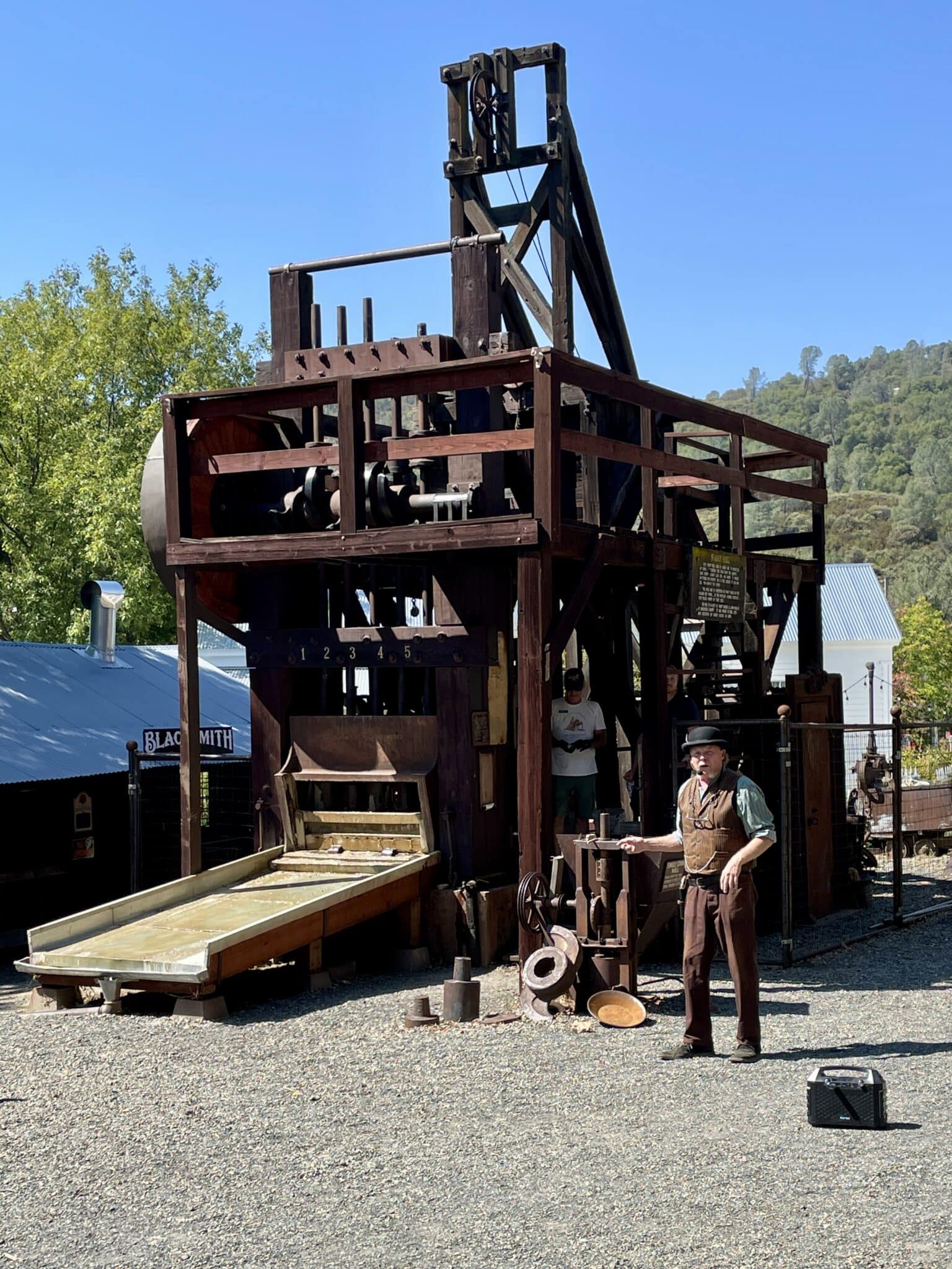
Mariposa Mine also used the first stamp mill in California, which served to mechanically crush and pulverize hard, gold-bearing rock into fine sand or powder to liberate gold particles. Last September, we were able to watch a stamp mill demonstration at the Mariposa Museum and History Center. The Smithsonian has called this museum “the best little museum of its size west of the Mississippi.” If you want to learn more about Fremont or California gold rush history, it is definitely worth a visit.
Sadly, due to poor investments, high debt, the legal costs of both defending his land claim against squatters and government challenges, and the Panic of 1873, Frémont eventually lost his ranch as well as almost all his money. At the end of his life, he lived for almost a decade in poverty, surviving on money from his wife’s writings. Finally, in 1890, he was awarded an annual pension of $6,000 for his service as major general, but he died three months later.
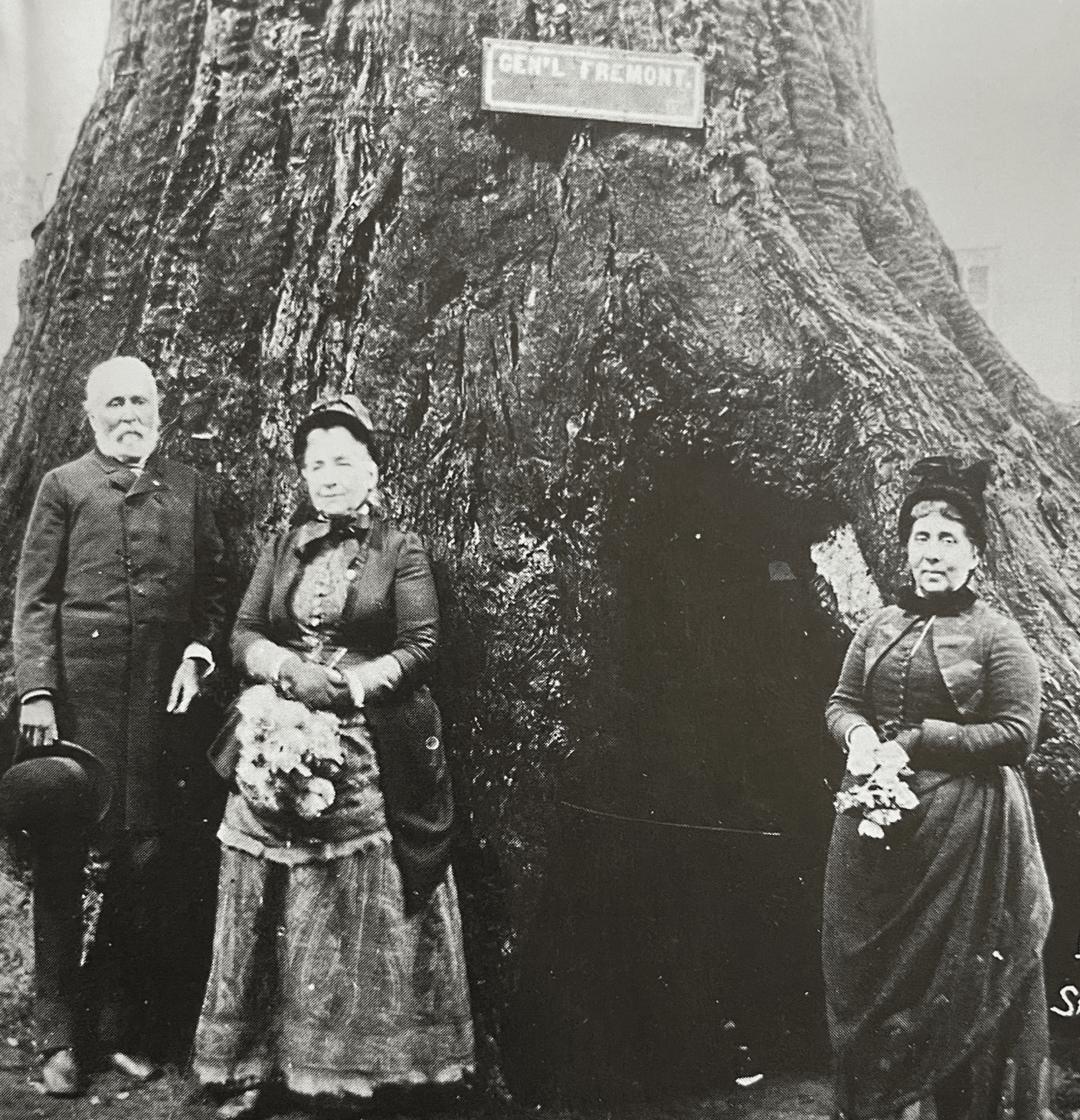
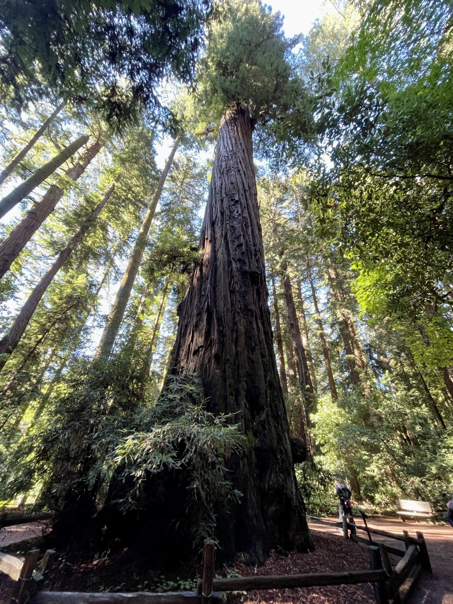
I like to imagine that one moment of happiness for him in those final years might have come when in 1888 he visited Welch Big Tree Grove, popularly called “Santa Cruz Big Trees” at the time, but now part of Henry Cowell Redwoods State Park. One of the park’s biggest attractions was the “Fremont Tree,” which was reputed to be where Frémont slept during his 1846 visit as part of his third expedition. The tree had been hollowed out by fire, providing a cavity measuring approximately twelve by fifteen feet with a ceiling about twenty-six feet high, with claims that thirty people could stand inside of it. On the day we were there, I couldn’t go inside the tree due to a large puddle from recent rain.
Frémont was greatly celebrated on this return visit, and he posed in front of the tree with his wife and daughter. Asked by a reporter whether that account was true, he reportedly said, “It’s a good story; let it stand,” according to the park brochure.
On that initial visit, both Frémont and Carson were hosted by frontiersman and early Santa Cruz Mountain pioneer Isaac Graham, who knew Kit Carson from his fur-trapping days and lived in a small logging settlement in the area. At Graham’s request, Frémont spent several days measuring the largest tree in the grove, and he found that it measured 275 feet in height and 15 feet in diameter, three feet above the base. That tree later became known as “The Giant” and is still called that today.
I find it a bit sad, given all his adventures and fame in the West, that Frémont died while on a trip to New York and is buried there in Rockland County. His wife Jessie could not afford to have his body returned to California. She was later buried there beside him, as were some of their descendants. Perhaps one day, I will pay a visit to their final resting place.
Endnotes
- “Standing Tall: Sculpture of John C. Frémont Displayed at Pathfinder Regional Park.” Canon City Daily Record, 4 Sept 2013, https://www.canoncitydailyrecord.com/2013/09/04/standing-tall-sculpture-of-john-c-Frémont-displayed-at-pathfinder-regional-park/
- “Tales in Geography: John C. Frémont Charts the West.” CivilGEO, Inc., 2026, https://www.civilgeo.com/tales-in-geography-john-c-Frémont-charts-the-west/,
- Nicollet, Joseph Nicolas; Frémont, John Charles; and Stone, William James. “Hydrographical basin of the upper Mississippi River from astronomical and barometrical observations, surveys, and information.” Published by order of the U.S. Senate, Washington, 1843. Library of Congress, https://www.loc.gov/item/78692260/.
- Col. Frémont planting the American standard on the Rocky Mountains.” Baker & Godwin, New York, c1856, https://search.catalog.loc.gov/instances/3fcd4578-ad01-5b13-b53e-29de02bdc71c?option=lccn&query=2003689276.
- Jackson, Donald and Spence, Mary Lee, editors. The Expeditions of John Charles Frémont: Travels from 1838 to 1844, Vol. 1, Urbana, IL: University of Illinois Press, 1970.
- Drane, Robert E. “Frémont’s Second Expedition Explores The West Coast.” Road to the Civil War, https://roadtothecivilwar.org/chapter/fremonts-second-expedition-explores-the-west-coast/#content.
- “The Big House , center of life at Fort Vancouver.” Photo by Tonya McQuade, 27 Jun 2024, Fort Vancouver National Historic Site, Vancouver, Washington, https://commons.wikimedia.org/wiki/File:Col._Frémont_planting_the_American_standard_on_the_Rocky_Mountains_LCCN2003689276.jpg.
- “McLoughlin House – Fort Vancouver National Historic Site (U.S.)” National Park Service, 22 June 2024, https://www.nps.gov/fova/planyourvisit/placestogo-mcloughlin-house.htm.
- “Dr. John McLoughlin.” National Park Service, 21 March 2019, https://www.nps.gov/people/johnmcloughlin.htm.
- Denton, Sally. “Fremont Steals California.” American Heritage, Winter 2011, Vol. 60, Issue 4, https://www.americanheritage.com/fremont-steals-california.
- Weiss, Stephen Craig. “The John C. Frémont 1842, 1843–’44 Report and Map.” Elsevier Science Ltd, 1999, https://www.sciencedirect.com/science/article/abs/pii/S1352023799000313.
- “History | NC Historic Sites.” NC Historic Sites, https://historicsites.nc.gov/all-sites/president-james-k-polk/history.
- “Explorers and Surveyors – John C. Frémont. Capitol Reef National Park Utah Brochure. National Park Service, 27 Dec 2020, https://www.nps.gov/care/learn/historyculture/explorers-and-surveyors.htm.
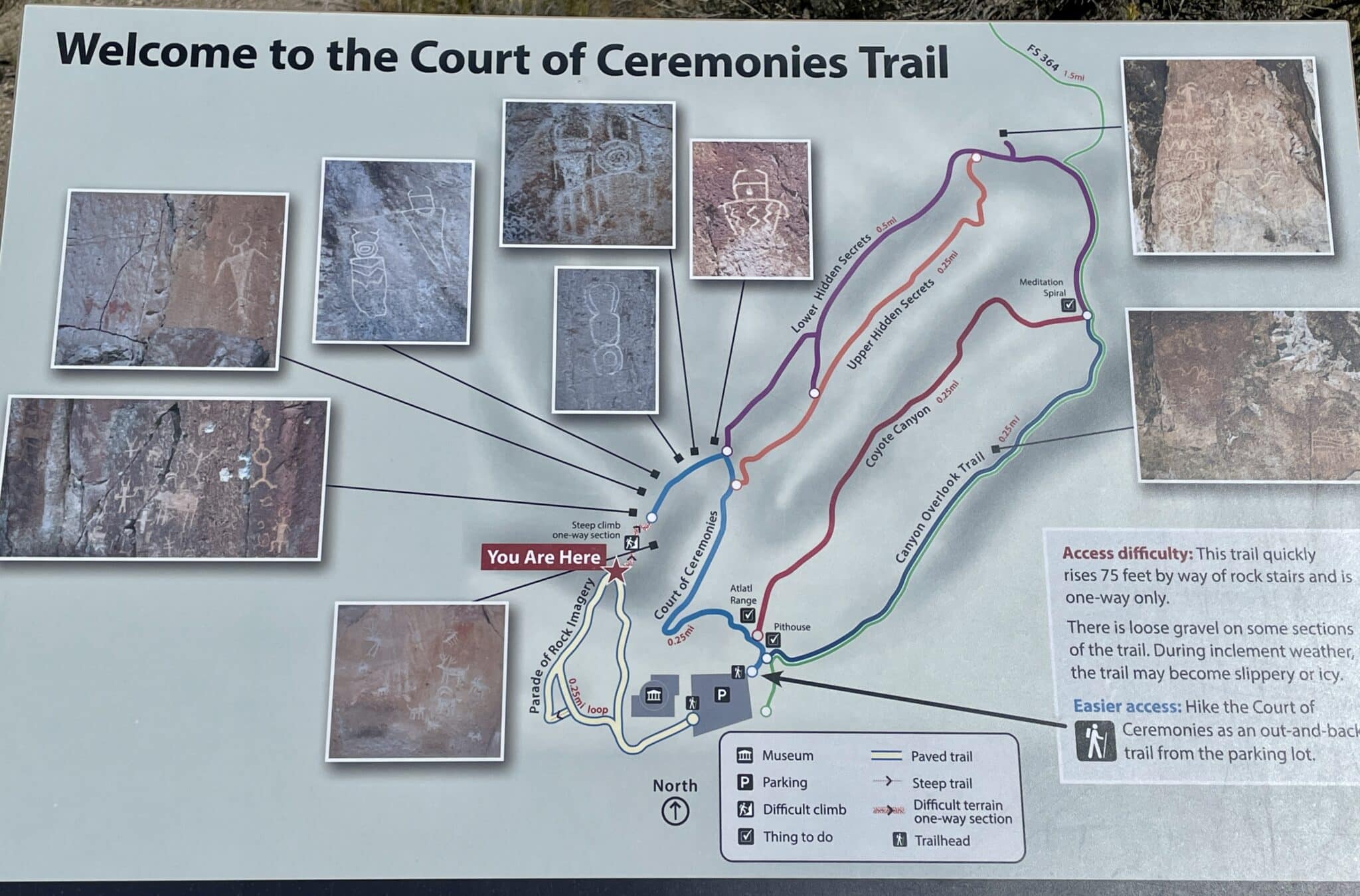
- “Welcome to the Court of Ceremonies Trail.” Photo by Tonya McQuade, 6 Oct 2025, Frémont Indian State Park, Sevier, Utah.
- “What’s In a Name – The Golden Gate? – Statistics & Data | Golden Gate.” Golden Gate Bridge, Highway and Transportation District, https://www.goldengate.org/bridge/history-research/statistics-data/whats-in-a-name/.
- Chamberlain, Newell D. The Call of Gold (1936). Yosemite Online Library, https://www.yosemite.ca.us/library/call_of_gold/john_Frémont.html.
- Ibid.
- Ibid.
- “Mariposa and the Fremont Land Grant.” Photo by Tonya McQuade, Mariposa Museum and History Center, 13 Sept 2025, Mariposa, CA.
- “John C. Fremont and Las Mariposas Grant.” Photo by Tonya McQuade, Mariposa Museum and History Center, 13 Sept 2025, Mariposa, CA.
- “Mariposa Mine.” Mariposa Museum and History Center, 13 Sept 2025, Mariposa, CA.
“Do I REALLY have to know about Fur Trading in order to understand what was happening on the West Coast… and how that impacted John C. Fremont?”
Yes.
In Tonya McQuade’s excellent article mention is made of Dr. John McLoughlin, Chief Factor for the Hudson Bay Company. The Hudson Bay Company competed against John Jacob Astor’s fur trappers and had outposts all across Canada, and included many trading posts in what would become the American states of Idaho, Washington, Oregon, California. Dr. McLoughlin toyed with the idea of founding the Independent State of Oregon [hence the welcome to Americans streaming into “nationality uncertain” Oregon Territory.] And for other schemers, it was the British Canadian trading posts of the Hudson Bay Company south of Oregon that provided opportunity for Mexico to “arrange transfer of California to Great Britain” before terms of the ending of the Mexican-American War – and the carving up of conquered territory — could be finalized. Acting on Secret Orders of President Polk, John C. Frémont may have been responsible for preventing that transfer, preserving California for the United States. One hundred eighty years later, the Truth of Frémont’s sanctioned support of Robert Stockton, the supposed withdrawal of an approaching British fleet, and the extent of Jefferson Davis’s hatred for The Pathfinder… are all subject to debate.
Thanks for adding to the information about McLoughlin (a very interesting and impactful man) and to the many questions about Fremont’s secret orders. It would certainly be interesting to know what Fremont was told to do – and how closely what he did followed those orders!
Tonya, very interesting and very wide-ranging. John C. Fremont – the Forrest Gump of the West.
LOL – Gotta love that description of him! 🙂