In the “Hoofsteps” to Gettysburg: Touring the Loudoun Valley Campaign of June 1863

Of all the sites related to the Gettysburg Campaign, the sites to see in the Loudoun Valley are some of the best preserved and most beautiful places in Virginia. Though in June 1863, there was nothing pretty about thousands of cavalrymen from north and south criss crossing the lush fields between the Bull Run and Blue Ridge Mountains.
As Maj. Gen. Joseph Hooker sent Federal cavalry westward in search of Lee’s infantry (and his intentions) the mountain passes became ground zero for military conflict. The first pass was in the Bull Run Mountains, at a village called Aldie. Here the macadamized Little River Turnpike (turning into the Ashy Gap Turnpike west of Aldie) ran through the Aldie gap.
Aldie
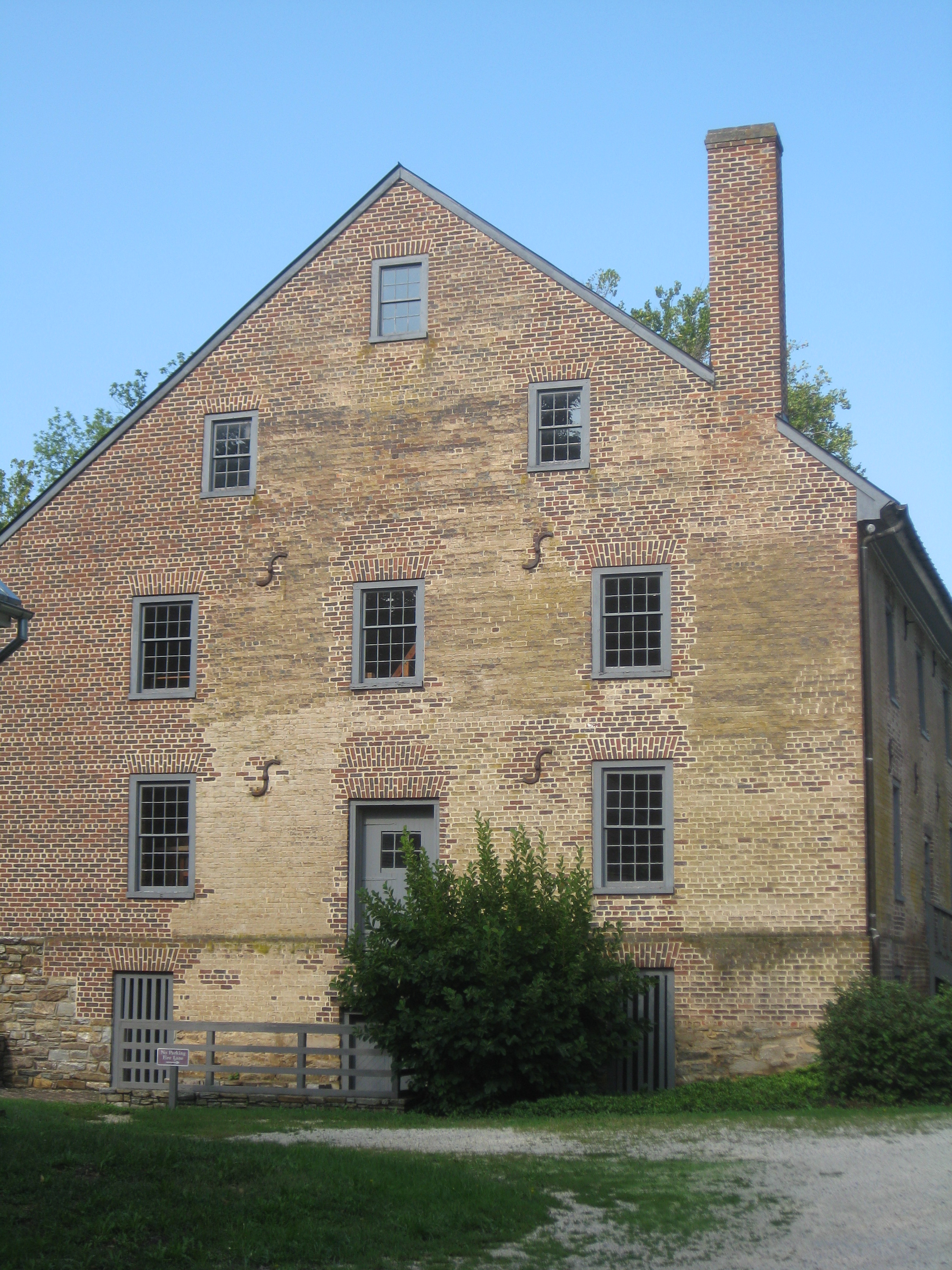
Today Aldie is a small village that is the end of the Washington, DC suburbs and the beginning of Virginia’s horse country. Start your visit at the Aldie Mill Historic Park (39401 John Mosby Highway, Aldie VA). Here several Civil War Trails markers introduce you to the Gettysburg Campaign in the Loudoun Valley and the Battle of Aldie, which began in the village and culminated west of town. The operable ca. 1807 mill is now a historic site that highlights the role of water-powered mills in American history.

Route 50 will serve as the main roadway for touring the actions in the Loudoun Valley. To visit the Aldie battlefield, turn left out of the Aldie Mill parking lot and drive 0.6 miles and make a right onto Route 734 (Snickersville Turnpike). In 1.2 miles at the intersection with Oatlands Road, you will come to the Furr House and, soon, a sharp bend in the road. At the bend, there is a small pull off on the right side in front of the 1st Massachusetts Cavalry Monument. Not only is the road bed here original to 1863 (showing the deadly trap the Confederates set for the Federal cavalry) but so is the Furr House and the stone walls behind the monument that were used by the dismounted Confederate cavalry.
Middleburg
After Confederate cavalry retreated from Aldie, their next line to slow down the Federal

cavalry was on the hills west of Middleburg. Today, Middleburg is one of Virginia’s most scenic towns lined with local stores and restaurants. Most of the buildings in town are from the 19th century. Recently the Civil War Trust and NOVA Parks worked together to preserve a portion of the Middleburg battlefield at a place called Mount Defiance. The property currently is in transition, but there is a Civil War Trails marker to see at the site. To reach the site, drive west through Middleburg on Route 50 and take the first left turn after Zulla Road. Be careful, as the four-lane highway can be very busy. When you turn into the median, look carefully to your right for oncoming traffic, then you will go straight across the eastbound lanes into the driveway for Mount Defiance. The Civil War Trails marker is ahead on your left. More interpretive markers are now in the planning stages. The house and buildings (which were here during the battle) here are private residences, so please respect their privacy.
Rector’s Crossroads and Goose Creek Bridge

Stuart continued to fall back, delaying the Federal cavalry and screening Lee’s infantry in the Shenandoah Valley. Stuart decided to use the hills west of Goose Creek as his next place of defense. Also, at the nearby village of Rector’s Crossroads (now modern day Atoka), Stuart made his headquarters here after the Loudoun Valley battles.
To reach Rector’s Crossroads and Goose Creek Bridge battlefields, turn left onto Rt. 50 west. This is a dangerous intersection, so please use extreme caution. Travel 2.5 miles and make a left onto Route 713 (Atoka Road). Immediately to your left is a parking area for a Civil War Trails sign. The nearby stone house is the Rector House. It was here in the backyard that JEB Stuart made his headquarters on June 22nd. It was also here that oral history states John S. Mosby formed his famed partisan command on June 10, 1863. The house today is the headquarters of the Mosby Heritage Area Association. Local history and tourism information can be found inside.
Return to Route 50 and turn left. Travel 0.9 miles and make a right onto Route 832 (Lemmons Bottom Road). To the right there will be a circle gravel drive that leads you to the parking area for a Civil War Trails sign. Be sure to walk to the actual bridge as well. This beautiful bridge was built in 1802 as part of the turnpike that led from Aldie to Winchester. The Federals attacked from the opposite banks of Goose Creek and the Confederate artillery was located on the hills behind you as you read the Civil War Trails sign.
Upperville

As Stuart pulled west closer to the Blue Ridge Mountains and the very important Ashby Gap, his last good ground to stand on was the hills around the village of Upperville. The Battle of Upperville was the largest of the cavalry battles in the Loudoun Valley and included Federal infantry. To reach the first of two battlefield stops in Upperville from the Goose Creek Bridge site, return to Route 50 and make a right. Travel 2.8 miles and make a left into a gravel drive that leads to a parking area for a baseball field. Two Civil War Trails markers will be to your left, facing east (the battle area around Vineyard Hill). To reach the second battlefield marker, make a left onto Route 50 and drive 1 mile, you will pass through the village of Upperville. Many of the buildings here are from the 19th century and be sure to check out the Hunter’s Head Tavern for a bite to eat or drink. Make a right onto Rt. 619 (Trappe Road) and travel 1 mile to a Civil War Trails marker on the left side of the road. This spot will provide you a wonderful view of the countryside, Blue Ridge Mountains and Ashby Gap.
For more information on the battles of Aldie, Middleburg and Upperville as well as the diverse history of this region, visit the Mosby Heritage Area Association website at www.mosbyheritagearea.org. All of these sites and more are detailed in the book, The Last Road North: A Guide to the Gettysburg Campaign by Rob Orrison and Dan Welch.
2 Responses to In the “Hoofsteps” to Gettysburg: Touring the Loudoun Valley Campaign of June 1863