The Chancellorsville History Trail
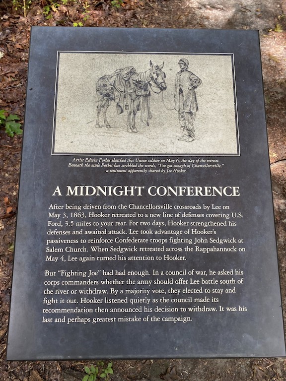
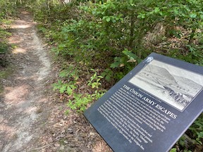
 In this month’s Emerging Civil War newsletter, I mentioned my time over the last month and a half exercising on Chancellorsville History Trail. For folks who can’t make it out into the woods, I thought I’d take you on a really basic “virtual tour” by sharing the signs posted along the way.
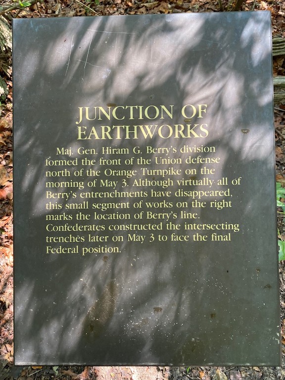
The trail begins at the Chancellorsville Battlefield Visitor Center and runs in a 3.2-mile loop. The first leg of the trail, from the parking lot to the main loop, runs 0.2 miles and joins with the larger loop at a junction of earthworks.
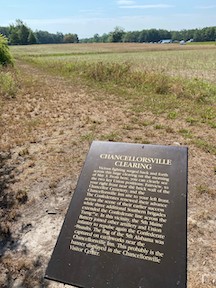
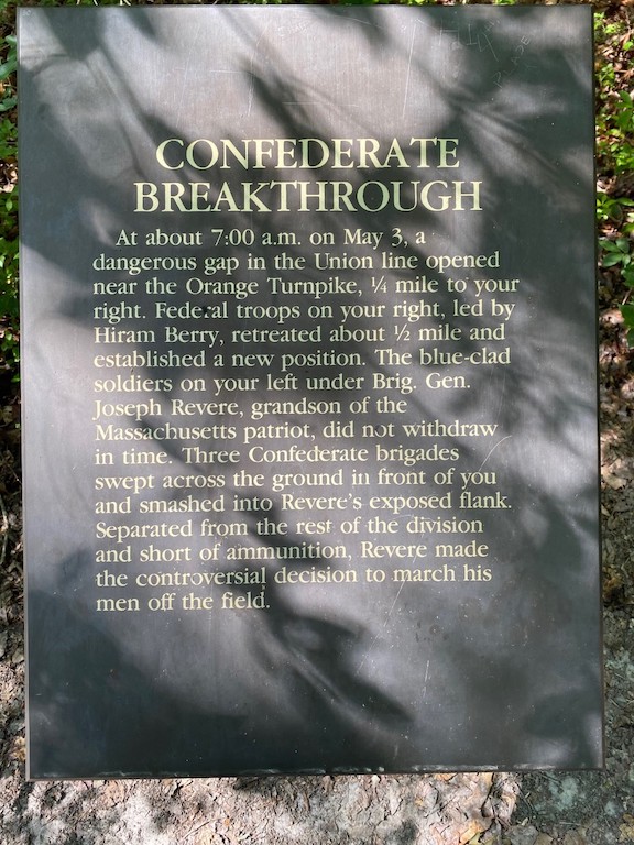
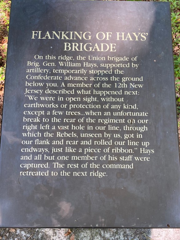
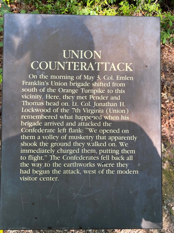
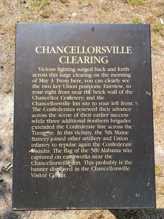
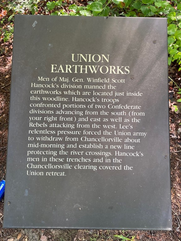
Bearing to the right, the path extends for a mile to the clearing where the Chancellorsville mansion once stood. Three signs stand along this stretch of trail–and area that saw intense fighting on the morning of May 3, 1863. A fourth signs in the clearing where the path exits the woods.
On the far side of the road opposite the parking area, the path branches into two forks. The right fork crosses the field, goes through a narrow finger of woods, and then deposits walkers on Hooker Drive. On the opposite side of Hooker Drive is the next sign.
 From there, the path parallels Hooker Drive until it reunites with the other branch of the path near the park’s maintenance facility. This loop is 0.7 miles.
Meanwhile, back at the fork in the path opposite the Chancellorsville clearing, the left fork skirts the edge of the field and quickly goes back into the forest. This shorter way, 0.4 miles, comes out near the maintenance facility on Hooker drive, where it reunites with the other branch of the path. There are no signs along the shorter branch of the trail.
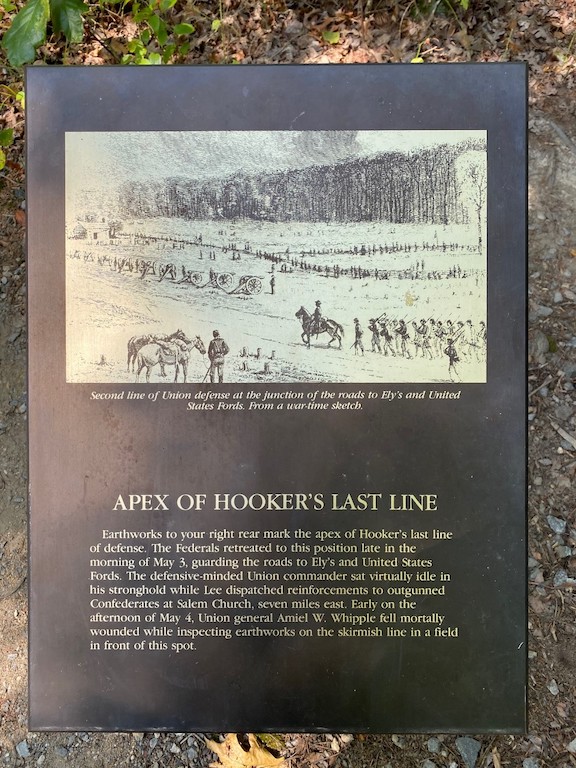
The path crosses Hooker Drive and soon plunges down into a swale. After 0.6 miles, it comes out near the apex of Hooker’s last line and the next sign.
Across the road, the park’s Bullock Road extends back toward the visitor center. On the south side of the road is the former site of the Bullock house; on the north side of the road, the trail winds off into the woods. This section of the trail is 0.7 miles and has two signs along the way.

The trail crosses Bullock Road and extends for another 0.1 miles, with a final sign, before finally reaching the junction of earthworks and the trail spur that heads back to the parking lot.

Congratulations–you just done 3.2 miles! A 0.5-mile mini-loop sits on the far side of the visitor center, showing off Federal Third Corps earthworks. I’ll take you over there on a different day.
It’s really nice to see Chancellorsville getting some more love. That is an outstanding trail and it really demonstrates how parts of Chancellorsville was fought in “the Wilderness”. I once shared that those woods are teaming with “Mountain Laurel”. This vegetation can appear as a large shrub or a small tree. When in bloom, it has beautiful white blossoms. I have a theory that the “Mountain Road”, where Stonewall Jackson received his wounding while conducting his reconnaissance, is named for this shrub. Nobody seems to know exactly how it received its name when there are no mountains on the Chancellorsville battlefield. The NPS theory is that it was an ancient Native American trail which led west to the mountains. The vegetation on any battlefield can be useful to a battlefield detective. Thank you again for sharing and good luck with your fitness-trail activities.
A visit to the Burton Farm is always a highlight, as military history occurred there.