A Walk Across Spindle Field/Laurel Hill
 At 7:45 a.m., the running battle between Robinson’s division and retreating Confederate cavalry came to an abrupt end along a ridge on the southern edge of Sarah Spindle’s farm. Robinson’s exhausted men, jumbled and confused by the running engagement, once more deployed, but resistance stiffened. Kris White will have an excellent two-part story later this morning that outlines that part of the battle.
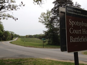
To better understand that story, I thought I’d walk you across Spindle Field so you can see how deceptive the topography was for advancing Federals. Let’s follow their route so you can see things from their perspective and understand why the ground caused them so much trouble.
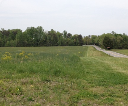
If you park at the Spotsy exhibit shelter and walk past the Sedgwick monument, the Laurel Hill trail begins on the far side of Brock Road (be careful of the traffic when you cross). Federal brigades deployed to the left and right of the road and made their way across the open field toward the Confederates positioned along the treeline in the distance.
————
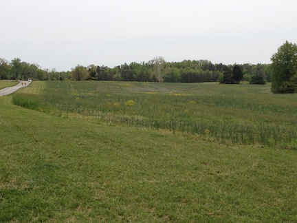
Spindle Field is also known as Laurel Hill, although there’s not much “hill” to it. An actual “Laurel Hill” existed nearby, but apparently, disoriented soldiers misappropriated the name for this position and it stuck. Halfway across the field, a rise in elevation becomes apparent, perhaps creating the illusion of a hill.
————
At the top of the ridge, soldiers found an unwelcome surprise: there was more open field ahead, hidden by the ridge. They’d only crossed about two-thirds of the distance they needed to traverse. The ridgeline they had been marching toward was a farm lane that cut across the field; the gateposts in the photo below mark the road trace at the top of the crest. Blockouse Road (seen in the left of the picture) joins the Brock Road here. Confederates used Blockhouse Road to funnel their infantry into position as they double-timed their way to the battlefield.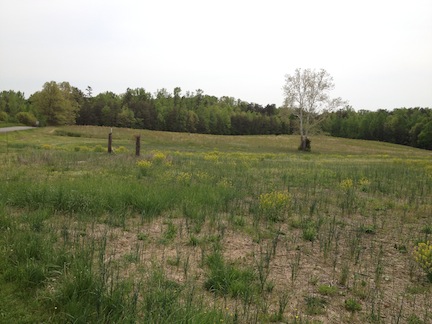
————
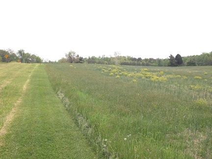
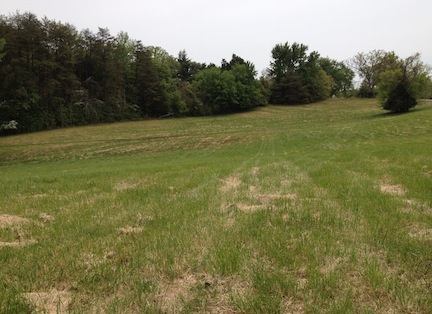
Advancing past the farm lane, Federals crossed ground that continued to dip and swell. A look westward shows the uneven topography that made it difficult for their formations to maintain cohesion as they continued their advance.

————
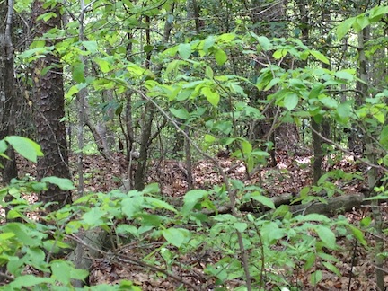
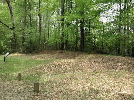
Finally, in the far treeline, Confederates waited. But no longer did the Federals face only dismounted cavalry—infantrymen from Anderson’s First Corps had marched a route roughly twice as long as the Federal route and double-timed it into position. They situated themselves in the treeline, which shielded their strength. Federals didn’t get this close (although an attack by Marylanders did break through for a bit later in the day). Today, earthworks run through the trees; Confederates posted here for days fortified the original position.
————
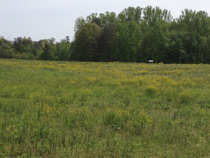
From the ridgeline where the farm lane runs, a look backwards shows the gently rolling swells of Spindle Field. However…
…the ground on the eastern side of the road was not so gentle. A huge swale posed a huge problem for Col. Peter Lyle’s brigade—the first to deploy on the field and advance. They got within thirty feet of the Confederates posted along the crest of the far ridge then bogged down in the swale. They soon found themselves trapped there. “[T]here was but one course to take,” realized one of the Federals, “and our retreat was immediately made in the greater confusion.”
————
To Lyle’s right, on the western side of the road, Col. Andrew Denison’s brigade went in next. To Denison’s right came Joseph Bartlett’s brigade, which actually came from a different Federal division, mixed in with Robinson’s by the logjam on Brock Road. Those men advanced across Spindle field along the route traced today by the hiking trail and, a little further to the west, straight up the field toward Sarah Spindle’s house. The site of the house, which was destroyed in the battle, is marked today by an interpretive marker.
————
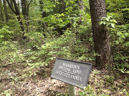
If you follow the Laurel Hill walking trail all the way around, it will take you along Hancock Road. There, the remains of Warren’s original line run parallel to the road. As his attacks faltered on the morning of May 8, he dug in. From his fortified position, he renewed his attacks later in the day; he launched attacks from this position again on May 10 and May 12. Although he had two limited breakthroughs, all the attacks ultimately proved futile.
Who was Sarah Spindle? Who was her husband and children and the parents of sarah and her husband?
I am working a history of the Spindle familu and I would like to add these to the family.
Was any information ever found on the family of Sarah Spindle? I also am completing family history on the Spindle, Spindel and Spindler Family. Any information or suggestions will be greatly appreciated.
I have not been able to find anything about that part of the Spindle family.
.Let me know if you find anything.
I would be very interested in learning about your part of the family, mine was from Spotsylvania and Hustle, my mother is Evelyn Louis Spindle d/o John Muse Spindle s/o John Muse Burke Spindle.
Brad Garrett
Love this continuing information from the Emerging Civil War series. I have every one of the books and refer to them on countless occasions. Thanks and keep them coming.