ECW Weekender: Hiking Up Sitlington Hill at McDowell Battlefield

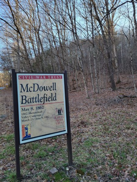
The battle of McDowell, fought on May 8, 1862, marks a turning point in “Stonewall” Jackson’s Valley Campaign as he began to re-launch offensive movements to defend the Shenandoah Valley. After his defeat at Kernstown in March, Jackson had retreated up (south) in the Valley. Reinforced by General Richard Ewell, Jackson slipped off — without telling Ewell the plan, other than Ewell should stay put — and headed west. Moving through Staunton, then up into the mountains, Jackson prepared for fight Union General Robert Milroy from Fremont’s command. Milroy retreated toward the tiny village of McDowell, and the troops clashed in and around that area.
The region is mountainous, adding additional physical exertion for the soldiers’ march and battle. In fact, part of the battle of McDowell was fought on high hills. For example, the Confederates held Sitlington Hill, overlooking the village. At one point in the battle, Union troops attacked up the western face of the small mountain.
Today, this area of the battlefield has been preserved and a 1.4 mile walking trail climbs approximately 600 feet to the crest of Sitlington Hill which is often called “the heart” of McDowell battlefield. In mid-March, I was in Highland County and decided to make a stop at the battlefield and hike the trail. It’s a steep one and shows just how challenging mountain fighting could be. Here are some photos to inspire you to take a hike or show you the view from the top if you don’t feel like making the climb.
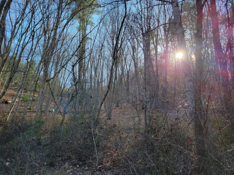
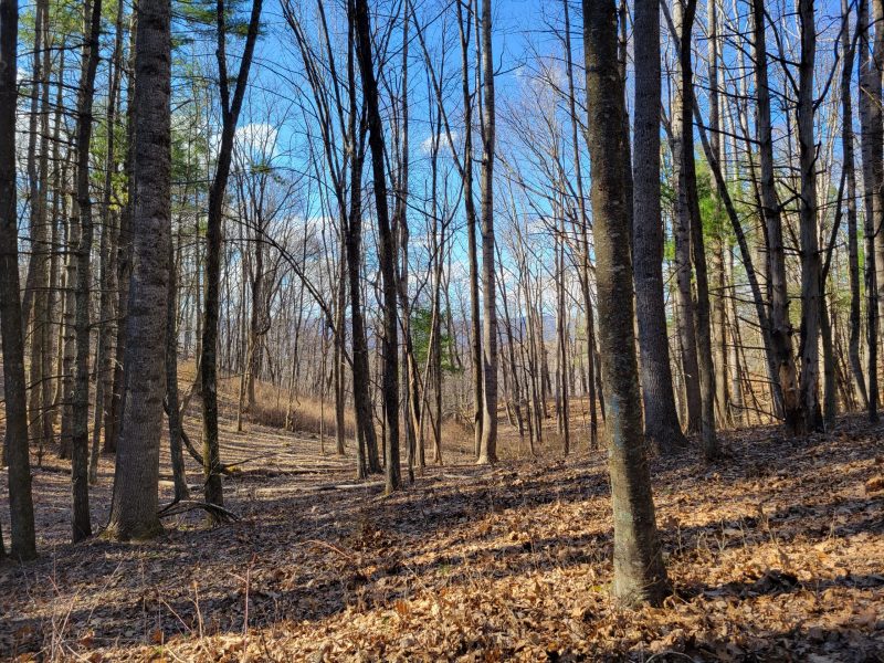
Even at the beginning, you know it’s going to be a trek. Imagine make a march along the winding, steep, mountain road from Staunton and then getting told, “Go straight up this sloop and fight off the Yankees coming up the other side.”
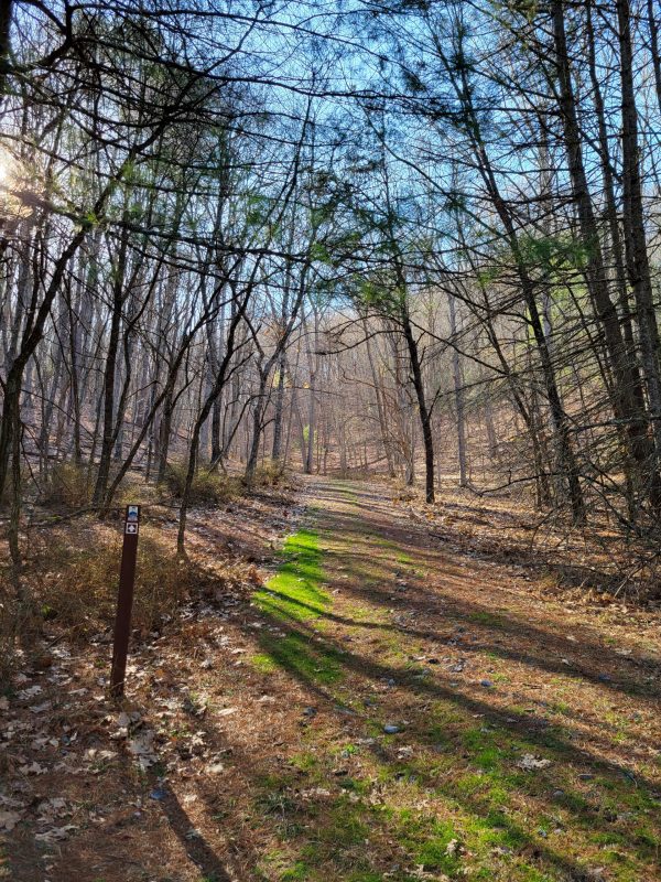
As of spring 2022, there are some trail blazes and trail markers. Some fallen brush a couple hundred yards from the beginning of the trail makes it a little confusing, but keep toward the road and you’ll pick the trail again fairly easily.

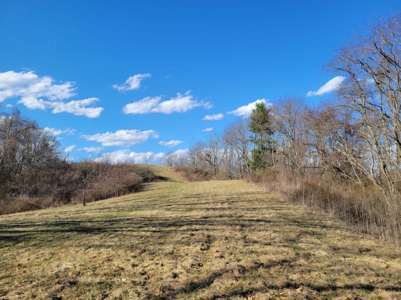
After a long steep incline, the trail levels out for a bit. There is a good view of the ravine that Civil War soldiers used, and there are interpretive signs along the trail, too!
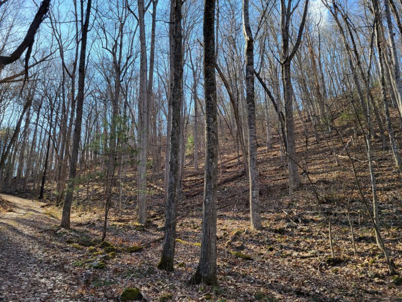
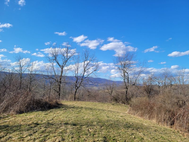
After another steep climb, you’ll reach the top, cleared around of Sitlington Hill. I’m not sure how the view would look when the leaves are on the trees, but it was a great view in late winter and I’m sure it would be gorgeous in the autumn, too.

There is another branch of the trail that makes another climb. (It’s to the left as you break into the cleared area.) I was racing daylight and wanted to be able to drive out of the mountains before dark, so I did not venture up to that other trail spur on this hike.
I would definitely recommend the trail, the views, and the history to explore in this part of McDowell battlefield. Just be aware that the hike may be considered strenuous for some. I hike quite a bit, and I was huffing and puffing and taking extra “photography breaks” along the way.
If the Sitlington Hill trail isn’t quite your battlefield adventure level (don’t worry, we won’t tell Jackson), there’s still plenty to see around McDowell. There are interpretive panels at the trailhead for Sitlington Hill, along with other signs in the village, and Highland County Museum. If you’re in the area, drive over a couple more mountains to the town of Monterey to find more Civil War Trails markers and some nice little restaurants. I like The Curly Maple country store, bakery, and deli which is not far from the historic courthouse and right on the main street of town.
————
Shenandoah Valley Battlefields National Historic District has this helpful driving tour for Civil War sites around McDowell
ECW’s Chris Mackowski took a hike up the hill in 2020 and recorded this video.
I can “second” the comments made about this great Civil War site. It is a nice hike, and for those advanced in age, you can always take a break every 40-50 yards. That’s what we did the last time my cronies and I climbed Sitlington’s Hill. The site is well interpreted at the top.
Another stop is the Presbyterian Church in McDowell, and a visit to the cemetery.
I’d recommend Grant’s Grocery in McDowell…we were allowable to get a sandwich here, home made!
A few years ago, a friend, the EarDoc and I did the entire 1862 Valley Campaign. It took us 10 days , and we visited everywhere…andI mean, if you read Tanner’s book on the Campaign, we stopped at every place Tanner mentions…and I mean every place. Thats is the best way to tour the 1862 Valley Campaign.
How did you like the Turner Ashby’s death plaque in Harrisonburg???? I was lucky enough to walk into it looking for a bar!
Excellent info. Always enjoy your descriptions of your yonderings.
I hiked the trail many years ago, At that time there were trail markers identifying the remains of defensive trench/earthworks and diary excerpts from some of the participants.
Just curious. Are they still there??
Thanks again for the posting.
Yes, there are still good interpretive panels and they had primary sources quotes!
New signs were put in place on April 29th of this year.
Sarah, this was really relevant to me this week, when I made my first visit to Lookout Mountain! As usual, a wonderful post.
Nice! I can’t wait to go to Lookout Mountain one of these days.
New signs were placed on the trail at the end of April. Be sure to check them out. If you do the entire hike up and back including both ridges it is a 2.5 mile hike total.
Thank you for this article, along with the pictures! I’m currently reading a book on Stonewall Jackson while podacasting a story about this battle, and the pictures are very helpful to gain a sense of the topography.