The Topography of Spotsylvania
Last Friday and Saturday, I had the opportunity to give a tour of the Spotsylvania and North Anna River battlefield to a great group from the Central Ohio Civil War Round Table. I have walked Spotsylvania many times; however, one of the main topics I kept coming back to on Friday was how topography influenced the fighting. While there are many examples, I want to share a few that stood out the most.

Courtesy LOC
A critical crossroads that offered an avenue of advance to the main road to Richmond, Spotsylvania Court House loomed large in the minds of the Union high command following the Battle of the Wilderness. On the morning of the first day, May 8, Maj. Gen. J.E.B. Stuart’s cavalry utilized a series of ridges and knolls along the Brock Road to slow the advance of Lieut. Gen. U.S. Grant and Maj. Gen. George G. Meade’s Federals toward the road junction. Stuart had employed similar tactics the previous summer in the Loudoun Valley during the Gettysburg Campaign. Fighting dismounted, his troopers would hold their position and engage the Yankee infantry just long enough until they deployed from column into a line of battle. Then, the Confederates would saddle up and withdraw to the next ridgeline. These actions seriously hampered the Union advance and bought valuable time for Confederate infantry to arrive and block the route to Spotsylvania. Although debatable, this very well could have been Stuart’s finest hour as a tactician. Unfortunately, he had only days to live; he would be mortally wounded at the Battle of Yellow Tavern three days later.
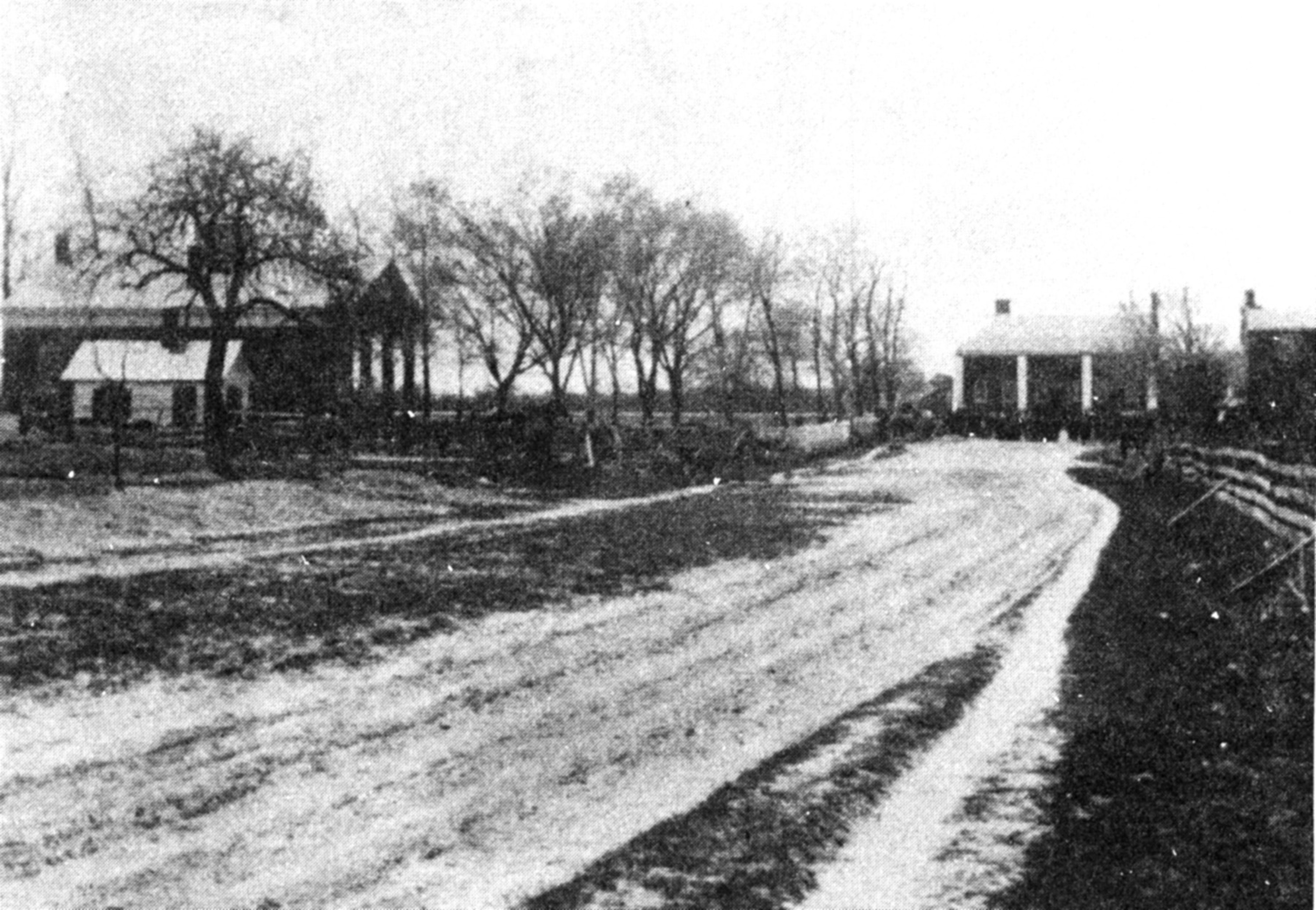
The Confederate infantry that relieved Stuart’s troopers took up a position on land owned by Sarah Spindle. One of the more distinct features of the Spindle property lies just east of the Brock Road. There, the ground slopes sharply down into a ravine and resembles a bowl. Standing at certain points in the “Spindle Bowl” today, one can barely see vehicles passing on the highway. During the initial Union attacks by Brig. Gen. John Robinson’s division, Col. Peter’s Lyle advanced across this ground and sustained heavy fire from Mississippi and South Carolina infantry on the road above. This destructive fire helped to break up Robinson’s assault.
Rivers also influenced the battle. Gen. Robert E. Lee may very well have planned to dig in along a three mile front, with his flanks anchored on the Po River in the west and the Ni River in the east, thus protecting the Spotsylvania crossroads. Unfortunately for Lee, Maj. Gen. Ambrose Burnside’s IX Corps arrived on the heights above the Ni River on the morning of May 9 before Maj. Gen. Jubal Early’s Third Corps arrived to extend the line. This forced the Confederates to refuse their line, bending it back to the south and forming a salient that would come to be called the “Mule Shoe.” The Mule Shoe in itself was laid out along a series of ridges. A massive ravine cut across the northern face of the salient. Another, smaller ravine, approached the salient perpendicularly to the northwest.
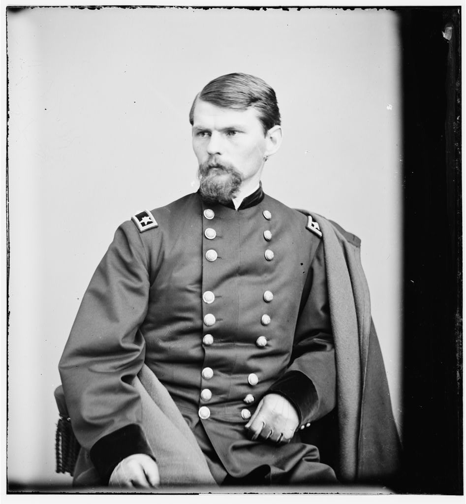
This ravine was used as cover for a Union assault that took place on May 10. Led by Col. Emory Upton, the blue infantry advanced in column and utilized the slopes of the ravine to shield them from enemy fire. Although initially successful, Upton was eventually driven back.
On May 12, the Federal II Corps attacked the salient itself, bursting a hole in the Confederate line. Desperate Confederate counterattacks eventually pushed the Yankees out of the salient and reclaimed a portion of the outer line of earthworks. These assaults focused on one of the salient’s ridges and a slight bend in the trenches. This “Golgotha of horrors” is known as the Bloody Angle. Union troops would use the ravine to the north from which to launch their many attacks against the line. After the fighting at the Bloody Angle, Lee withdrew to a new, stronger position at the base of the Mule Shoe.
With the abandonment of the salient, the Federals shifted their efforts toward Lee’s right flank. Their operations would center on Myers’ Hill, an imminence that if held, could serve as an artillery platform to bombard the Confederate line. Union troops would eventually be pushed off this high ground after occupying it for much of the day on May 14.
Then, on May 18, Grant decided to attack “Lee’s Last Line” at the base of the old salient. As they had six days earlier, the II Corps formed for an assault. This time, they used the cover of the ravine just north of the Mule Shoe as their jumping off point. This assault, similar to all of the Union attacks at Spotsylvania, would be repulsed. After thirteen days of relatively inconclusive fighting, Grant decided to break the stalemate and leave Spotsylvania, and its topography, behind. The armies would meet again along the banks of the North Anna River in central Virginia.